6/6: Storms Move Into The DFW Area From The West
Update 9:41 p.m. from Larry Mowry: Another round of storms developing over Dallas, Tarrant, Collin, Ellis and Johnson Counties. Not severe, but more lightning and heavy rain.
Update 9:30 p.m. As of 9:30, damage has been reported at a house under construction in Allen, to boats at Eagle Mountain Lake, and to the roof of an apartment building in Fort Worth. A vacant building in Carrollton was damaged from a lightning strike.
Update 7:50 p.m. from Larry Mowry: Severe Thunderstorm Warning for most of Van Zandt County until 830pm. Storm may produce winds around 65 mph. Storm near Fruitvale at 8pm, Grand Saline at 815pm, Van around 825pm, Edom at 830pm. Worst of this storm may split around Canton, but lots of lightning and some rain coming for you in Canton.
Update 7:30 p.m. from Larry: Strongest storms closing in on Canton, Athens and Emory. Lots of lightning, very heavy rain, small hail and wind gusts to 45 to 50 mph. No warnings at this time. But close to being severe. By the way, SEVERE THUNDERSTORMS are defined by storms that produce hail 1" or larger and/or winds 58 mph or higher.
Update 6:12 p.m. from Larry Mowry: There are currently strong storms in Hunt County, and they continue throughout Dallas County. But there aren't any storm warnings at this time.
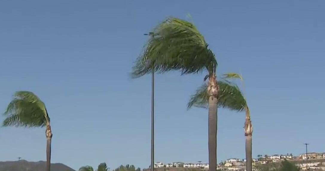
They'll continue to slowly move east until they're out of the Dallas/Fort Worth Area. Many cities are reporting between a half-inch to an inch of rain. The strong winds earlier did cause damage in some places –– we're hearing about trees down and a collapsed roof.
Update 5:36 p.m. from Larry Mowry: There's plenty of heavy rain moving into Dallas County –– we're hearing reports of stalled vehicles just east of downtown, so be careful if you must travel in that area.
Dallas rainfall estimates are up to 1.5 inches in the past hour alone. Severe Thunderstorm Warning continues for Dallas until 5:45 p.m. There's lots of wind and lightening with these storms, and, as you can see by the radar above, they're scattered over much of the region.
Update 4:52 p.m. from Larry Mowry: And now there's a new Severe Thunderstorm Warning for northeast Dallas County until 5:45 p.m. Like that Plano storm we just mentioned, this one brings the possibility of quarter-sized hail and 60 mile-per-hour winds.
This'll be in Highland Park and University Park around 5 p.m., Rowlett at 5:10 p.m., Garland at 5:15 p.m. and Sachse at 5:35 p.m.
Update 4:33 p.m. from Larry Mowry: Severe Thunderstorm Warning has expired in Rockwall County and been extended until 5:15 p.m. in Collin County. Two cells are active right now that are capable of producing quater-sized hail. One is near Rockwall, another is on the east side of Plano just east of U.S. 75.
Both of these are moving north at 15 m.p.h. The Collin County storm carries quarter-sized hail and winds of up to 60 m.p.h. The strongest part of this storm is near Plano.
Update 3:44 p.m. from Larry Mowry: There's a solid line of ran and storms in western Tarrant County moving east slowly. Expect gusty winds, lightning and heavy rainfall. Most locations will pick up at least a half inch of rain, but maybe more.
Viewer Video from Jon McKenzie in Hurst
There have been reports of 15 mile per hour winds and quarter-sized hail across the area. A severe thunderstorm warning has been issued for Collin and Rockwall Counties until 4:30 p.m.
Rains are currently scattered across Denton, Dallas and Tarrant Counties.
Original story:
FORT WORTH (CBSDFW.COM) – Storms are firing up in a very warm, humid and unstable atmosphere and should reach the Dallas/Fort Worth Area around 2:30 p.m.
A line of thunderstorms has developed along an outflow boundary from Montague County south to Granbury. The rain and storms are pushing to the east/northeast at around 10-15 mph –– fairly slow-moving. These are prolific lightning producers, along with some gusty winds and up to quarter size hail.
The storms should arrive closer in to the Metroplex around 2:30 p.m. to 3:30 p.m. this afternoon.
Keep an eye on the weather with our radars here. And email any weather photos to pix@ktvt.com.