Weather maps, radar show when nor'easter will be at its worst
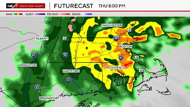
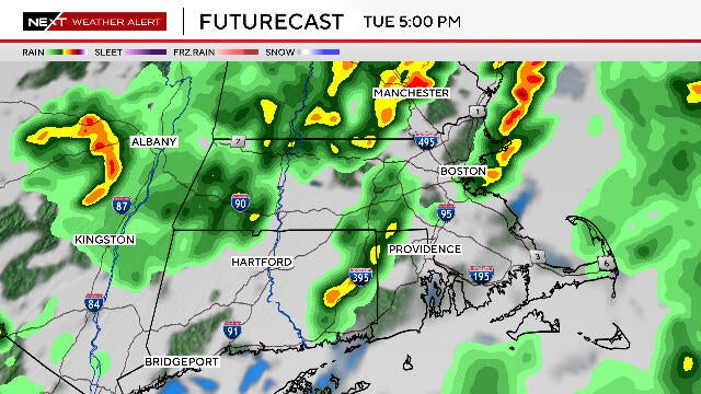
Radar shows the nor'easter is underway in Boston, and today will be one of the worst weather days so far this spring.
Watch CBS News
Radar shows the nor'easter is underway in Boston, and today will be one of the worst weather days so far this spring.
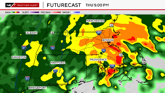
A coastal storm will bring several hours of heavy rain, windy weather and some minor flooding to the Boston area.

Unsurprisingly, the Boston area can once again expect rain in the weekend weather forecast.

The pollen count is very high in Massachusetts, with allergy season kicking into high gear.

The Mother's Day weather forecast across Massachusetts Sunday is just about perfect.
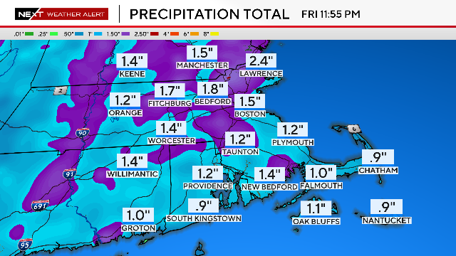
This week could end up being one of the wettest of the entire spring and summer in Massachusetts.
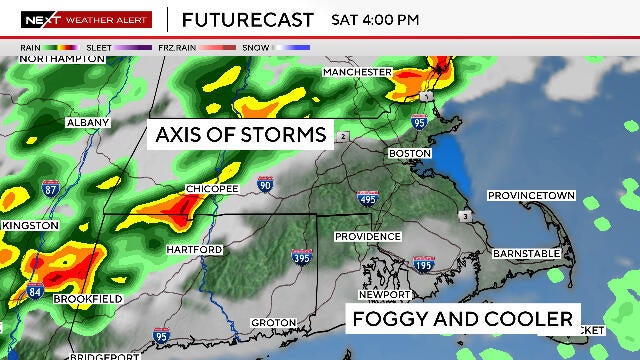
The weather forecast for Boston area this weekend is complicated, with storms that could bring flooding to Massachusetts.
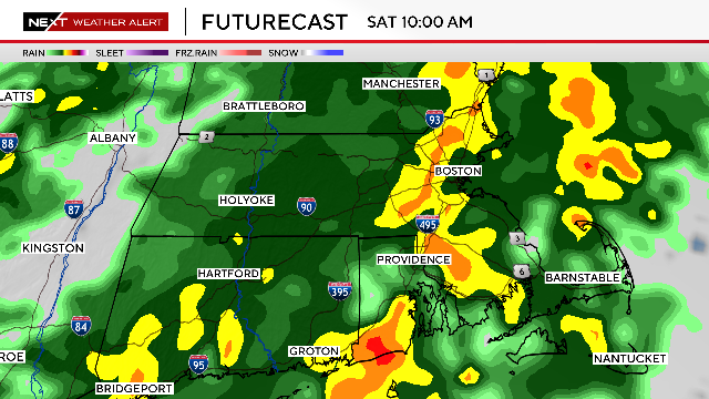
Unfortunately, once again, it will be a rainy Saturday in Massachusetts.
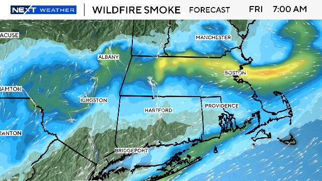
The greatest concentration of New Jersey wildfire smoke in Massachusetts is likely to occur during Friday morning.
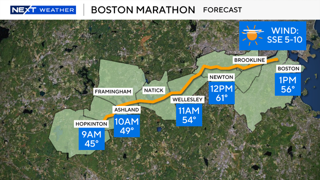
A perfect weather day for the Boston Marathon is rare, but it's going to be pretty close for the 2025 race.
After the coldest winter in years, snow season is officially over in Massachusetts.
The weather forecast calls for thunderstorms to potentially bring small hail to Massachusetts on Tuesday.
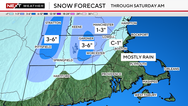
After Saturday's snow, New England will see a final round of rain on Sunday.
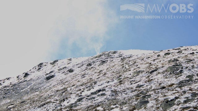
Crews snapped a photo of a rare weather phenomenon known as a "snow devil" on New Hampshire's Mount Washington.

April can be downright cruel, especially when it comes to the weather forecast in Massachusetts.