
Air quality alert up north mars otherwise ideal summer day in Minnesota
Most of Minnesota is in for a beautiful day on Wednesday, though northern Minnesota is still under an air quality alert.
Watch CBS News

Lisa has been fascinated by the weather all her life. She grew up watching Midwest thunderstorms in her hometown in northwest Indiana. She obtained her Bachelor of Science degree in Meteorology with a minor in mathematics from Valparaiso University. She also obtained a Bachelor of Arts degree in Communications, and has the American Meteorological Society Certified Broadcast Meteorologist designation, as well as a NWA Seal of Approval from the National Weather Association.
While at Valparaiso, she was the founding Chief Meteorologist for their college TV station VUTV, President of the Northwest Indiana American Meteorological Society/National Weather Association, and active member of the Valparaiso University Storm Intercept Team (VUSIT). Part of her involvement with the storm chase team included a 10-day convective field study in which she chased storms across the plains traveling 5,626 miles through seven states seeing her first tornado!
Before making it back to the Midwest, Lisa previously worked for CBS affiliates in Sacramento, West Texas and Central Illinois.
She obtained a master's degree in strategic communications from the University of Minnesota with her capstone project focusing on communicating climate change.
She is a Nationally Certified Emergency Medical Technician and volunteer with Northstar Search & Rescue with her K9 named Thunder.

Most of Minnesota is in for a beautiful day on Wednesday, though northern Minnesota is still under an air quality alert.

Minnesota could see above-average temperatures and below-average rainfall for the autumn months, according to an outlook released by the National Oceanic and Atmospheric Administration's Climate Prediction Center.

After an air quality alert expires Tuesday afternoon, the Twin Cities will be in for a nice couple of days.
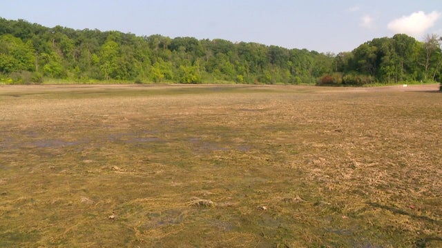
Officials are working to restore a lake northeast of the Twin Cities after a "mechanical issue" caused nearly all the water to drain.
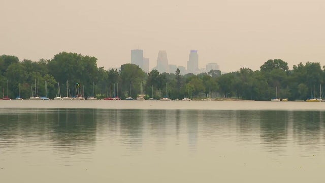
Wildfire smoke returns to Minnesota on Sunday, sweeping in from the northwest to the southeast.
With severe weather now out of the Twin Cities and surrounding areas, we're in store for calmer and slightly cooler afternoon temperatures on Saturday.

The Summer Glory Index rates how great Minnesota's summer days are based on high and low temperatures and rain.

Though the hazy skies will continue to clear in the Twin Cities on Tuesday, northeastern Minnesota is still dealing with air quality concerns.

It looks like just a normal barge parked on the Mississippi River, but it's actually a place where high school students and young adults can attend free river workshops.

The air quality in Minnesota will continue to improve on Monday as wildfire smoke moves out of the state.

Wildfire smoke will continue to exit Minnesota on Sunday, helping air quality improve as we wrap up the weekend.
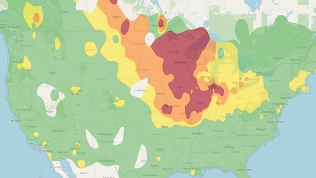
The state of Minnesota is entering another in a long string of summer days marred by air quality alerts. Poor air quality will continue through Saturday with lingering wildfire smoke from Canada.

Storms are expected to develop across western and central Minnesota later in the afternoon, reaching the Twin Cities by 7 p.m.

Drier, less humid air continues to move in behind Saturday's system, setting us up for a gorgeous Sunday.

The advisory will go into effect at noon and last through 8 p.m., affecting the metro, western Minnesota and western Wisconsin. Communities up north will be under an extreme heat warning starting at 11 a.m.