
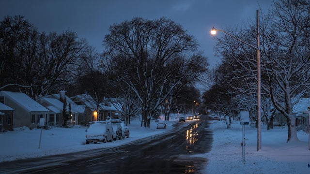
Dry and seasonable streak ahead for metro after soggy Tuesday
After some precipitation early Tuesday, the Twin Cities will be dry and seasonable for the next several days
Watch CBS News

After some precipitation early Tuesday, the Twin Cities will be dry and seasonable for the next several days
Areas south of the Twin Cities should brace for some snow Monday night as a wintry mix moves through.

Minneapolis-St. Paul International Airport had a record-high temperature on Friday, reaching 72 degrees, according to the National Weather Service. The previous record was 71 degrees.

Thursday will be mild and partly sunny with highs in the mid-to-upper 50s.

After a stunning northern lights show Tuesday night, Minnesotans will get another chance to spot them on Wednesday.

A warming trend takes hold in the Twin Cities on Tuesday, with a stretch of quiet days ahead.

The work week will get off to a cold start in Minnesota before a steady warm-up in the coming days.
Things will turn cloudy and cooler on Friday, with wind gusts up to 30 mph and highs in the upper 40s.

Highs will top out in the mid-50s on Thursday as wind gusts hit 30 to 35 mph.

High temperatures will be in the 50s through Thursday. There's a chance the Twin Cities will hit 60 degrees on Tuesday.

Scattered rain showers will develop Friday in the Twin Cities and continue into the trick-or-treating hours.

Following a foggy start to Thursday, high temperatures will only reaching into the upper 40s in the Twin Cities.

Thursday kicks off a mostly cloudy stretch that will last through Saturday morning, when the sun returns.

Rain will linger for some parts of Minnesota on Tuesday.
Monday will be breezy and increasingly cloudy in the Twin Cities ahead of an early week stretch of rain.