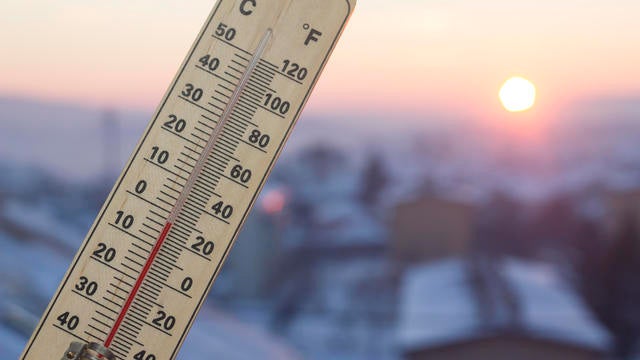
Temperatures climb to 20s on Wednesday before another drop
After a string of frigid days, temperatures will climb into the upper 20s in the Twin Cities on Wednesday.
Watch CBS News

Chris Shaffer was raised in Stillwater, Minnesota and left our great state for four years to attend the University of Utah in Salt Lake City, where he earned degrees in Meteorology and Mass Communications.
Chris is an Emmy award-winning meteorologist and a proud member of the American Meteorological Society. He has been awarded the AMS Certified Broadcast Meteorologist (CBM) designation. You may have seen him over the years doing the weather on television at KMSP FOX9 and WFTC/UPN 29. You may have also heard him back in his radio days on KOOL108, BOB100 (as Blaze Bodean), 104.1 The Point (as Cheeks), Cities 97, K102 (as Jack Wilde and himself) or KTLK.
It is no wonder why Chris is so passionate about Minnesota weather. His great uncle Wilbur was struck and killed by lightning while farming in southern Minnesota in the summer of 1952.
His family vehicle was once chased by a tornado near Maplewood, Minn. and one December on the way to Grandma and Grandpa's house, his family spent the night snowed in at a church in Winthrop, Minn., praying the blizzard would let up so they could get to Redwood Falls and open their presents the next morning.
Chris and his wife have family members all around the Twin Cities. And it's natural to forecast for the entire region with family in Pipestone, St. Cloud, Willmar, Sartell and Blooming Prairie just to name a few.
Chris loves the weather because it is always changing and is a constant challenge, much like raising his three daughters, who are as loud as a thunderstorm, pretty as a sunset and strong as a straight-line wind.
And who can forget the family pets? They've had guinea pigs, a hermit crab, a turtle, a salamander, a frog and several fish. They currently have two goldfish and their awesome Boston Terrier, Bailey.

After a string of frigid days, temperatures will climb into the upper 20s in the Twin Cities on Wednesday.

The week will wrap up with two mild days, but over the weekend highs will take a hit.

Highs across the state will be in the single digits, and even colder in spots.
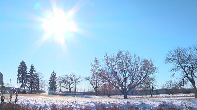
It will be quiet and cool again on Tuesday night in the Twin Cities, with temperatures falling back into the single digits.
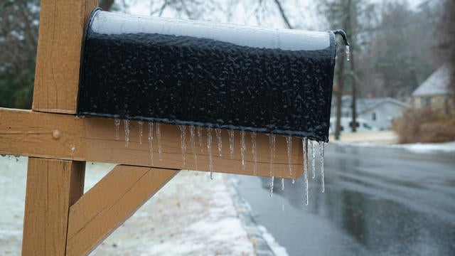
Highs will be just below freezing as the week begins, with freezing drizzle, freezing rain and snow possible across Minnesota and Wisconsin.
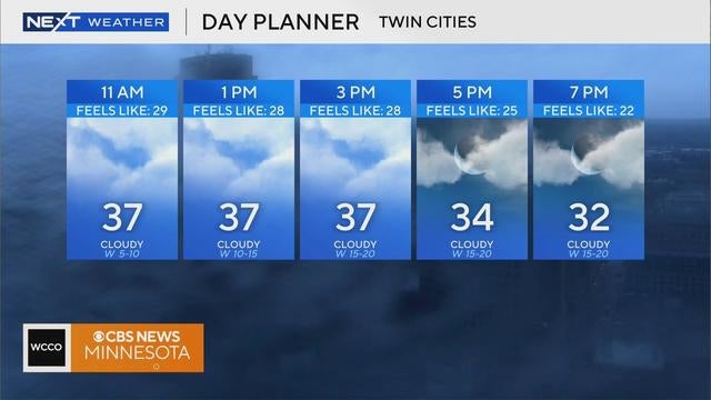
Monday will be another mild, overcast day in the Twin Cities with flurries in some areas.

A strong cold front is headed for Minnesota, bringing light snow in time for the Wednesday morning commute.
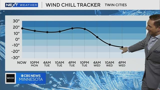
The Twin Cities will be mostly cloudy and windy on Monday evening, with temperatures falling back to around 20 degrees.
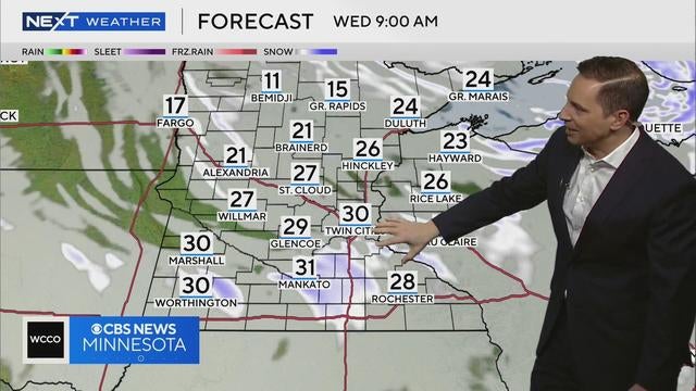
Morning commuters in the Twin Cities may be in for a hot mess on the roads early Wednesday.
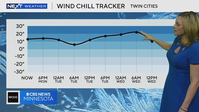
Enjoy the "warmup" in the Twin Cities on Tuesday because it will be brief.
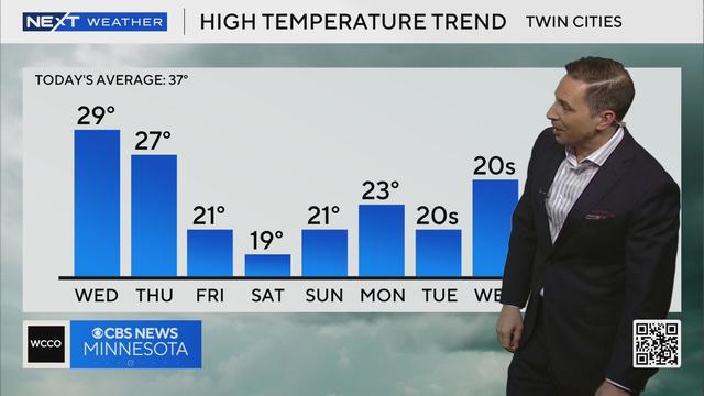
Temperatures will fall back to the upper teens on Tuesday night in the Twin Cities and clouds will roll in.
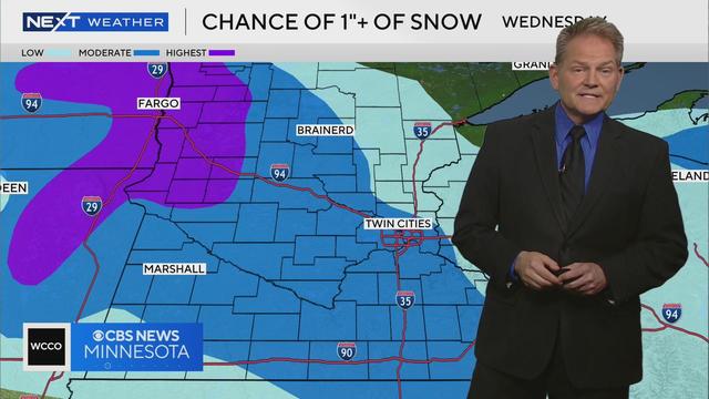
Light snow and flurries will move across Minnesota from west to east overnight Wednesday, with a dusting expected in the Twin Cities and 1-4 inches possible in the northwest corner of the state.
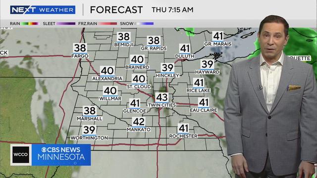
Gusty winds and rain are expected in the Twin Cities on Wednesday.
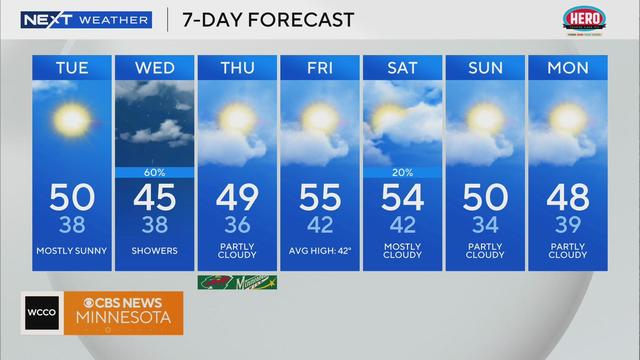
Tuesday will start out cold, then the Twin Cities will get more wind and sunshine before the next rain event arrives.
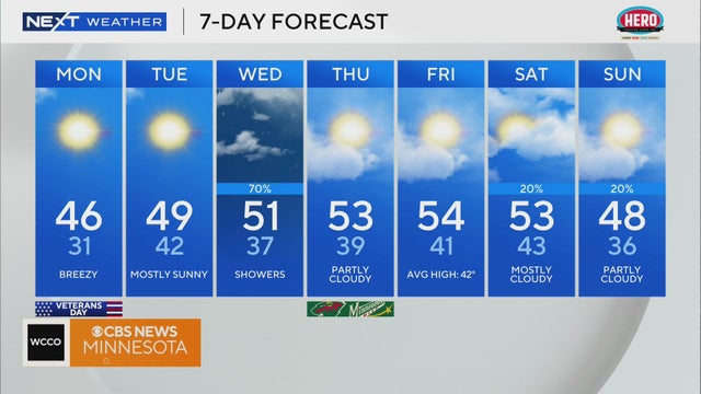
Things will dry out and clear up to start the week as cold winds bring temperatures down.