San Francisco Bay Area sees significantly warmer temperatures through Tuesday
The greater San Francisco Bay Area will see potentially record-breaking temperatures on Monday and Tuesday as the forecast calls for warm conditions and mostly clear, sunny skies, the National Weather Service said.
Parts of the interior, the North Bay and the South Bay will likely hit the 80-degree mark and higher, officials said.
While the National Weather Service forecast indicated there could be patchy morning fog in some areas, daytime highs will be mostly in the low 80s on the coast, in the mid 70s to low 80s around the bay, and high 70s to mid 80s inland. Overnight lows will be in the 50s.
Officials said local residents should prepare for significantly higher -- in some cases possibly record-breaking -- temperatures on Monday and Tuesday until cooler weather and the possibility of rain returns later in the week.
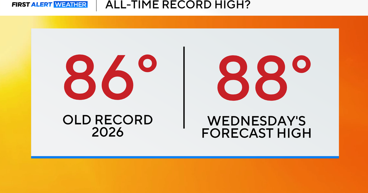
Forecasters did not say that the temperatures would be high enough to trigger any warnings on Monday and Tuesday, though temperatures are on track to be 15 to 20 degrees above normal on both days before a trough cools the region.
Until 11 p.m. Tuesday, a Beach Hazards Statement is in effect for Pacific Coast beaches due to increased risk of sneaker waves and rip currents.
According to the NWS, there is a slight chance of light rain, mainly over the North Bay on late Wednesday and Thursday. More significant rain is projected as a possibility during the weekend, particularly on Sunday evening into Monday morning.