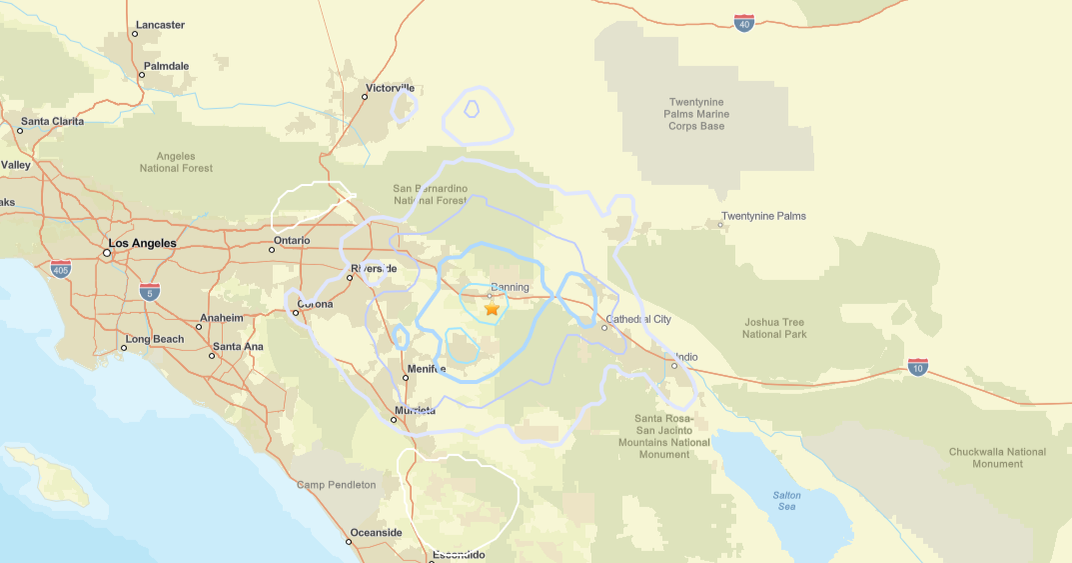
Magnitude 3.6 Quake Rattles Southern California Desert Near Coachella
MENLO PARK (CBS SF) -- The U.S. Geological Survey says a magnitude 3.6 earthquake rattled the Southern California desert early Sunday.
The quake struck at 6:02 a.m.
The earthquake epicenter was located 7 miles northeast of Borrego Springs, about 25 miles southwest of Coachella, and struck at a depth of 7 miles. Deeper quakes are less noticeable. Quakes just below the earth's surface -- in the 0 to 10 miles range -- can cause damage at lower magnitudes.
The San Diego County sheriff's department told the Associated Press there were no initial reports of damage.
The quake's magnitude was first reported Sunday as magnitude 4.1 but was reclassified by mid-morning.
In recent days, several California earthquakes have been misreported due to a malfunctioning automated USGS alert system, causing the agency to remove quakes from its online map.
COMPLETE QUAKE COVERAGE: CBS Earthquake Resource Center
DID YOU FEEL IT?: USGS Shake Map For Northern California
LIVE QUAKE MAP: Track Real-Time Hot Spots
BAY AREA FAULTS: Interactive Map Of Local Faults
Strong earthquakes with an epicenter off the coast can trigger tsunamis, depending on the size and type of the fault movement. The Pacific Tsunami Warning Center tracks earthquake data for the West Coast.
WEST COAST TSUNAMI TRACKING:

Tsunami Alerts & Maps