Next atmospheric river takes aim at Northern California; Heavy rain, gusty winds forecast
WATSONVILLE — Wet, miserable weather continued across huge swaths of California on Sunday as an atmospheric river that caused major flooding flowed eastward and makes way for another onslaught of rain and snow that could yet again pummel the beleaguered region as soon as Monday night.
The National Weather Service said the next torrent could exacerbate the severe flooding that overwhelmed the area in the past few days, including a levee failure that prompted widespread evacuations Saturday in farming communities near the state's Central Coast.
Monterey County evacuation zone map
Across Monterey County, more than 8,500 people were under evacuation orders and warnings Saturday, including roughly 1,700 residents — many of them Latino farmworkers — from the unincorporated community of Pajaro.
The Monterey County Sheriff's Office upgraded an evacuation warning to an evacuation order Sunday afternoon for community members living near the Salinas River due to flooding.
Residents residing near the river from Gonzales River Road north to Highway 69 at Spreckels Road are ordered to quickly and calmly evacuate the area as of 1:29 p.m.
Residents are encouraged to check in with their neighbors, monitor law enforcement's social media, and call 2-1-1 for more information. Residents should only call 9-1-1 in the event of a life-threatening emergency.
An evacuation map is available online.
The Monterey County Sheriff's Office upgraded an evacuation warning to an evacuation order on Sunday for community members living near Salinas River due to flooding.
Residents residing near Salinas River from Gonzales River Road north to Highway 69 at Spreckels Road are ordered to quickly and calmly evacuate the area as of 1:29 p.m.
Residents are encouraged to check in with their neighbors, monitor law enforcement's social media, and call 2-1-1 for more information. Residents should only call 9-1-1 in the event of a life-threatening emergency.
An evacuation map is available at the following link: https://bit.ly/3Za0Xc0
KPIX 5 First Alert Weather: Current Conditions, Forecasts, Alerts For Your Area
The next weather system does not appear to be as powerful as the last one, but weather officials nevertheless cautioned that "considerable flooding" could occur in lower elevations from additional rain and snowmelt that could swell creeks and streams.
"Definitely prepare for some more flooding impacts. The ground is very saturated. We're already seeing some impacts from some light amounts even today," National Weather Service forecaster Eleanor Dhuyvetter said Sunday.
A Flood Watch has been issued for the entire San Francisco Bay Area and Central Coast that goes into effect Monday night and will remain in place through Wednesday morning. Additionally, a High Wind Watch that was later upgraded to a warning will be in effect for the entire region for south winds 25-45 mph with gusts up to 50 mph in the valleys and up to 70 mph at the coast and elevations over 1,000 feet.
The rain and snow is expected to extend from Central California to Oregon, as well as northern Nevada.
The atmospheric river, known as a "Pineapple Express" because it brought warm subtropical moisture across the Pacific from near Hawaii, was melting lower parts of the huge snowpack built in California's mountains.
While there are scattered showers expected throughout the day Sunday, the weather service said the next storm system will arrive Monday night into early Tuesday morning. It will bring gusty south/southeast winds and more moderate to heavy rain. The region could see more wind gusts toppling vulnerable trees and power lines with the soils already extremely saturated.
There will be another break in the weather Wednesday evening into Friday when another system looks to move in Friday morning, the weather service said.
Ongoing flooding issues from the incessant rainfall and damage to roadways across the region from recent storms is making travel around the Bay Area a challenge Sunday with a number of major roadways getting shut down.
Though the rain on Sunday was not as widespread and heavy as the intense precipitation that fell Thursday afternoon into Friday morning, there were some isolated downpours that were contributing to flooding in parts of the East and South Bay.
Marin County has again activated warming shelters ahead of more rain forecast for Monday and Tuesday.
The overnight severe weather emergency shelter is at the Marin Health and Wellness Campus, located at 3240 Kerner Blvd., in San Rafael.
It will be open Monday and Tuesday night from 5 p.m. to 6:30 a.m.
The shelter is run by the county in partnership with the Episcopal Community Services of San Francisco.
The emergency shelter is activated when the forecast calls for 72 hours of rain with more than one inch per day on average during that period.
More than four inches of rain is forecast in San Rafael between Sunday and Wednesday morning.
Because of the massive flooding over the early weekend, more than 50 people had to be rescued by first responders and the California National Guard. One video showed a member of the Guard helping a driver out of a car trapped by water up to their waists.
The extent of property damages was still uncertain but Luis Alejo, the chair of the Monterey County Board of Supervisors, sought help from the state and federal governments.
"The need will be great! Will take months for our residents to repair homes!" he wrote in a tweet Saturday.
Gov. Gavin Newsom has declared emergencies in 34 counties in recent weeks, and the Biden administration approved a presidential disaster declaration for some on Friday morning, a move that will bring more federal assistance. President Joe Biden spoke with Newsom on Saturday to pledge the federal government's support in California's response to the emergency, the White House said.
Weather-related power outages affected more than 17,000 customers in Monterey County late Saturday, according to the Governor's Office of Emergency Services.
The governor's office said it was continuing to monitor the situation in Pajaro.
The Pajaro River separates the counties of Santa Cruz and Monterey in the area that flooded Saturday. Floodwaters that got into the region's wells might be contaminated with chemicals, officials said, and residents were told not to drink or cook with tap water.
Officials had been working along the levee in the hopes of shoring it up when it was breached around midnight Friday into Saturday. Crews began working to fix the levee around daybreak Saturday as residents slept in evacuation centers.
This week's storm marked the state's 10th atmospheric river of the winter, storms that have brought enormous amounts of rain and snow to the state and helped lessen the drought conditions that had dragged on for three years. State reservoirs that had dipped to strikingly low levels are now well above the average for this time of year, prompting state officials to release water from dams to assist with flood control and make room for even more rain.
In San Francisco, an 85-foot eucalyptus tree fell onto the Trocadero Clubhouse early Saturday morning. The 1892 clubhouse, a San Francisco historical landmark, was left severely damaged, with part of the roof crushed and the inside flooded.
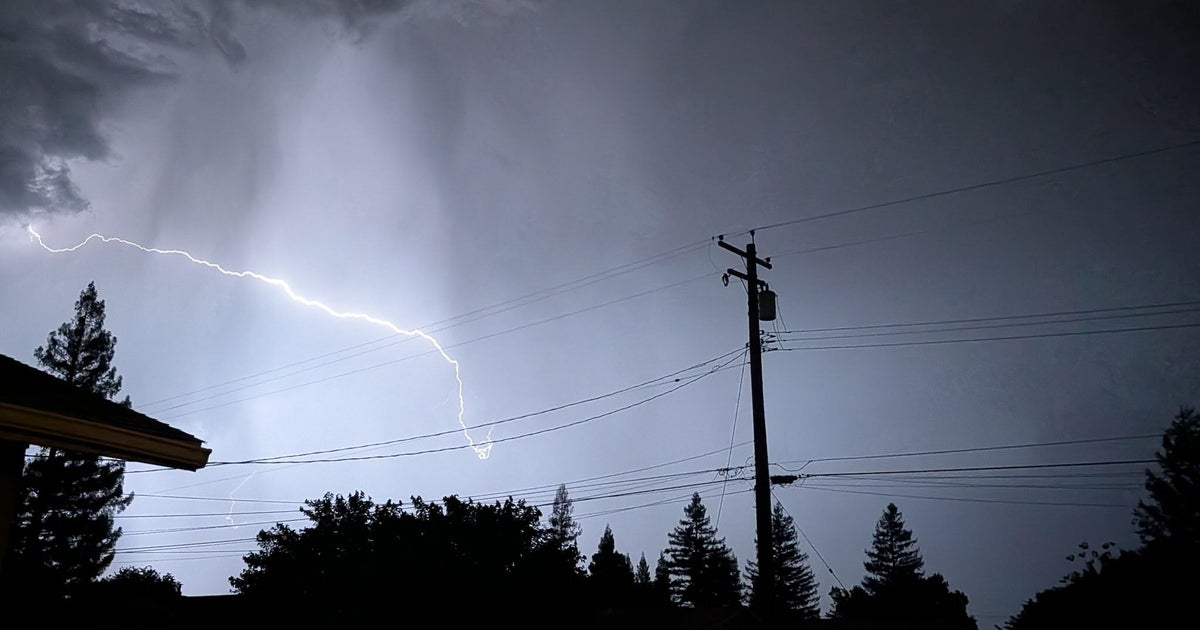
Funnel clouds were spotted in the Jamestown area — the heart of California's Gold Rush — on Saturday afternoon and the weather service issued a tornado warning — later canceled — for the Sierra Nevada foothills as severe thunderstorms, hail and high winds blanketed the region. Another set of tornado warnings were briefly issued in Fresno County, nearly 100 miles (161 kilometers) south of Gold Country. Flash flooding warnings were in effect late Saturday in Tuolumne County, with roads submerged around Sonora and neighboring communities.
