Dixie Fire Update: Wind-Whipped Flames Burn Structures Near Taylorsville; Genesee Valley Residents Flee Homes
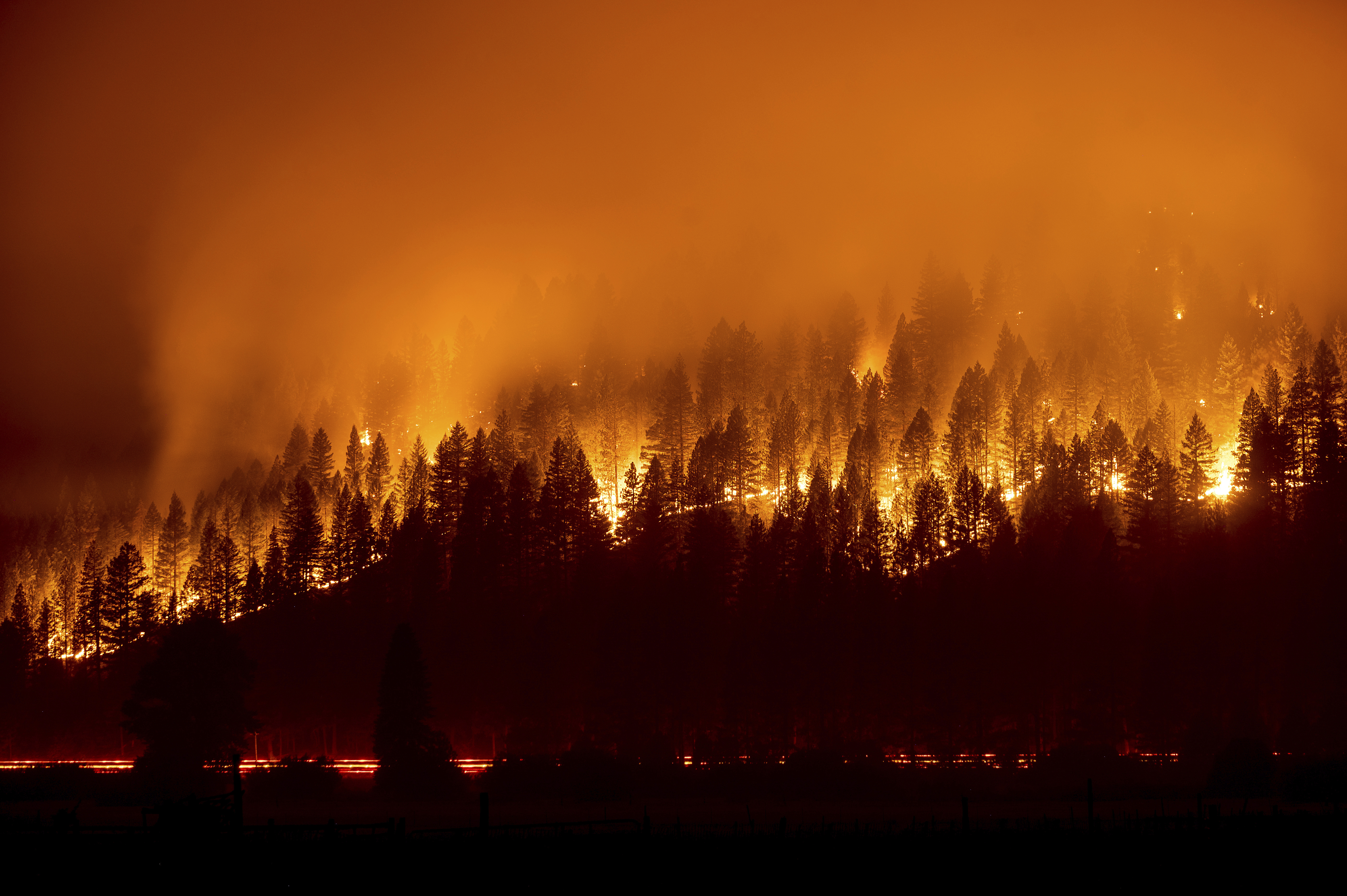
TAYLORSVILLE (CBS SF) -- Intense downdrafts from passing thunderstorms Friday evening fueled a rapid advance of the Dixie Fire, driving residents in the Genesee Valley from their homes, burning structures near Taylorsville and challenging firefighters along the northern edge of the massive blaze.
Before the surge, the wildfire's burn zone stood at 540,581 acres and was 31 percent contained. Its flames have ravaged more than 800 square miles — an area larger than the city of London.
"The last two days we have had significant development of thunderstorms," East Zone Incident Commander Rocky Opliger said at his late Friday night. "When those thunderstorms come in it's pretty critical. We had dry lightning occur over the fire area today."
"When one of those thunderstorms developed right over the north arm (of the fire), right around Diamond Mountain Road, we experienced outflow winds or what we call downdraft winds of 35-50 mph. And that has occurred in the last hour. It made the fire move rapidly and impact (burn) structures."
Flames Near Diamond Valley Road
But as the firefight began, crews discovered many residents had not obeyed a mandatory evacuation order. CHP and Plumas County deputies were racing to homes, evacuating those residents as the flames approached.
"We are actively engaged in a major firefight," Opliger said.
Plumas County officials ordered immediate evacuation of all of Genesee Valley southeast of Taylorsville up the Genesee Road to just south of Babcock Crossing, Walker Mine Road, north portion of Beckwouth Genesee Road.
"All residents must leave these areas immediately due to an imminent threat," deputies posted on Facebook.
The blaze was also threatening homes along the Keddie Ridge and in the Wilcox Valley.
"Unfortunately what we did see was those thunderstorms did materialize," East Incident Commander Jake Cagle said of the Keddie Ridge area during a Saturday morning update. "We did have gusty winds, 360-degree through there, gusts up to 50 mph. Our crews were highly engaged in the afternoon."
The surge also forced officials to cancelled the repopulating of several communities planned for Friday including Chester, Lake Almanor West and Prattvile.
The shifting weather conditions and increased intensity was an unwelcomed development for the more than 6,000 firefighters and the thousands of residents who have been out of their homes for nearly a month.
"This fire continues to test us," said Plumas National Forest Supervisor Chris Carlton.
Edwin Zuniga, a spokesman with the California Department of Forestry and Fire Protection, echoed Carlton's sentiments.
"Mother nature just kind of keeps throwing us obstacles our way," he said.
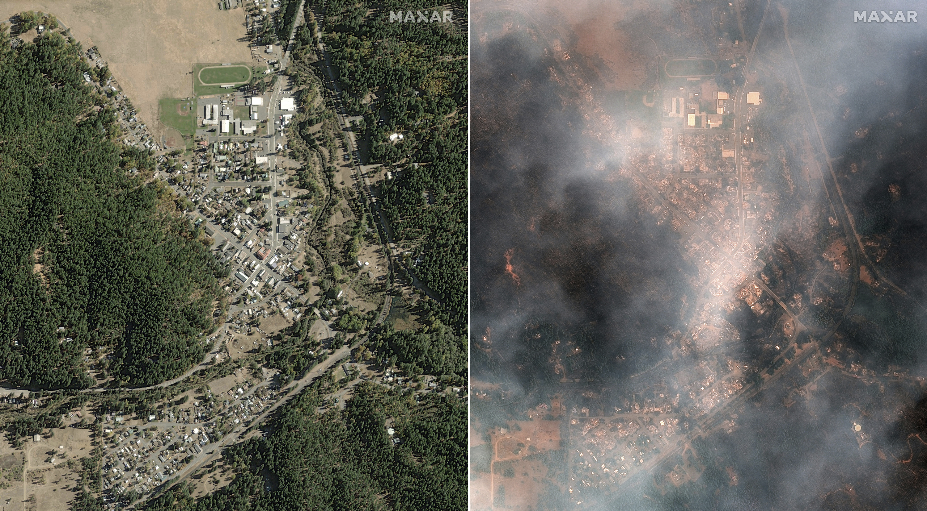
The fire, which started on July 14, has destroyed at least 557 homes and leveled the communities of Greenville and Canyondam. A stunning aerial photo of the destruction on Greenville was posted Wednesday.

The cause of the fire has not been determined. Pacific Gas and Electric has said the fire may have been started when a tree fell on its power line.
- Cal Fire Incident Report: Evacuations, Maps, Road Closures
- Evacuation Maps: Butte, Plumas County | Lassen County | Tehama County
- County Websites: Butte County | Plumas County | Lassen County | Tehama County
© Copyright 2021 CBS Broadcasting Inc. All Rights Reserved. The Associated Press contributed to this report.


