Dixie Fire Update: Wildfire Grows To 181,289 Acres; Flames Threatening Twain and Quincy
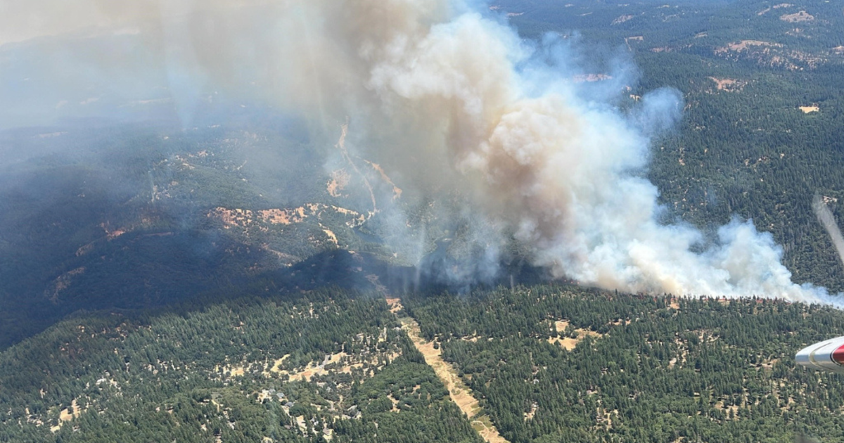
TWAIN, Plumas County (CBS SF) -- The Dixie Fire that was raging through bone-dry timber and brush in Plumas and Butte counties grew to 1828,298 acres by Saturday morning.
Cal Fire placed containment on the Dixie Fire at 19%.
Flames from a spot fire were still threatening the community of Twain and transmission lines from the Caribou hydroelectric facility.
Cal Fire said the Fly Fire -- another separate nearby fire -- had grown to approximately 1,600 acres as of Friday evening. It was endangering the town of Quincy. Though the fire is technically not a Cal Fire incident, the agency is providing crews that are trying to contain the fire.
One of the issues during Friday's firefight was that reduced visibility from increasing smoke made it impossible for air tankers to provide support from above, though helicopters were still able to make water drops during the day, Cal Fire said.
The fires were producing towering pyrocumulonimbus clouds that were part of the visibility issue for air tankers Friday, authorities said.
Earlier during his Friday morning briefing, Cal Fire Operation chief Mike Wink said the unnamed spot fire was well over 1,000 acres and growing rapidly.
"That spot fire outpaced all our modeling," he said. "It took what we thought it would do in eight hours. It tripled that in two hours."
Wink also said the flames had reached the transmission lines from the Caribou hydroelectric facility. Almost 4,000 personnel are assigned to the fire.
At least eight of the 1,510 structures threatened by the fire have been destroyed.
DIXIE FIRE:
- Cal Fire Incident Report, Evacuation Information, Road Closures
- Butte, Plumas County Evacuation Map
- Butte County Website | Plumas County Website
The rapidly expanded fire zone prompted the Plumas County Sheriff's Office to issue new evacuation orders Thursday evening for a portion of Chandler Road from Hwy 70 at Chandler Road west to Oakland Camp. Residents were advised to leave the area immediately eastbound to 59 Bell Lane in Quincy.
Earlier Thursday afternoon a mandatory evacuation order was issued for Greenville, Crescent Mills and the area around the Round Valley Reservoir. That order also covered Dixie Canyon, Indian Falls, Long Valley (west of Round Valley) and Dixie Canyon south to Indian Falls, south of Indian Falls to the Hwy 70/89 Junction as well as Highway 70 at Black Hawk Road north to the Hwy 70/89 Junction and everything on the western side of Hwy 70 including Butterfly Valley and Black Hawk.
On social media, posters said homes had burned in the Butterfly Valley area.
Firefighters were facing another day of difficult weather conditions.
"That critical pattern (of weather) is going to worsen over the next couple days," said Cal Fire meteorologist Julia Ruthford at a Thursday night briefing. "We are looking for a ridge of high pressure building in from the Great Basin. That's going to bring some significant warming over the next two days. Conditions will be getting drier than they are right now. Temperatures will increase 3-5 degrees (on Friday) and then increase more on Saturday. Saturday is going to be the hottest day of the week."
On both Friday and Saturday night, the winds will shift to the northeast as the famed 'Jarbo Winds' howl through the fire zone. The Feather River Canyon is well-known for high winds and these are named after the nearby Jarbo Gap.
"Those are going to be enhanced because of the high temperatures down on the valleys," Ruthford said. "The gusts will be in 25-35 mph range."
Chris Waters, a Cal Fire fire behaviorist, said the fuels in the area were at historically dry levels for July.
"We are at conditions we would not see until late September or October...right now we are in mid-July," he said. "That means that all these fuels that are on the ground, particularly the large dead fuels, are already at critical levels and fully available to burn unimpeded."
