Expanding heat dome brings 1st heat wave of the season to Bay Area
A heat dome parked over the western United States was set to sizzle the Bay Area beginning Tuesday with near triple-digit temperatures inland and 80s on the coast.
A Heat Advisory was in effect for the Sonoma coastal range, North Bay interior mountains and valleys, and East Bay hills and valleys from 8 a.m. Tuesday to midnight Thursday night, the National Weather Service said. The high temperatures Tuesday are expected to be well above normal high temperatures for early June. The coast will see 70s to the lower 80s, bayside highs will be in the 80 to 90 degree range, the inland temperatures will range in the 90s to the 100-degree mark.
KPIX First Alert Weather: Current conditions, alerts, maps for your area
As of 4 p.m. Tuesday afternoon, some of the high temperatures registered included 99 degrees in Berryessa-Knoxville, 98 degree readings measured in Concord, Altamont and Santa Rosa and 96 degrees in Napa.
Farther inland from the Bay Area, an excessive heat warning was in effect from 11 a.m. Tuesday to 8 p.m. Thursday because of dangerously hot conditions in areas along the Delta, the Central Valley, and the Sierra foothills. Cooling centers are being opened across the region to provide assistance for those residents who do not have air conditioning at home.
Early Tuesday evening, the heat advisory was extended into the Santa Cruz Mountains.
The heat is coming from a high-pressure system which is forecast to remain nearly stationary over the west late this week into next week, surrounded by low-pressure systems of various strengths, the Weather Service said. Weak upper-level troughing is expected to reach California by the weekend, providing a sea breeze cool down.
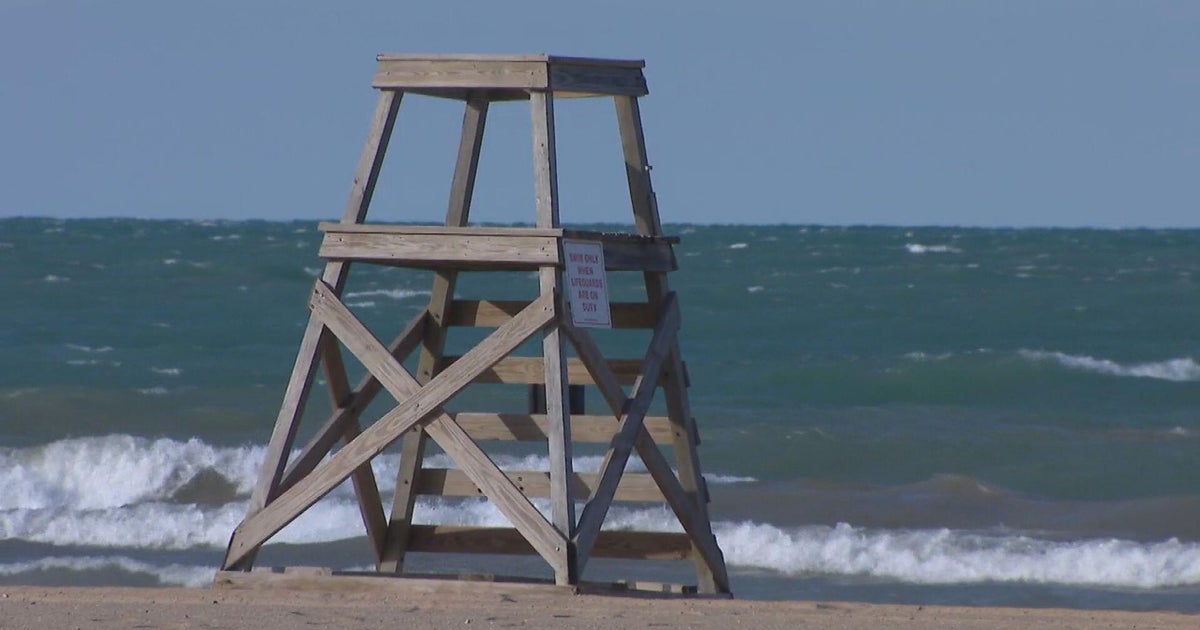
People seeking relief from the heat by heading to the coast were also advised of a Beach Hazards Statement beginning Wednesday morning through Thursday for the entire Bay Area coast from Point Reyes to the southern Southern Monterey Bay and Big Sur coast.
The Weather Service warned a northwest swell along the coast will create large breaking waves of 15 to 20 feet and bring an increased risk for sneaker waves, which can pull people into the water from rocks, jetties, and beaches. Inexperienced swimmers were advised to stay out of the water.
The first major heat wave of the season, an expansion of a heat dome that has punished Mexico for weeks, was forecasted to bring triple-digit temperatures to California, Nevada and Arizona this week, including Phoenix, which last summer saw a record 31 straight days of at least 110 degrees Fahrenheit (43.3 Celsius).
By Wednesday, most of an area stretching from southeast California to central Arizona will see "easily their hottest" weather since last September, and record daily highs will be in jeopardy from Las Vegas to Phoenix, the National Weather Service said late Monday.
The Weather Service advised people in hot weather areas to:
* Stay hydrated and drink plenty of fluids.
* Wear lightweight, light-colored clothing.
* Reduce time spent outdoors or stay in the shade.
* Never leave people or pets unattended in vehicles.
* Use sunscreen if going to the coast or the pool.
The Associated Press contributed to this report.