Atmospheric river soaks Northern California on Day 2 of storm; rain prompts North Bay flood watch
The second day of an atmospheric river brought heavy rain to Northern California and the Bay Area Thursday, with the heaviest downfalls in the North Bay ahead of the storm moving south on Friday.
The National Weather Service said Marin, Napa, and Sonoma counties are under a flood advisory through early Saturday morning. The 24-hour rainfall totals in the North Bay included more than 7 inches at Charles M. Schulz Airport in Santa Rosa and reports of over 10 inches in the coastal mountains of Sonoma County, the Weather Service's Bay Area office said in its daily forecast discussion.
The Sonoma County mountain communities of Venado and Austin Creek have seen 13.83 inches and 12.95 inches of rain, respectively in the last 36 hours, the Weather Service said.
KPIX First Alert Weather: Current conditions, alerts and maps for your area
Sonoma County flooding, damage
Santa Rosa Fire Department said the city had the second wettest day in a 24-hour period in the last 120 years. On Thursday, incessant rain led to flooding on Airway Drive north of Hopper Avenue. At the Sutter Health clinic, the only access road flooded, submerging cars.
"Due to extreme weather and flooding, we evacuated our care center at 3883 Airway Drive in Santa Rosa for the safety of patients and staff," a Sutter Health spokesperson told CBS News Bay Area. "The evacuation was carried out smoothly, thanks to the coordinated efforts of local officials, including Santa Rosa Fire and Police. We sincerely thank them for their support. We encourage patients at this location to reach out to their provider's office for updates on scheduling and ongoing care."
West of Santa Rosa near the town of Graton on Thursday, fire crews rescued a driver trapped by flooding from the swollen Green Valley Creek along Green Valley Road. Fire crews were also dispatched to Slusser Road near River Road south of the airport where a driver attempted to drive through a flooded portion of the road. The car became stuck after getting partially submerged and the driver was able to escape.
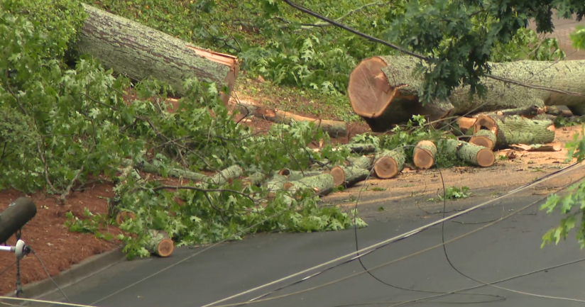
In Forestville on Wednesday night, one person was taken to the hospital after a massive tree crashed into a house and at least one car. The tree also took down power lines near the home.
Storm fueled by atmospheric river, bomb cyclone
The storm's intensity comes from a combination of the tropical moisture from the atmospheric river combined with a deep, rapid drop in pressure when a polar air mass collides with a tropical air mass, known as a bomb cyclogenesis, or a bomb cyclone.
A high surf advisory was also in effect for the Bay Area coast from Point Reyes south to Big Sur including the Southern Monterey Bay until 6 a.m. Friday. The Weather Service said large breaking waves between 14 to 19 feet would be seen on southwest-facing beaches and between 19 to 22 feet along well-exposed west-facing beaches.
Power outages across Bay Area
Most of the storm impacts were happening north of the Golden Gate, including downed trees and power lines along with thousands of power outages since Wednesday. Pacific Gas and Electric said more than 2,400 people were without power as of 11:30 a.m. Wednesday morning, most of them in the North Bay.
The strong southerly winds hitting the Bay Area were expected to decrease Thursday, but won't improve substantially until Friday evening, the Weather Service said.
Rainfall amounts on Thursday could decrease slightly in the North Bay; however, another 1 to 3 inches of rain are still expected in the valleys and up to another 6 inches in the mountains over the next 24 hours.
More rain coming Friday
While the rain Thursday will mostly be concentrated north of Interstate Highway 80, by Friday the storm will be more evenly distributed across the Bay Area. The Weather Service said the bomb cyclone conditions off the Pacific Northwest will reform by Friday increasing the intensity of the atmospheric river moisture flowing through the region. Heavy rain and strong winds are expected throughout the day Friday.
Longer-term forecasts see more rain for the Bay Area even as the atmospheric river conditions end, the Weather Service said. Showers are expected Saturday and subsequent waves of rain Sunday night and possibly Tuesday will also soak most of the region.
The total rainfall forecast from Thursday through next Tuesday ranges from about 2 inches in San Jose to over 6 inches in Santa Rosa in addition to what has already fallen.
