Latest atmospheric river storm brings flooding, road closures, evacuations to Bay Area, Central Coast
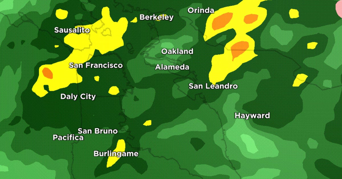
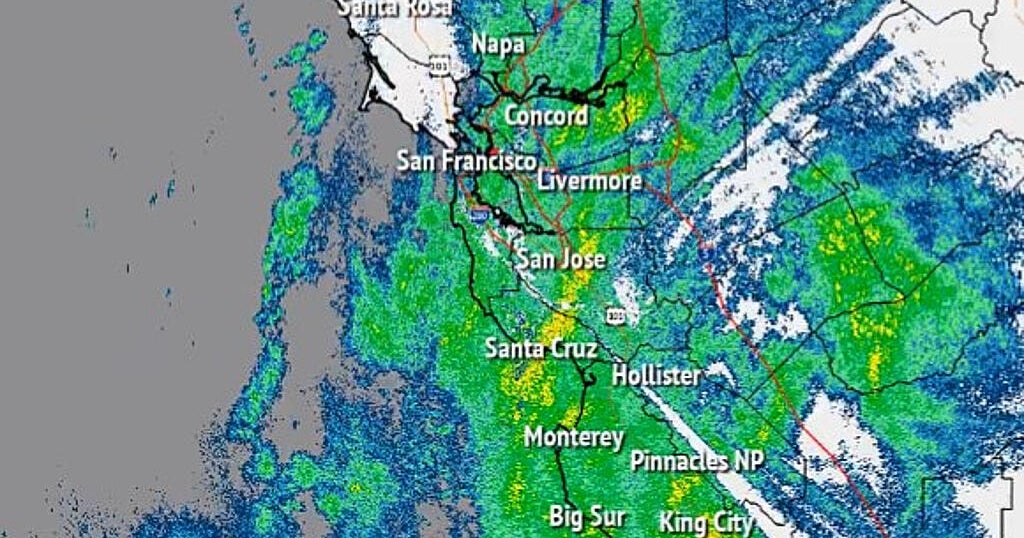
Showers lingered Saturday morning following another onslaught of wind and rain, fueled by a potent atmospheric river, which swelled waterways and flooded freeways Friday.
The latest round of wet weather impacted communities still recovering from the late February storm, triggering new evacuations and toppling trees into homes across the Bay Area and Central Coast.
Evacuation zone maps: Santa Cruz County | Monterey County
A Flood Warning was in effect for the Salinas River near Bradley affecting Monterey County, while a Flood Watch is in effect for the entire Bay Area and Central Coast from Thursday afternoon through Sunday morning.
KPIX 5 First Alert Weather: Current Conditions, Forecasts, Alerts For Your Area
Monterey County evacuation orders downgraded
An immediate evacuation order was expanded for residents in the Pajaro community and residents of San Ardo in Monterey County early Saturday morning.
Monterey County evacuation zone map
The mandatory evacuation order was issued at 12:32 a.m. for Pajaro residents in evacuation zones B-014 and B-019. San Ardo residents in zones G-028 and G-033 were told to evacuate at 12:55 a.m.
Update: Crews work to repair Main Street in Soquel after Bates Creek washes out road
SOQUEL -- Crews in Soquel were scrambling to make repairs to the town's main road, hoping to reconnect residents who were trapped in their homes early Friday when the Bates Creek washed out Main Street.
Runoff from the torrential downpour fueled by an atmospheric river turned the normally tranquil water of Bates Creek into a raging torrent Friday morning.
More than 6 inches of rain fell in the nearby Santa Cruz Mountains as the region remains under a National Weather Service flood watch until Sunday.
Bates Creek quickly rose and with force wiped out the only road in and out of the community. A shelter in place alert was issued for residents of Cherryvale, Glen Haven, Prescott and other neighborhoods.
"It's unimaginable," said Ed, a local resident. "I just could not believe, if you told me this was going to occur, I'd say never."
Flood advisory issued for Sonoma County
The latest round of wet weather fueled by an atmospheric river prompted a flood advisory for Sonoma County Friday.
The National Weather Service said flooding would impact the areas around Willow Brook, Laguna de Santa Rosa, Mark West Creek and Colgan Creek.
The flood advisory was in effect until 7 p.m Friday. The weather service said there could be minor flooding in low-lying and poor drainage areas of Santa Rosa, Petaluma, Rohnert Park, Windsor, Healdsburg, Cotati, South Santa Rosa, Roseland, Larkfield-Wikiup, Forestville, Graton, Glen Ellen, El Verano and Temelec.
KPIX 5 First Alert Weather: Current Conditions, Forecasts, Alerts For Your Area
Betweek three and four inches of rain have fallen in the area Friday as of 1:38 p.m.
The weather service urged people to "turn around, don't drown" when encountering flooded roads, and to be especially cautious at night.
Evacuation orders issued in Monterey County
The Monterey County Sheriff's Office Friday issued evacuation orders for the areas of Carmel Valley, Arroyo Seco and Pajaro as a result of the atmospheric river storm hitting the area.
Residents can look up at the county's evacuation zone map to see if their homes are under evacuation orders. If so, they should leave immediately and also check with neighbors to make sure they are aware of the order.
Uvas Creek floodwaters close SB Highway 101 near Gilroy
Flooding from the swollen Uvas Creek following steady overnight rains closed southbound U.S. Highway 101 in Gilroy Friday morning.
At around 8:30 a.m. Friday morning Caltrans had closed the southbound right lane and shoulder betweeen Monterey Road and State Road 25.
By 10:13 a.m., the California Highway Patrol said all of southbound 101 was closed from 10th St. to SR 25.
Overnight wind and rains cause damage in San Francisco
In San Francisco, there was some damage and closures caused by the overnight storm.
Pine Lake Park in the Sunset District is closed because of storm damage. The overnight wind and rains left trees split and uprooted, destroying paths and creating dangerous conditions.
Parks and Rec also announced all grass fields and diamonds were closed Friday, as were parts of Golden Gate Park in order to keep fields from being further damaged.
Wind from the storm caused a 100-foot eucalyptus tree to collapse on to five cars in the Panhandle near Lyon Street early Friday.
The tree completely smashed in the roof on one vehicle and destroyed the windshields of the others. It was quite the shock for residents in the area when they woke up Friday to the sound of chainsaws.
"I think anyone would be surprised seeing their car under a big tree like that behind us," said one local resident. "[I'm] pretty shocked. I don't think there's much coming back for it. It was pretty wrecked."
Update: Some evacuation orders and warnings lifted in Santa Cruz County
Authorities in Santa Cruz County announced late Friday morning that some of the evacuation orders issued almost 12 hours earlier had been lifted.
Officials said orders remain in place in South County zones along Corralitos/Salsipeudes creeks. Authorities continue to monitor the Pajaro River. Residents can check zone at https://aware.zonehaven.com/search.
Late Thursday night, the Santa Cruz County Sheriff's Office issued an evacuation order for residents in low-lying areas including parts of Felton Grove, Soquel Village and Paradise Park that were flooding.
An evacuation warning that had gone out Thursday afternoon to weather-weary residents in a Felton Grove neighborhood near the San Lorenzo River became an evacuation order by early Friday. Sheriff deputies went door to door in the neighborhood, telling residents to leave their homes.
In Soquel, Main Street has been washed out as the Bates Creek rolled over its banks. A shelter in place alert has been issued for residents of Cherryvale, Glen Haven, Prescott and other neighborhoods north of Bates Creek.
California storm damage prompts President Biden emergency declaration
President Joe Biden on Friday declared an emergency exists in California because of the ongoing storms, flooding, mudslides and other associated damage across the state, ordering federal assistance for disaster relief.
The president's declaration was effective on March 9 and authorizes the Department of Homeland Security (DHS) and the Federal Emergency Management Agency (FEMA) to coordinate disaster relief efforts and mobilize equipment and resources.
The emergency declaration was in effect for the following counties: Amador, Butte, El Dorado, Fresno, Humboldt, Imperial, Inyo, Kern, Lake, Los Angeles, Madera, Mariposa, Mendocino, Merced, Mono, Monterey, Napa, Nevada, Placer, Plumas, Sacramento, San Bernardino, San Francisco, San Mateo, San Luis Obispo, Santa Barbara, Santa Clara, Santa Cruz, Sierra, Sonoma, Stanislaus, Tulare, Tuolumne, and Yuba.
Major freeways shutdown by flooding, slides
Multiple freeways and highways were shut down to traffic Friday due to impacts from the current storm.
In Oakland, I-580 was shut down for hours by flood waters from High Street and 35th Ave. The closure was announced early Friday at around 3:30 a.m. According to Caltrans, all eastbound lanes were re-opened at 9 a.m.
All lanes had reopened in both directions by 11:30 a.m., Caltrans said.
In the North Bay, Highway 12 under Stony Point Road and several other streets around Santa Rosa was closed for several hours overnight due to flooding, but reopened at around 7:20 a.m. Friday morning.
In Sonoma County, Caltrans said Highway 1 was shutdown between Marin/ Sonoma County line to School St,, with all lanes blocked due to flooding.
In Santa Cruz County, State Route 152 was closed between Casserly Road and Watsonville Road due to multiple landslides, according to CHP.
SR-129 was also closed between Murphy Crossing to 101 due to slides.
There was also a major slide in Scotts Valley. Authorities said the slide has shutdown Green Hills Road from Falcon Ridge Road to 1500 Green Hills Road. Police and public works were on the scene working to clear the mudslide, but did not have an estimate of when the roadway will reopen.
Several Santa Cruz County schools close Friday
The Pajaro Valley Unified School District in Santa Cruz County announced Thursday evening the closure of several schools on Friday.
District spokesperson Alicia Jimenez said the schools will be closed because of current evacuation orders, evacuation warnings and accesibility issues due to major road closures related to the storm that is over the region.
The following schools will be closed Friday:
Ann Soldo Elementary School
Pajaro Middle School
Watsonville High School
Renaissance High School
Watsonville Infant Center
Two suffer minor injuries when tree hits car on Old La Honda Road
There was a weather-related road closure at Old La Honda Road and Skyline Boulevard in unincorporated Redwood City Thursday night after a falling tree struck a vehicle.
The San Mateo County Sheriff posted on Twitter about the incident shortly after 9:30 p.m. Thursday. A photo showed a large tree that had crushed what appeared to be a white Tesla. Authorities said both passengers suffered minor injuries and were expected to be ok.
The Calfire San Mateo-Santa Cruz unit also responded to the incident, as did CHP, the sheriff and area fire departments.
Major Rohnert Park thoroughfare closed due to flooding
A major street in Rohnert Park was closed Thursday night due to flooding.
A spokesperson for the Rohnert Park Department of Public Safety said Rohnert Park Expressway was closed at Rancho Verde because of flooding from the storm.
Motorists were urged to avoid the area until further notice.
Fallen tree blocks lanes on northbound I-280 in San Bruno
SAN BRUNO -- A tree has fallen and is blocking lanes on northbound Interstate 280 in San Bruno early Thursday evening.
A California Highway Patrol spokesperson said the tree is blocking the two right lanes of northbound Interstate 280, south of the Crystal Springs Road on-ramp.
Emergency road crews are heading to the scene to remove the tree from the freeway.
Incoming storm could deliver 8 feet of new snow to Sierra; Winter Storm Warning in effect
LAKE TAHOE -- A Winter Storm Warning went into effect for the Sierra Thursday morning ahead of the arriving atmospheric river with the mountains facing up to eight more feet of snow from the storm.
The warning will remain in effect through Sunday morning for the Sierra and the southern Cascades. People in those mountain areas are advised to be prepared for chain controls, major travel delays and likely road closures. Winds during the height of the initial storm Thursday into early Friday could gust at speeds 50-70 mph.
California's Sierra Nevada snowpack, which provides about a third of the state's water supply, is more than 180% of the average on April 1, when it is historically at its peak.
Evacuation warnings issued in Santa Cruz County
From the Santa Cruz County Sheriff's Office:
EVACUATION WARNING
Heavy rains and run off are expected starting Thursday afternoon through Friday evening. Residents in low lying areas should be prepared to evacuate and move to higher ground. If possible, consider moving prior to the start of the weather system. The Sheriff's Office is issuing an evacuation warning for the following zones in the unincorporated areas:
FEL-E008, FEL-E012, CRZ-E081
CTL-E014-B, E015-B, E018-A, E019-B
CTL-E051-B, CTL-E050-B
PAJ-E015-B, E024-B, E027-B, E026, E028
These areas have been identified as the highest threat to flood, however flooding could take place in areas outside of these identified zones. The Sheriff's Office recommends residents remain mindful of their surroundings and their proximity to potentially flooded areas.
Millions face flood threat from latest atmospheric river; 'There is an absolute huge threat'
A potent weather front containing an atmospheric river engorged with warm tropical moisture triggered flood fears across Northern California and the state Thursday.
More than 17 million people are under flood watches in California and slices of Nevada. Much of California is under a significant risk of excessive rainfall that could inundate places already devastated by severe flooding earlier this year.
Among the areas of concern, forecasters said, were rivers, creeks and waterways in the South Bay and the Russian River near Hopland.
Atmospheric river: Bay Area residents brace for strong winds, floods, toppling trees, power outages
A powerful jet stream hurled a potent category 4 atmospheric river at the San Francisco Bay area early Thursday, triggering a flood watch for the region and warnings of mudslides, downed trees and power lines.
The National Weather Service said the plume of subtropical moisture would dumped several inches of rain over the next 24 hours.
"Inland regions expected to see 1-3 inches, inland hills 3 to 6 inches, Santa Cruz Mountains 4 to 6 inches with locally higher amounts up to 8 inches," forecasters said.
Storm prep: Where to get sandbags in the Bay Area
The National Weather Service issued a flood watch that goes into effect Thursday afternoon for the entire San Francisco Bay Area as an atmospheric river slams into the region.
Many Bay Area residents are looking to take precautions against possible flooding after the heavy damage caused by rains in late December through January. Here is a list of where to get sandbags in every Bay Area county; remember to bring a shovel just in case.
Bay Area prepares for heavy rain, high winds ahead of arriving storm system
The entire Bay Area is bracing for another round of torrential rain and high winds as the latest atmospheric river takes aim at the region, residents and business owners scrambling to make last-minute preparations.
Wind and rain are expected to arrive in late Thursday morning with the precipitation increasing in intensity as the day progresses. Oakland city officials urge residents to prepare and even volunteer to prevent flooding.
Forecasters with the National Weather Service have issued a flood watch for the entire Bay Area, which includes a 40 percent chance of flash flooding Thursday night into Friday morning.


