Unsettled weather returns to Northern California as we "fall back" this weekend

Changes are ahead through next week as our weather shifts from a mild pattern into a cooler and unsettled one.
Through Friday, rain will focus mainly across northern portions of the Sacramento Valley into the Pacific Northwest. Most from Chico to the south will stay dry until this weekend.
The end of the week will stay mild with partly cloudy skies and temperatures slightly above average across the region.
We'll start noticing the changes as we get closer to Sunday, as rain is in the forecast with breezy winds. We'll have better rain and snow potential as we head into early next week, but a little precipitation will be expected this weekend.
The Track
Our track starts to shift further south by the time we get into Saturday. Rain begins to develop across areas north of I-80 late Saturday before tracking to the south heading into Sunday.
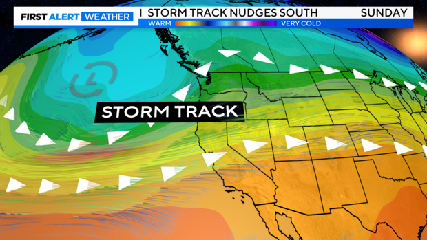
This shift in the pattern will keep rain and cooler temperatures in the forecast through early next week.
Rainfall Amounts
As far as rain amounts go, this weekend, we're not expecting anything major. Most from the Bay Area to the Sacramento Valley can expect up to a tenth of an inch.
The Sierra will pick up slightly more rain accumulations with a quarter to half an inch expected Saturday through Sunday evening.
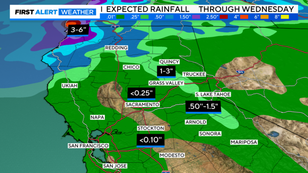
Looking ahead to next week, models are hinting at larger amounts across the Sierra as snow levels drop and more moisture arrives.
Monday through early Wednesday is when we are tracking to receive more than an inch of snow to our passes, especially to those north of Highway 50.
Snow Potential
Snow levels remain above 8,000 feet in elevation until temperatures drop on Sunday.
As temperatures get colder, the rain will change over to snow quickly. The passes could be looking at slick roads, low visibility and chain controls, especially through Tuesday.
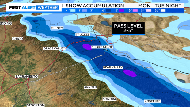
As amounts go, models have not been in alignment yet as we are still five days out. But models hint at 2 to 5 inches of snow possible for the passes, especially across Highway 50 and I-80.
We are calling Tuesday a First Alert Action Day. Stay with us as we track this over the weekend for any changes to snowfall amounts.
Weekend Forecast
Valley
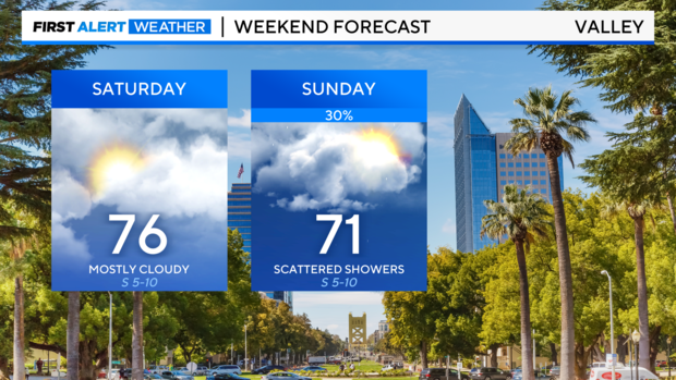
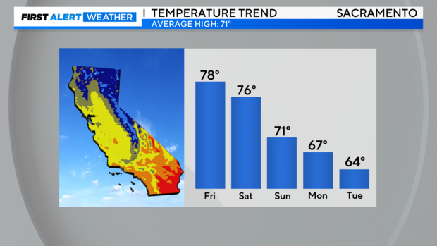
This weekend across the valley will start off primarily dry with temperatures in the mid to upper 70s Saturday with passing clouds.
By Sunday, breezes start to pick up and clouds increase. Showers start to fill in Sunday evening through Monday from north to south across the Valley. Amounts on Sunday will be light.
Don't forget to "Fall Back" Sunday morning with an extra hour of sleep. Sunrise and sunset will be an hour earlier starting Sunday at 2 A.M.
Foothills
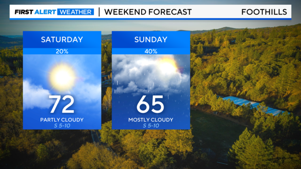
More sun is expected on Saturday as temperatures hover in the low 70s. It'll be a nice day to get outside with passing clouds and light breezes.
Clouds fill in by Sunday with light to moderate rain showers filling into the afternoon and evening. Temperatures will be cooler in the mid-60s for most.
Sierra
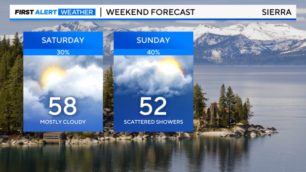
Cool and cloudy across the Sierra this weekend with highs in the 50s both Saturday and Sunday.
Saturday expect a few more sun breaks during the afternoon before clouds fill in by Sunday.
Mostly cloudy skies and scattered showers are expected Sunday. With afternoon temperatures in the 50s, we're not expecting any snow accumulation. But as temperatures drop through the evening, we may start to see snow stick by Monday.
Delta
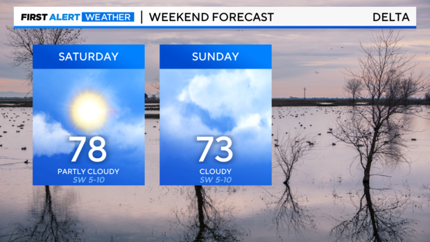
As for the Delta, this weekend will bring more clouds and slightly cooler temperatures.
Saturday will be the nicest day to get outside with highs in the upper 70s and partly cloudy skies.
Sunday will bring more cloud cover with a few sprinkles towards the evening, with light breezes and highs in the low 70s.
Bay Area
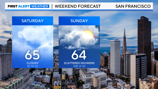
Rain begins north across the Bay Area early Saturday before showers move to the south. Measurable rainfall is not expected from San Francisco south on Saturday, but don't be surprised to catch a few raindrops. Cloudy skies are expected with temperatures in the mid-60s.
By Sunday, we'll have a better chance of showers with up to two-tenths of an inch expected by Sunday night.