Late summer heat returns to Northern California. How long will it last?

Tuesday was the first of what's to come over the next few days. Highs reached the upper 90s and triple digits in the afternoon, roughly 5 to 20 degrees above average.
More heat will come through the week as widespread triple-digit highs return on Wednesday.
Although Meteorological Fall began on September 1, the next few days will remind us that summer is not over just yet.
The hot pattern
A strong ridge of high pressure has built in over the West Coast, keeping temperatures above normal for the rest of the week.
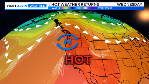
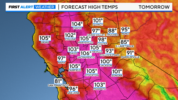
Mid-week highs will range from 100-108 degrees across the Sacramento and Central Valley.
It's not unusual for Sacramento and surrounding valley locations to see triple-digit highs in September. As many remember, it was just two years ago that Downtown Sacramento hit the all-time record high at 116° on September 6.
But climatologically speaking, the triple-digit heat is almost over.
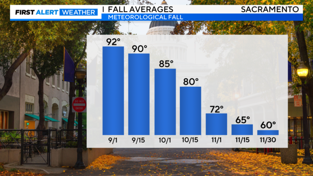
The official start to fall will begin on Sunday, Sep. 22. By then, the average high in Sacramento will be 88 degrees. As we get closer to October average highs will continue to fall into the low 80s.
First Alert Action days
The hottest days this week will be Wednesday, Thursday and Friday as Valley highs are going to range from 100 to 108 degrees. Major heat risk across the Valley and foothills is expected, with localized areas of extreme heat risk in portions of the lower foothills.
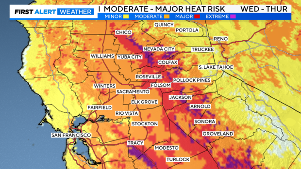
Delta highs will range from the upper 90s to triple-digits. In the foothills and Sierra, highs through the afternoon will be in the 80s and 90s. There will be limited overnight relief with lows in the 60s to low 80s, the warmest temperatures across lower foothill locations.
Fire danger will be elevated this week with periods of gusty winds (10 - 20 MPH) through the afternoon. Dry conditions, hot temperatures, and humidity levels in the 10 - 20% will keep fire danger high.
With several days of heat on the way, it is important to limit your time during the peak heat hours of the day between 1 p.m. and 7 p.m. Also keep yourselves hydrated through the day.
Relief by the weekend
By Friday temperatures in the valley will be in the low-100s, which will be an improvement from the peak heat earlier in the week.
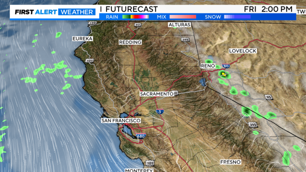
Models are hinting at more instability over the Sierra this weekend. A few showers and isolated thunderstorms will be possible along the eastern slopes and western Nevada Friday afternoon and evening.
Highs through the weekend will still be warm with most in the 90s. By Saturday an area of low pressure will dive closer to Northern California. This will increase onshore flow, also known as the Delta Breeze locally ushering in cooler air by early next week.
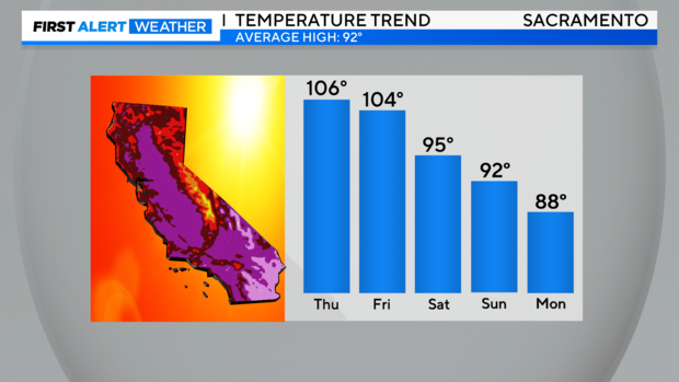
A gradual cool down through the weekend, with a better cool down in store next week. Make sure to stay with the CBS Sacramento First Alert Weather team as we time out when the cooler air will arrive.