Northern California's heatwave makes final surge before weekend relief
Many were able to get some relief across the Sacramento Valley Tuesday as the Delta Breeze returned helping to keep highs from hitting the century mark.
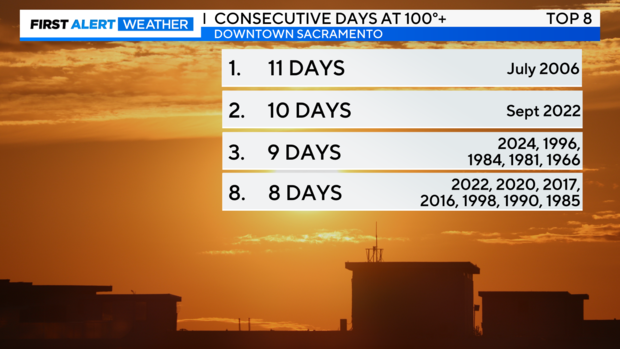
This comes after nine consecutive days of temperatures at or above 100 degrees, marking one of the top eight longest heatwaves in Sacramento.
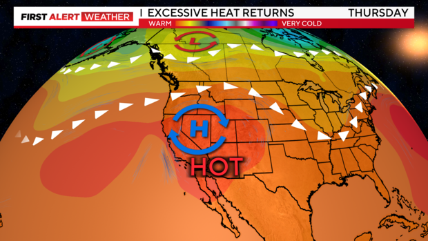
This heatwave is not completely over just yet as temperatures heat up again Wednesday-Friday with more excessive heat across the Valley and Foothills.
Dome of heat
A ridge of high pressure has remained persistent over the West Coast for nearly two weeks. It flattened out slightly Tuesday, just enough to let the Delta Breeze inland.
Starting Wednesday through Friday, the ridge begins to rebuild and strengthen. Heating up temperatures and bringing another round of triple-digit highs.
By the weekend, this ridge begins to move further eastward leaving the West Coast in a more mild pattern and restoring the Delta Breeze in Northern California.
Mid-week warm-up
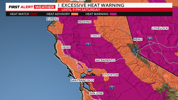
Wednesday marks another day of triple-digit highs. An Excessive Heat Warning and Heat Advisory have been reissued, these heat alerts will stay in place through Saturday evening.
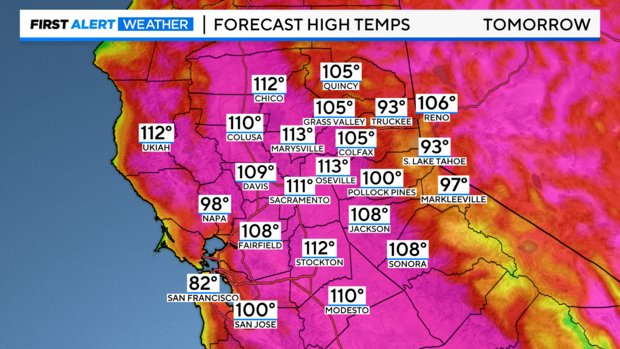
Temperatures climb Wednesday through Friday with highs returning to the 105°-112° range, which is 10-15 degrees above average.
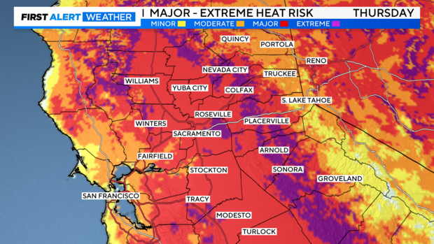
The hottest day of the week will be on Thursday. Areas of major to extreme heat risk will be likely from the valley to the foothills.
Extreme heat could cause heat-related illnesses. Make sure to limit time outdoors during the late morning through early evening to avoid the peak heat of the day.
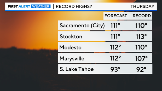
Highs across the region will be near records if not exceeding them by Thursday afternoon. Sacramento will be close to the 1961 record of 111 degrees.
Little to no relief will be felt over the next few evenings as lows drop to the upper-60s to low-80s.
Although the wind will be light to finish the week, a reminder that fire danger will still be elevated. Many landscapes are bone dry after several weeks of above-average temperatures. Hot and dry conditions will help a fire spread if started.
Weekend relief
It will be a slow cooldown into the weekend, but a much-needed one.
Highs across the region will hold to the low-100s Saturday afternoon. It will still be a toasty day, but luckily no excessive heat.
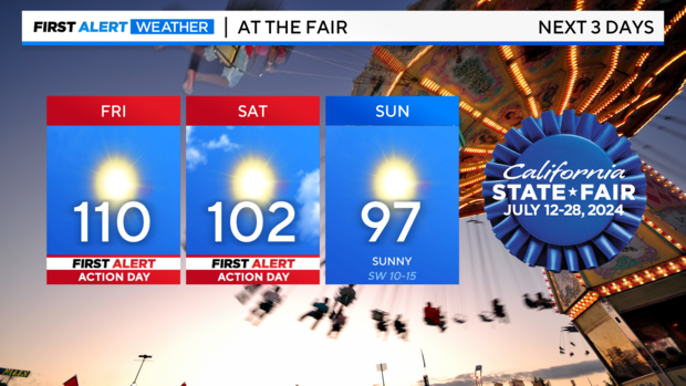
If you're making it out to the California State Fair, temperatures will be the hottest Friday and Saturday before a bit more relief on Sunday.
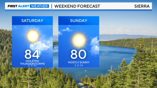
The coolest spots this weekend will be the coast with highs in the low 70s and the Sierra with highs in the 80s.
With just enough instability and a little moisture in the atmosphere, a few isolated thunderstorms will be possible over the Sierra crest on Saturday. The best areas for a thunderstorm will be mainly south of Highway 50.
Temperatures cool down a bit more on Sunday with a nice breeze settling in and valley highs in the upper 90s to finish the weekend.
Looking ahead
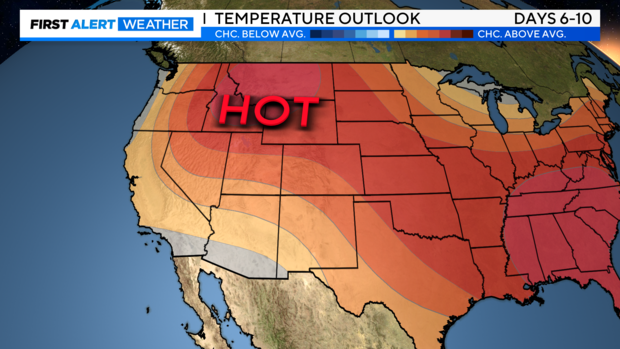
Our pattern next week returns to near normal. Highs hold to the upper 90s for most of the week across the valley.
Hot afternoons and dry days continue as we get further into the summer months. Make sure to do what you can to prevent a wildfire from sparking. Fire danger will stay high.
Stay with the CBS Sacramento First Alert Weather team as we continue to track the latest summer temperatures and weather patterns.
