Northern California to see mid-week cool down after hot weekend

A very persistent ridge of high pressure and a lack of a Delta Breeze has kept temperatures across Northern California this weekend above average.
Sunday marked day 43 of temperatures at or above 100 degrees this year in downtown Sacramento. This puts us in second place, very close to the all-time record of 44 days at or above 100 degrees in a year set back in 2022.
If Monday's high hits 100 degrees or more, this would place 2024 in the top spot tied with 2022 of 44 days.
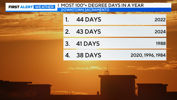
In an average year, downtown Sacramento usually hits 23 days at or above 100 degrees.
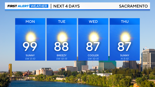
We'll keep the heat around on Monday before cooler air arrives mid-week.
The big picture
The start of the week will have a similar feel to the weekend. Sunny, dry and highs back to the 90s and triple digits.
We'll begin to notice more of a breeze in the Valley by the evening with gusts up to 20-25 mph, stronger gusts along the eastern slope of the Sierra up to 35 mph. This signals the next change in our weather pattern.
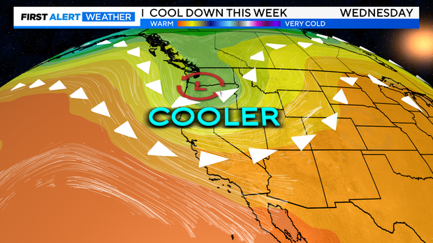
Starting Monday, the ridge of high-pressure overhead from the weekend will begin to shift towards the east. Behind it, an area of low-pressure drops in from the Gulf of Alaska.
This will bring noticeably cooler temperatures, a few clouds and an increase in the Delta Breeze.
Mid-week cool down
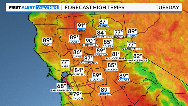
Tuesday through Thursday will bring a refreshing change of pace. Valley highs reach for the upper 80s to low 90s, back to average for some locations. Morning temperatures will start in the 60s.
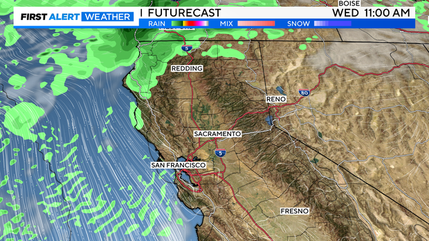
Wind will begin to increase by Wednesday afternoon across the Valley. There is a chance of a few showers and isolated thunderstorms across the northern Sacramento Valley, foothills and Sierra. Any rainfall we get would be light as there is not much moisture within this storm system.
We are still several days out and models could change. Make sure to stay with us through the workweek to see if any raindrops make it closer to Sacramento.
Any more heat to come?
Long term, models have been more consistent about more changes to our weather pattern in the coming weeks.
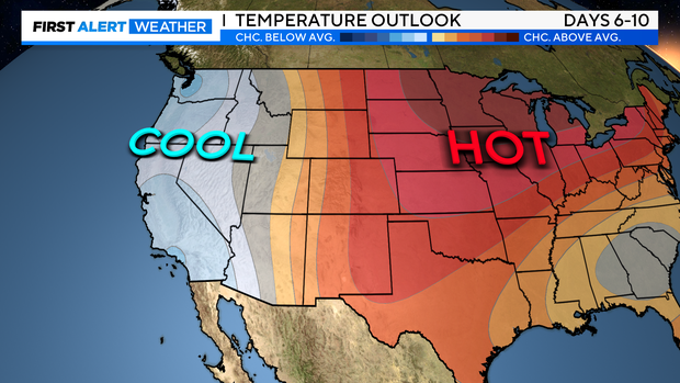
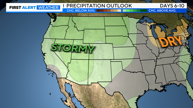
NOAA's climate prediction models for the next 6-10 days places Northern California in the "below average" category for temperatures and "slightly above average" for precipitation.
This could be a signal of fall-like weather returning. Make sure to stay with the CBS Sacramento First Alert Weather team for updates.