Northern California to see hot finish to week before beautiful Labor Day weekend

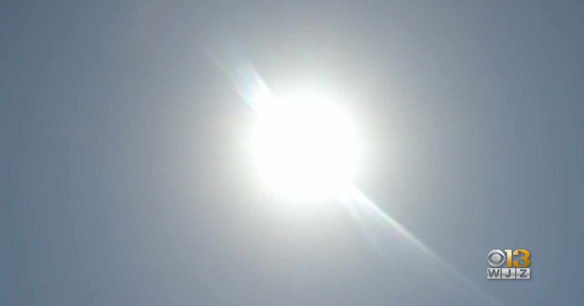
The last few days have been an indication summer is not quite over just yet. Highs in the upper 90s and triple-digits to finish the last week of August. A bit of a transition this weekend will help to break up the summer heat as we get closer to Labor Day.
Warm finish to August
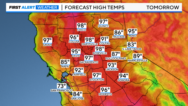
Thursday and Friday will be a warm finish to the week with valley highs in the upper 90s and triple digits. Sacramento will manage to stay out of the triple digits through Friday, yet afternoons will stay in the upper 90s.
Sunny, dry, and breezy across the region through the next few days, with clouds building up along the coast.
Breezy winds will return each afternoon, strongest in the Delta with gusts of 15-25 mph.
Cooler Labor Day weekend
An area of high pressure has kept heat in place for the past few days. By Saturday, this high moves toward the east allowing an area of low pressure along the coast to move in.
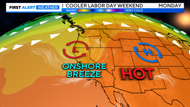
This upper-level low will slide eastward over Northern California through the weekend increasing our Delta Breezes and ushering in cooler air just in time for Labor Day.
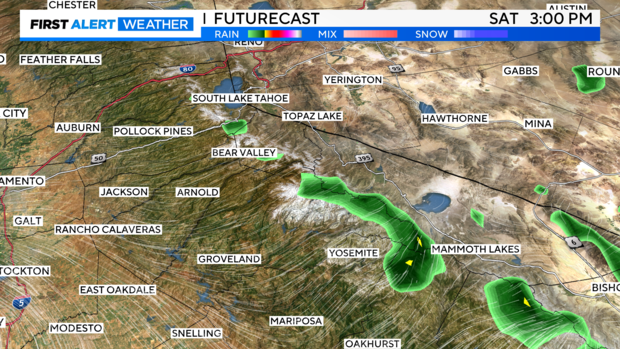
As this feature moves inland it may bring a few showers and isolated thunderstorms over the high Sierra. The best chances for a storm will stay along and south of Highway 50. Thunderstorms that develop may bring gusty winds, brief heavy rain, lightning and small hail. Make sure to keep an eye on the sky if your holiday plans take you to the mountains this Labor Day.
By Sunday, the region dries out and returns to sunshine with cooler-than-average highs from the Delta to the Sierra.
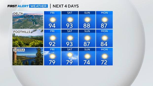
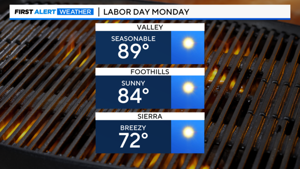
Sunday and Monday will be a great day to spend outdoors with family and friends as valley highs reach for the upper 80s, low 80s in the foothills and low 70s across the Sierra.
More Summer Heat in September
As we turn the calendar page to September, our weather pattern is bringing back the summer heat in time for the first few days of the new month.
Models are bringing back upper 90s and triple-digit highs as we get closer to Wednesday.
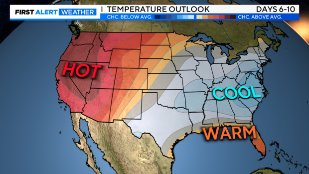
Sep.1 marks the first day of meteorological fall, but it looks like summer may be staying a bit longer. Climate Prediction models keep most of Northern California in the favorable category for above-average highs for the next 6-10 days.
Make sure to stay with Sacramento's First Alert Weather team for updates on how long the heat will stick around for next week.