Widespread rain and Sierra snow return. Here's Northern California's Halloween forecast
Fall has finally arrived in Northern California, and the last few days have really shown that the season can offer a variety of weather.
Our recent storm system on Monday and Tuesday gave us a taste of winter with scattered showers in the valley and snow across the Sierra.
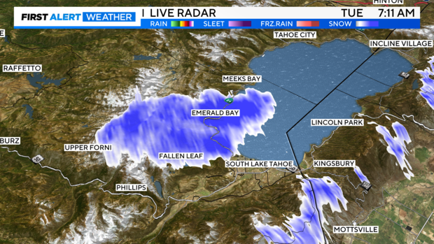
On Tuesday morning, we even saw a rare occurrence of lake-effect snow on the south shore of Lake Tahoe. This is a sight many see around the Great Lakes, but it is not typical in Northern California.
Even though it did not snow around the entire lake, there was enough cold air in place, winds out of the northeast, and warm waters of Lake Tahoe to develop snow near Emerald Bay.
Wednesday afternoon brought a brief break in the activity before more unsettled weather arrives the rest of the week.
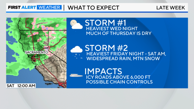
Our next storm system will come in waves thanks to a series of cold fronts, with the first arriving Wednesday night.
Storm #1: Wednesday through Thursday (Halloween)
Wednesday was another cool, dry day at first. It was partly cloudy through the afternoon before our next storm system approached.
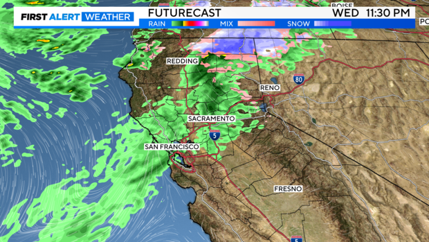
Between 6 p.m. and midnight, our first batch of rain will develop across the Sacramento Valley. Rain begins to transition into snow overnight on Wednesday across the Sierra.
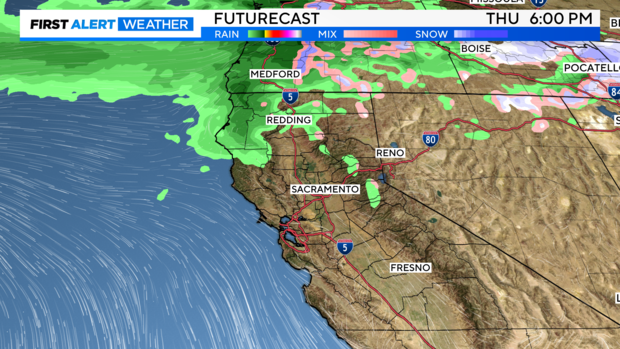
By sunrise Thursday, much of the activity will be south of our area with lingering rain and snow showers continuing for the Sierra through the morning.
By the afternoon, most begin to dry out from I-80 southward. However, a few lingering showers continue north of I-80, especially across the Northern Sierra through Halloween evening.
Rainfall will be light with under 0.10 inches for the valley and up to 0.25 inches in the foothills. Across the Sierra, 1-3 inches is expected above 6,000 ft.
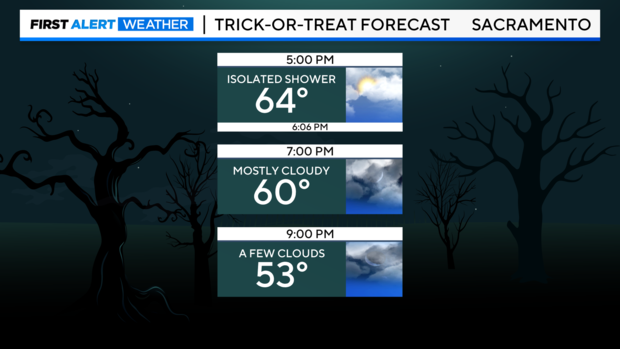
Trick-or-treaters will stay mainly dry! Just make sure to grab a jacket as temperatures drop. Expect 60s in the afternoon with low 50s - upper 40s at night.
Through Thursday, snow showers linger across the Sierra and we could see chain controls issued at times, especially during the morning. Snow levels will drop between 6,000 to 5,000 feet at the lowest. Be ready for delays, closures, and chain restrictions if your Halloween plans take you over the mountain passes.
Snow levels are expected to drop to around 5,000 feet in the Sierra by Thursday.
Storm #2: Friday through Saturday
Our next wave arrives through the day on Friday and into the start of the weekend. This wave is looking the most impactful with widespread rain and snow chances.
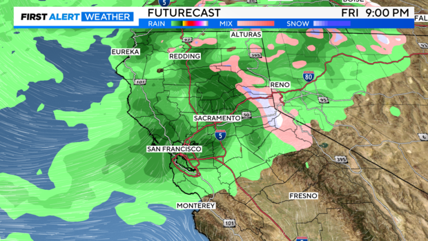
Scattered rain showers redevelop in the valley through Friday afternoon and evening as snow begins to fill in again across the Sierra.
Rain begins in the Valley after dinner on Friday, with the heaviest overnight. Snow in the Sierra will become heavy at times, especially above 6,000 ft. Traveling over the passes will be difficult.
Showers will travel north to south through Friday with the San Joaquin Valley getting rain after 8 p.m.
Through the overnight hours and into early Saturday, we could see moderate-to-heavy rainfall rates at times.
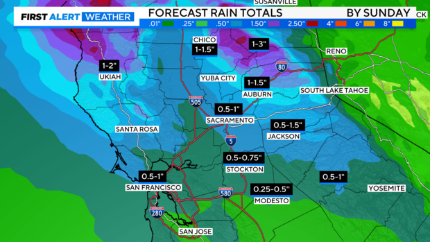
Expect 0.5'' to 1 inch in the valley, 1 to 2 inches in the foothills and up to 3 inches in the mountains. Watch for large puddles in low-lying and poor-drainage areas.
Rain and snow will begin to taper off through the day on Saturday with a few scattered snow showers possible across the Sierra.
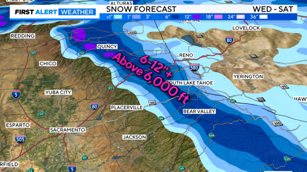
By Saturday night, 8-16" of additional snow is possible for elevations above 6,000 feet with localized amounts of 20-24" possible at the peaks. Snowfall along the Eastern Slope will be less, with 2-4" of snow for Tahoe and 3-6" expected for Truckee.
Early rain and snow totals
We'll continue to watch how models perform over the next couple of days. But the precipitation this week will be good to help dampen the fire season.
Rainfall totals in the Valley and Delta will range from 0.25'' to an inch. Amounts will range from a quarter of an inch to over 2 inches in the foothills and Sierra.
By Saturday, we could see 6 to 12 inches of snow around pass level with over a foot of snow at the peaks.
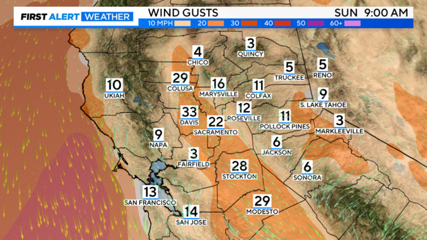
Behind this storm, our weather turns windy but sunny Sunday through Monday. We could see wind gusts up to 25-35 MPH.
Dry weather returns by Sunday with highs warming to the upper 60s to low 70s.
Make sure to stay with the CBS Sacramento First Alert Weather team for updates as our weather turns active.

