More rain, snow chances for Northern California expected by Friday after mild start to New Year
It was another cold, cloudy morning to ring the new year. Clouds have returned to the region thanks to a storm system passing across the northern Sacramento Valley.
The first few days of 2025 will remain dry for many before another storm system arrives by Friday.
Friday's system may be the last for the next week as a drier pattern returns for the first part of January.
New Year's Day weather forecast
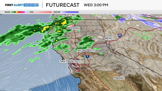
A weak storm system is bringing more rain to Northern California's North Coast and northern Sacramento Valley on New Year's Day, while Sacramento starts 2025 mainly dry.
Clouds became more widespread on New Year's Day as a storm system passed north of Sacramento. This system will bring enough for a few light showers across the Sierra and foothills, but for the valley, many stay dry.
Some in and around Sacramento may get a few showers through the early evening. Yet, amounts will be less than a tenth of an inch.
Our current weather pattern continues to deliver cold nights and mornings to the valley. Thanks to recent rain, some patchy to dense fog will be possible in the Valley in the next few days. Visibility could be reduced to a quarter of a mile or less.
Many will drop back into the 30s by early Thursday before highs climb back to the 50s by the afternoon.
When is the next time it will rain in Northern California?
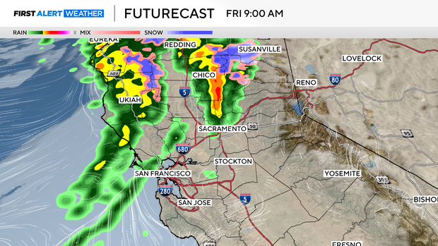
Thursday stays quiet as clouds linger and the afternoon stays dry. By Thursday night, our next storm system approaches the North Coast, bringing more rain to the valley and snow to the Sierra.
In the valley, rain chances start Friday morning. Between 6 a.m. to 10 a.m. rain becomes more widespread as it moves further south.
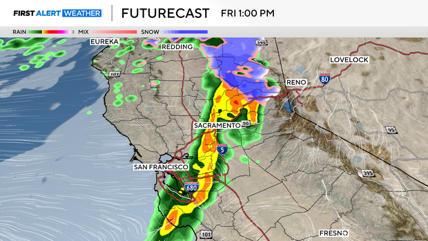
Showers begin across the Sierra in the morning becoming heavier by the afternoon. Snow levels will start above 8,000 feet at first then drop to 5,500 feet by Friday afternoon.
Snow will impact drivers over mountain passes from the afternoon through the early evening. Expect travel delays, chain controls, and slick conditions.
We are expecting our heaviest rain around 1 p.m. clearing out by 3 p.m. in the Sacramento and San Joaquin Valley. Once the cold front sweeps across, our storm is over and we may see more sunshine by the early evening.
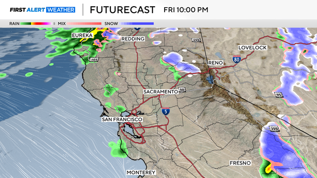
Light showers linger across the foothills and Sierra through early Saturday but will stay light.
Saturday we clear out with mostly sunny skies likely by afternoon and Sunday will look similar. Dry and cool with highs in the 50s.
How much rain and snow is expected?
Rain and snow totals will be on the lower side with this incoming storm as it does not stick around for long.
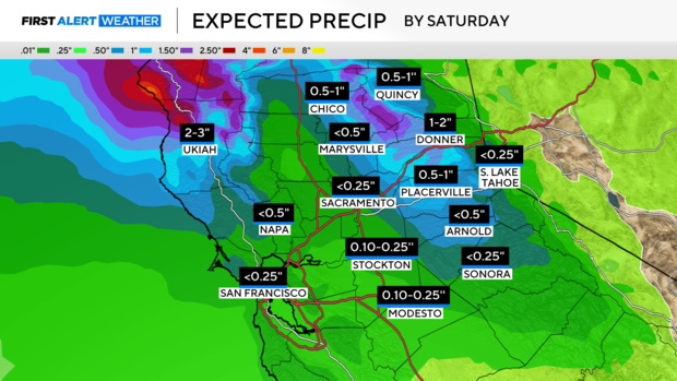
By Saturday, most in the valley can expect 0.10'' to one inch of rain, with our highest totals north of I-80.
In the foothills and Sierra, amounts will also be higher the further north you are of I-80. However, most can expect 0.25'' to two inches of precipitation by Saturday morning.
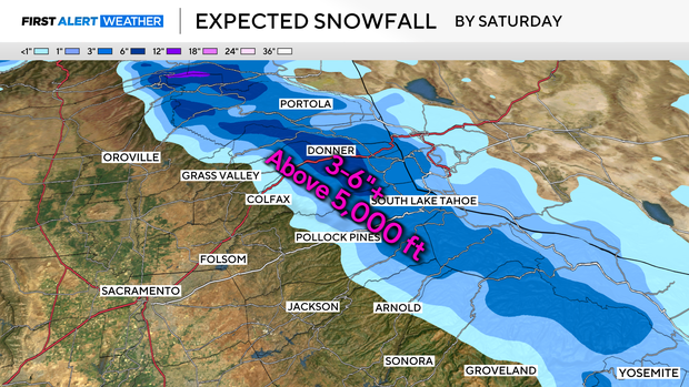
With snow levels starting high, snow will take a little longer to stick. But once it does, our highest impacts will be over the mountain passes.
Many spots above 6,000 feet can expect three to six inches of snow by Sunday, with up to eight inches for Sierra peaks.
Long-range weather forecast for Northern California
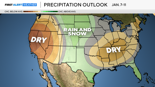
After Friday's storm system, we begin another quiet pattern for the first full week of 2025. Long-range models are keeping Northern California quiet through Jan. 15 as high-pressure rebuilds over the West Coast.
There may be a few opportunities for some light precipitation over the foothills and Sierra, but generally expect a dry pattern with mild temperatures.
High pressure starts to move mid-month and it may be enough to let another system sneak in.
Stay with the CBS Sacramento First Alert Weather team for changes and updates to our weather pattern.

