Northern California storm brings flooding, heavy Sierra snow and difficult travel Thursday
A powerful storm continued moving across Northern California Thursday morning, bringing heavy rain, flooding and difficult Sierra travel, with thunderstorms possible later in the day.
The National Weather Service said widespread rain and snow will continue through the morning before becoming more scattered Thursday afternoon and evening.
A flood advisory is in effect until 10:45 a.m. for Sacramento, Placer, Yolo and Solano counties, along with southern Sutter County and northwestern San Joaquin County.
Between 1 and 3 inches of rain had fallen across the advisory area over the previous 24 hours, with up to another inch possible. Minor flooding of roads, small streams and other low-lying areas is expected.
Forecasters said isolated strong to severe thunderstorms are also possible Thursday afternoon and evening, particularly south of Interstate 80. Heavy rain, gusty winds, frequent lightning, quarter-sized hail and brief funnel clouds or tornadoes are possible.
SMUD's outage center showed no active outages Thursday morning, though the utility said its outage map was temporarily unavailable. More than 32,000 customers were without power at one point Wednesday as strong winds swept through the region.
Sacramento County has three sandbag locations open for people living in unincorporated areas:
• Branch Center, 3847 Branch Center Road
• Orangevale Community Center, 6826 Hazel Ave.
• Sacramento Metropolitan Fire Station 116, 7995 Elwyn Ave.
The county provides sand and bags, but residents need to bring their own shovels. There is a limit of 20 bags per visit.
Heavy snow expected in the Sierra
A winter storm warning remains in effect for the Sierra above 4,000 feet until 4 a.m. Friday.
Another 8 to 12 inches of snow is expected above 4,000 feet, with as much as 18 inches at the highest peaks. A few inches could fall as low as 3,500 feet.
Snowfall rates could reach 1 to 2 inches or more per hour at times Thursday, making travel very difficult or impossible.
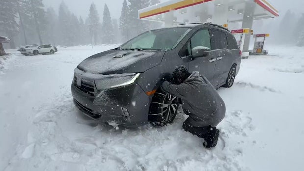
As of early Thursday, chains were required on Interstate 80 from just east of Gold Run to the Nevada state line.
Westbound tractor-trailers were being stopped at the Nevada state line because of spinouts, while some eastbound double-trailer rigs were restricted at Applegate.
On Highway 50, chains were required from about 1.5 miles east of Kyburz to Meyers.
Highway 88 was closed over Carson Spur between an area east of Silver Lake and Kirkwood for avalanche control. Chain controls stretched from Dew Drop to near Woodfords.
Several restrictions were also in effect on Highway 89. Monitor Pass remained closed because of snow, along with a stretch between Ebright's and Bliss State Park. Chains were required over Luther Pass and from Bliss State Park to Olympic Valley.
Farther south, Highway 4 remained closed over Ebbetts Pass between the Mt. Reba turnoff and Highway 89. Chains were required from east of Camp Connell to the Mt. Reba turnoff.
Highway 108 was also closed over Sonora Pass, with chain controls in effect between the Long Barn and Strawberry areas.
The early-season snow is allowing several ski resorts to open earlier than originally planned.
Heavenly, Northstar and Boreal are scheduled to open Friday. Palisades Tahoe and Bear Valley plan to open Saturday, while Sugar Bowl will open Sunday for season passholders before opening to the public Nov. 27.
Some Sierra snow showers could linger into Friday morning before drier conditions arrive Friday afternoon. Another, weaker system is expected to bring additional Valley rain and mountain snow this weekend.


