August storm to bring cooler temperatures, possible thunderstorms to Northern California
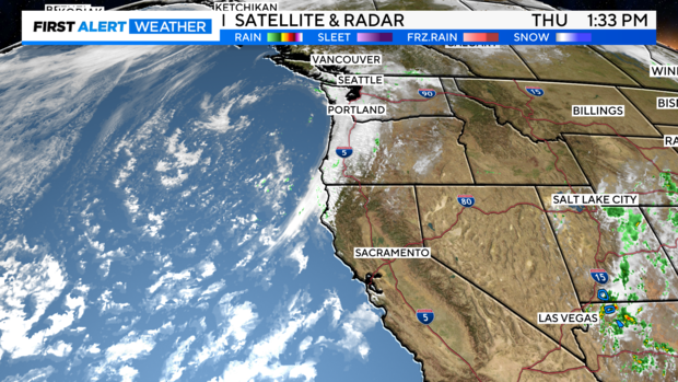
After a hot summer stretch, a taste of fall is coming to Northern California to close out the week. Cooler temperatures, gusty winds, rain, and a dusting of snow are in the forecast as changes begin as early as Thursday afternoon.
An unusually strong low-pressure system moving down from the Gulf of Alaska will increase onshore wind and pull more moisture into the region in the next few days.
Sure, August rain is not that unusual, but temperatures on Friday will be some of the coolest we've seen in over 60 years for late August.
Windy Thursday
Wind increased through the day Thursday ushering in our larger storm system for the next few days.
Cooler air filtered in as highs reached the low-mid 80s and southwesterly wind picked up across the Delta and Valley at first before reaching the Sierra by midday.
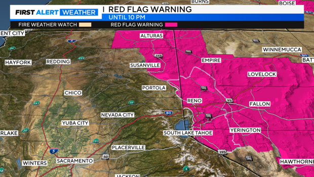
With an increase in wind and lower humidity levels across the eastern slopes of the Sierra into Nevada, fire danger was high. A Red Flag Warning was issued until 10 p.m. Thursday.
Unsettled, cooler Friday
By Friday, fire danger will lower across the region with an increase in humidity.
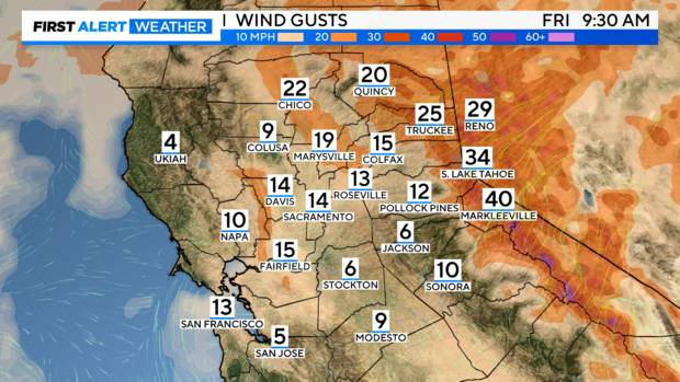
Friday will be another breezy day with more cloud cover as the storm moves in from the north through the afternoon. Windy especially across the Sierra tomorrow with gusts up to 45 mph.
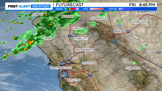
The first round of showers will stay north of Interstate 80 in the Sacramento Valley through the morning and afternoon. By the evening, showers begin to develop closer to Sacramento and the surrounding foothills.
Friday won't be a washout but expect a few light showers through the evening. Most of the San Joaquin Valley will stay dry.
Rain amounts will be light with up to 0.25'' of rain expected for areas further north of Sacramento.
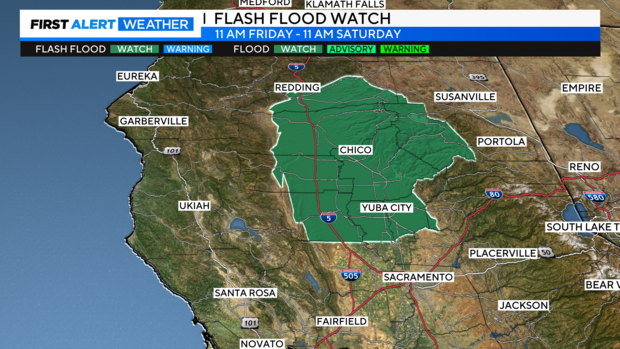
Thunderstorm chances increase behind the cold front Friday afternoon. Isolated thunderstorms will be possible Friday through Saturday morning, with best chances north of I-80. Any storms that develop will be capable of small hail, heavy rain, gusty winds, and lightning.
Depending on heavier showers or a thunderstorm, flash flooding concerns increase around the Park Fire burn scar in Butte, Tehama, Shasta, and Plumas counties.
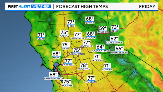
Temperatures behind the front will quickly cool. Highs on Friday will be in the mid to upper 70s across the valley. A mix of highs in the 50s and 60s from the coast to the Sierra. These will be some of the coolest temperatures we've seen in over 60 years for late August.
Saturday morning snow?
It's a possibility. However, you'll need to travel high up in elevation to find it.
As temperatures drop Friday night into Saturday areas along the Sierra crest above 8,000 feet in elevation may start to see a mix of rain and snow.
Most of the snow won't stick as the ground will be too warm. But as you get up to 10,000 feet in elevation some areas may wake up to a light dusting Saturday morning.
Summer heat returns next week
By Saturday afternoon the majority of our storm system moves into Nevada with drier air filtering back in. Highs will be cool to start the weekend with most in the 80s across the valley on Saturday.
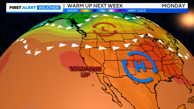
Wind shifts out of the north by Sunday as high-pressure rebuilds. High temperatures will return close to normal in the Sacramento Valley and Delta, to the upper 80s to low 90s by Sunday.
Heading into next week, Monday and Tuesday bring another round of summer heat with the upper 90s and triple digits expected. Stay with Sacramento's First Alert Weather team as we time out the next round of heat on the way.
