Atmospheric river could drench Sacramento with month's worth of rain in 1 day as Sierra Nevada faces blizzard
SACRAMENTO—Sacramento received a month's worth of rain in just 24 hours on Friday, while Northern California's Sierra Nevada mountains saw blizzard-like conditions as an atmospheric river continued to pummel the region.
Record rainfall
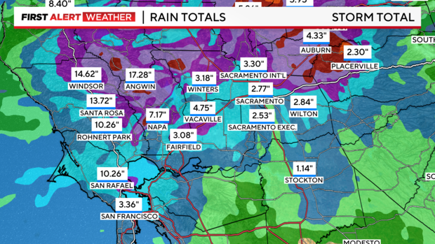
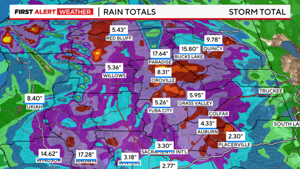
Friday was a soaker across the region. Especially for those along and north of I-80. Here's a view of storm totals as of Saturday morning during a break in rain.
Since Wednesday through Saturday morning, Sacramento has received over two inches of rain. Sacramento International Airport has received over three inches. In November, Sacramento averages about 1.78 inches of rain throughout the month.
During Sacramento's wettest months, the city averages about just under 4 inches of rain in January and nearly 3.75 inches during February.
The heaviest rain has fallen over the Coastal Range near Santa Rosa. The Santa Rosa Airport has received over 13 inches of rain. Further north, rainfall amounts range from five inches in Yuba City to Paradise with over 17.5 inches.
Is there more rain on the way?
Short answer, yes. But, the worst of the storm is now behind us.
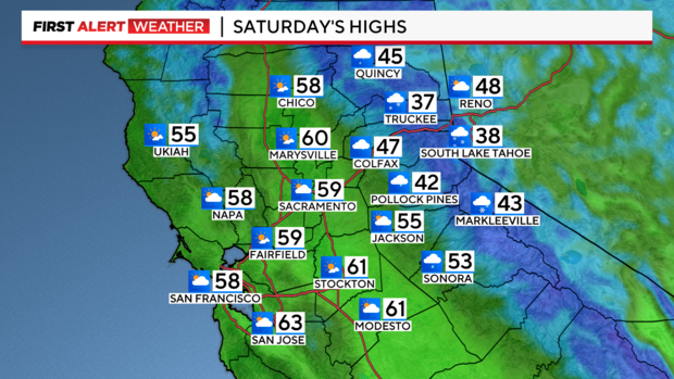
Rain returns Saturday afternoon moving west to east across the Valley. During the afternoon, we can't rule out on/off showers. Yet, Saturday will not be a washout like Friday was.
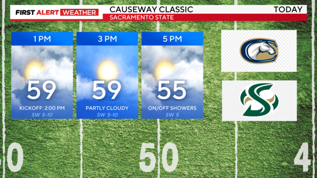
During the Causeway Classic, the rivalry game between Sacramento State and UC Davis, fans will stay mostly dry but we can't rule out a few raindrops during halftime.
The San Joaquin Valley will mainly stay out of the rain through the start of the weekend. With partly cloudy skies and highs in the upper 50s to low 60s.
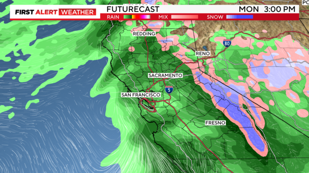
Scattered showers continue Sunday with another round of rain from Sunday afternoon through Tuesday. The most precipitation will stay mainly north of I-80, yet many spots in the Valley could get another 0.50'' to one inch by Tuesday.
The bulk of the heaviest rain will arrive by Monday and linger into Tuesday.
More snow in the Sierra
As the rain moves through the valley and foothills, it will turn into snow as it reaches higher elevations in the Sierra.
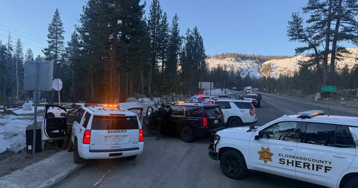
Snow levels will stay around 5,000 feet through the day as snow fills in again across mountain passes. Expect chain controls, slick and icy conditions with reduced visibility at times.
Chain controls are in effect for the Sierra across I-80 and US-50. A Winter Storm Warning continues through 4p Tuesday.
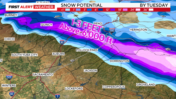
Elevations at about 6,000 feet and above could reach up to 3 feet of snow between this weekend and Tuesday. Higher peaks could see up to 4 feet of snow during that same period as more systems move through Northern California.
Drivers can check Caltrans for the latest road conditions.
Looking ahead to Thanksgiving
Rain and snow will begin to taper off late Tuesday through early Wednesday. Wednesday will stay dry with plenty of sunshine from the valley towards the foothills.
Thanksgiving looks beautiful. Partly cloudy skies, and a few lingering showers over the Sierra but most stay dry. Highs in the upper 50s to low 60s for the holiday.
Make sure to stay with the CBS Sacramento First Alert Weather Team for the latest forecast and if any more rain and snow will return by next week.
