Widespread light to moderate rain Sunday evening ahead of gusty winds Monday
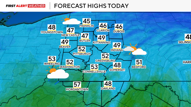
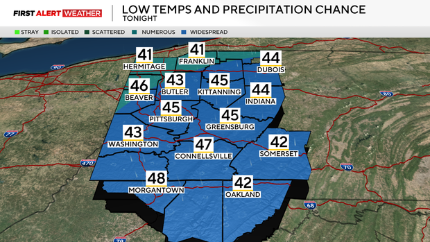
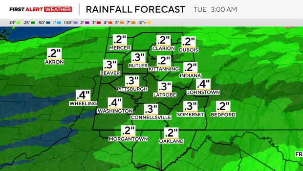
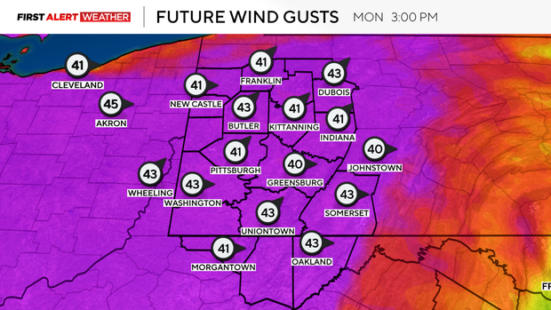
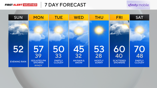
Most of our area has experienced a hard freeze as of early Sunday morning, with temperatures dropping well into the 20s accompanied by a thick frost. The typical last date for a minimum temperature of 28 degrees or colder in the Pittsburgh area is April 8, and the typical last date for a minimum temperature of 32 degrees is April 25 per 1991-2020 climatology, so this is completely normal and expected for this time of year. After Sunday morning's hard freeze, temperatures will recover by afternoon with highs in the mid 40s to low 50s. A brief spike into the mid 50s is likely Sunday night into Monday as southerly winds advect warmer air and moisture ahead of an approaching trough and low pressure currently moving through the Midwest. The time of arrival of this system will bring scattered to numerous rain showers, mainly during the evening Sunday (likely after 6 p.m. - 7 p.m.) into Monday morning. Models have suddenly backed off on the expected rainfall amounts with this system, with totals now likely to range between 0.25 inches - 0.5 inches as opposed to over 0.5 inches. This rain will still be beneficial as we have started to slip into a slight rainfall deficit in recent weeks. Skies will gradually clear on Monday morning, although a few afternoon and evening showers cannot be ruled out, especially towards the Laurel Highlands and north of Route 422 towards I-80 as a front and upper-level disturbance pass through.
WEATHER LINKS:
Current Conditions | School Closings & Delays | Submit Your Weather Photos
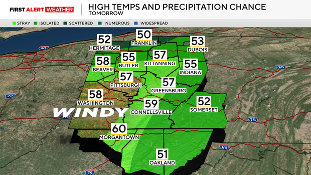
The trough that brings this round of rain will be followed by several days of near to slightly below normal temperatures for this upcoming week, although based on the latest models, things do not look as cool as originally expected. Highs will generally be in the low 50s on Tuesday and Thursday, while Wednesday will be the day we likely struggle to make it out of the mid 40s. A disturbance swinging in from the northwest Tuesday evening into Wednesday morning will produce scattered to numerous showers, especially over the southern half of our area. Temperatures during this time look to support a mix of rain and snow that will quickly exit through the morning hours of Wednesday.
A warming trend back to above normal temperatures is expected by the end of this week. Some showers may accompany a warm front on Friday followed by warmer air continuing to build in through the upcoming weekend. This warm air will likely preclude the start of a period of very active and potentially stormy weather as we round out March and begin April.
Stay up to date with the KDKA Mobile App – which you can download here!