Overnight temperatures bring frost risk to Western Pennsylvania
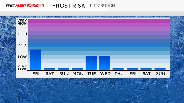
PITTSBURGH (KDKA)—This morning, we saw the first widespread frost of the season, with places north of Pittsburgh and in higher elevations having the best chance of seeing frost.
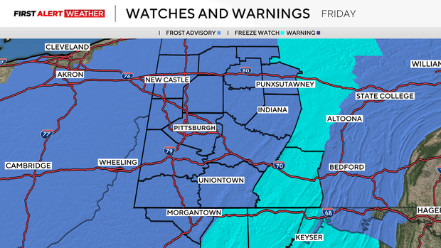
Frost will be back on Friday, and everyone is under a frost advisory.
WEATHER LINKS:
Current Conditions | School Closings & Delays | Submit Your Weather Photos
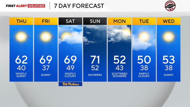
Just communities from Butler County to the north and east are under an advisory this morning. I have morning lows in Pittsburgh dipping down to 37 degrees on Friday morning.
Temperatures are dipping behind a cool front that rolled through in the overnight hours. 850mb temps have dipped to 2°C. 850mb temps will rebound to around 8°C as soon as Friday afternoon.
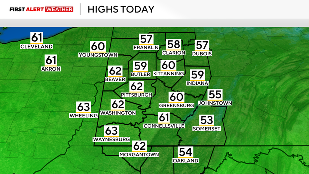
This means highs that will be near 70°. This is where we will stay for our highs through the weekend.
Our next rain chance comes on Sunday. Rain is expected to start before noon but will be light. Rain will wrap up early on Monday morning.
Right now it looks like most places should expect less than a tenth of an inch of rain. Highs on Tuesday & Wednesday will only be in the 50s.
Prayers are going out for Florida today as they are now set to recover from Hurricane Milton. Milton is now back out to sea but has certainly left its mark on Florida.
The storm came ashore in the early evening hours of Wednesday, but it was leaving its mark on the state well before making landfall. Powerful tornados moved through the state ahead of the storm and some of these tornados were blamed for the first deaths due to the storm. As the storm dumped up to 10 inches of water on the state along with pushing in high water, flooding became an issue through the overnight hours.
The good news is that the worst weather is now done for Florida. At first light this morning we will begin to see what sort of devastation the storm has left behind.
Stay up to date with the KDKA Mobile App – which you can download here!
