Clearing skies in western Pennsylvania lead to a late-week warm up
PITTSBURGH (KDKA) - Skies are mostly cloudy this morning which has prevented temperatures from dropping as much through the overnight hours as they otherwise could have under clear conditions.
WEATHER LINKS:
Current Conditions | School Closings & Delays | Submit Your Weather Photos
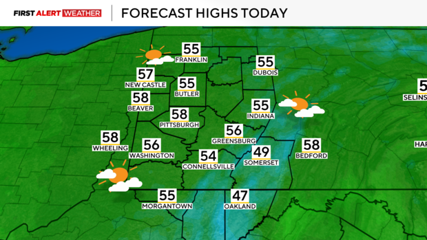
Expect gradual clearing skies on Thursday during the morning to midday hours with highs reaching the middle to upper 50s.
As high pressure settles in leading to clear skies and calm winds, temperatures on Friday morning will drop well into the low to mid-30s with perhaps a few folks seeing upper 20s.
In Pittsburgh, the forecasted low of 36 degrees, so while the city should avoid a freeze, that may not be the case elsewhere.
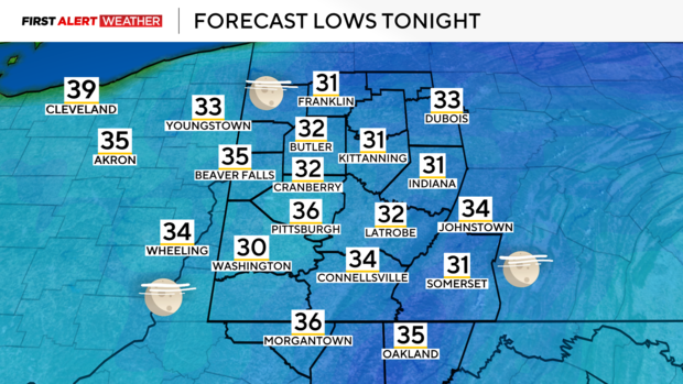
The average first freeze according to the 1991-2020 climate normal period for Pittsburgh is October 20, so if we don't hit freezing on Friday morning, there is a really good chance we'll wait until the end of October and early November before a freeze officially occurs in town.
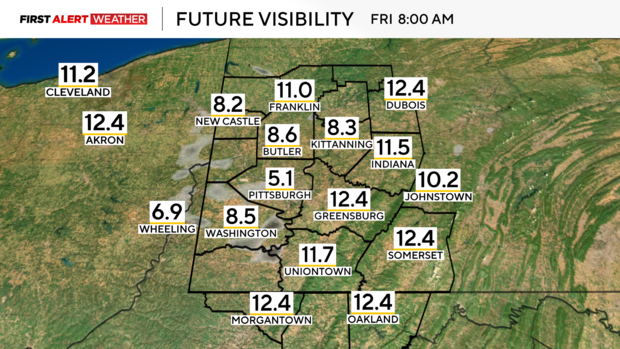
Patchy fog could also be an issue on Friday morning, especially in river valleys and low-elevation areas as cold air will be able to settle into those areas efficiently under calm winds. Any fog should mix out by mid-morning leading to mostly sunny conditions in the afternoon.
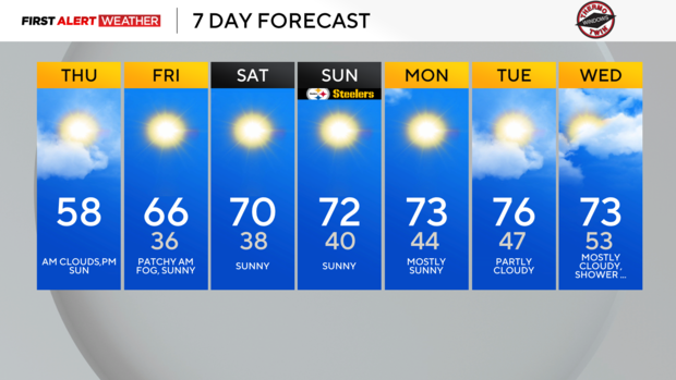
From Friday onward, daytime high temperatures will become progressively warmer each afternoon.
Expect highs in the mid-60s on Friday, upper 60s to low 70s on Saturday, and low to mid 70s from Sunday onward. The Steelers are back in town this weekend, and unlike the October 6th game with severe storms, this game should be free of weather issues.
Not only are we expecting a warming trend, but a prolonged dry stretch appears likely at least until the middle of the third full week of October. There is a high probability of above-normal to well-above-normal temperatures persisting through the end of the month.
Our next opportunity for a shower or two may not come until next Wednesday into Thursday and even then, the wave of low pressure passing through the region currently does not have much moisture projected to flow into it, so rain chances are low at the present moment.
Stay up to date with the KDKA Mobile App – which you can download here!


