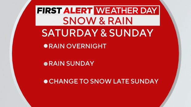
Snow, rain, strong winds expected at various times this weekend | First Alert Weather Day
The Pittsburgh region saw snow turn into rain on Saturday, and now we're experiencing an overnight period of rain that could be heavy at times.
First Alert: Tonight through Sunday night
Aware: Snow, rain, and gusty winds are expected at various times through Monday midday.
Climate: Average High: 40 | Average Low: 23
The rain continues Sunday as low pressure crosses the region.
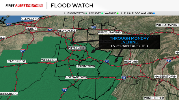
A flood watch is posted for Pittsburgh, south through Washington and Westmoreland counties, and into northern West Virginia due to the likelihood of runoff from 1-2" rain. This could lead to river and creek flooding, especially along the Monongahela River. The rain will be heaviest between midnight and midday Sunday before it shifts east through the day.
A trailing cold front then sweeps in, kicks up winds, rapidly drops temperatures Sunday afternoon, and turns the rain back to snow.
Winds will pick up to 20-30 mph, with gusts of 45-55 mph expected Sunday night into Monday morning. The highest winds and potential for damage and power outages will be in the Laurel Highlands and Ridges, where a high wind watch is in effect. An inch or so of snow will reappear in lower elevations by Monday morning with higher amounts possible in the Laurel Highlands and Ridges, mainly looking at 1-3" of accumulation.
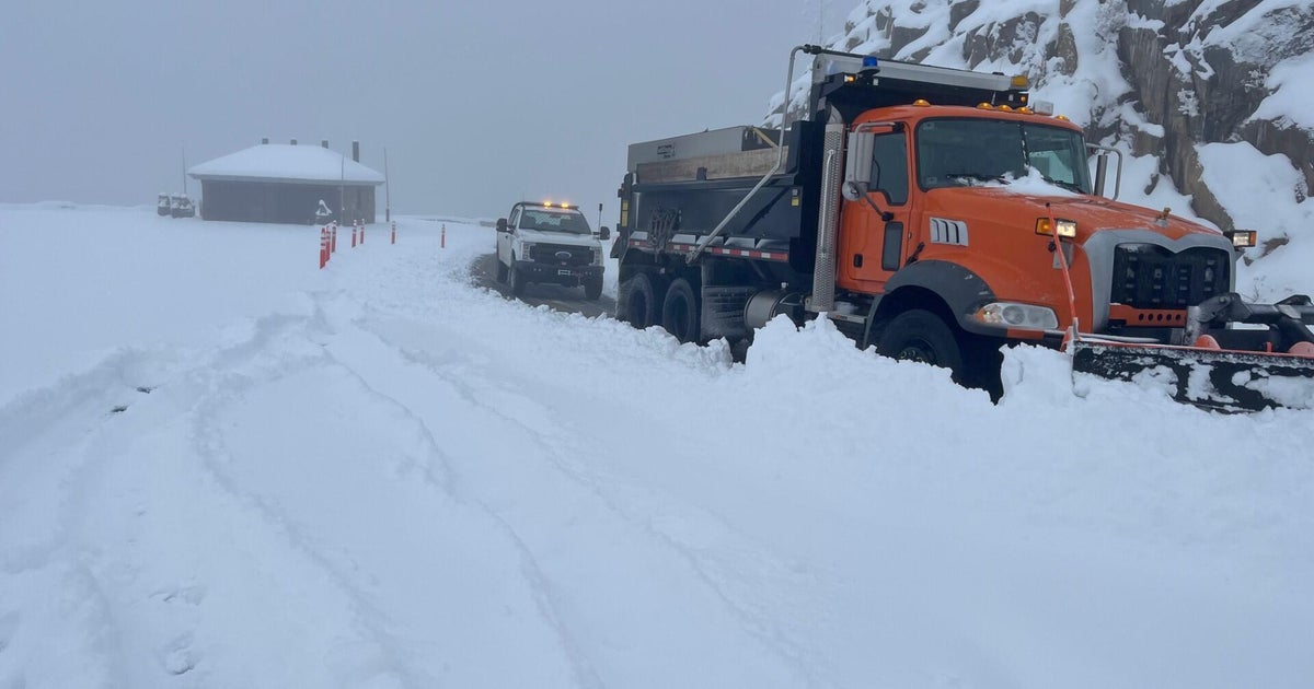
There's even a blizzard warning for Garrett County, M.d., and Preston County, W. Va., where gusts could reach 60 mph with 5-8" of snow in the highest elevations. Travel along I-68 and other roads there Sunday night into Monday morning will be nearly impossible, with very limited visibility and blowing snow.
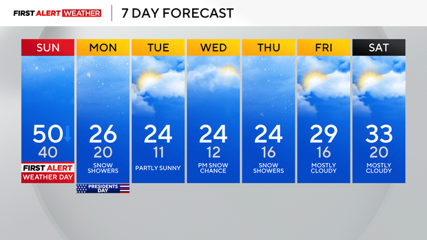
It all wraps up by Monday evening, but frigid temperatures stick around all week with overnight lows in the teens through Friday.
WEATHER LINKS:
Current Conditions | School Closings & Delays | Submit Your Weather Photos
Stay up to date with the KDKA Mobile App – which you can download here!