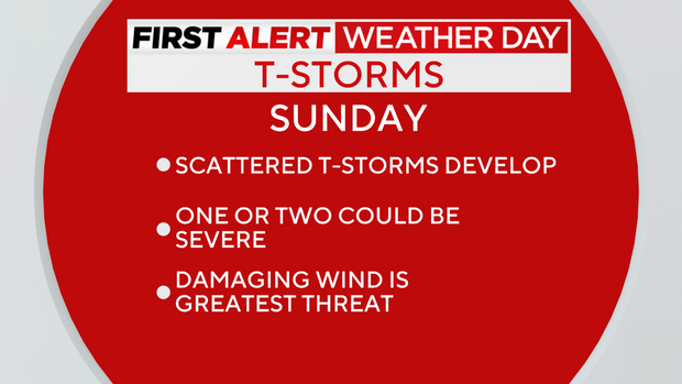
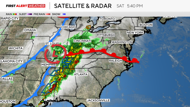
Isolated showers and storms northwest of Pittsburgh Saturday; scattered storms possible Sunday
A disturbance moving in from the west is prompting a KDKA First Alert Weather Day on Sunday. While some rain showers will develop overnight, it is looking like the main line of showers and thunderstorms will move through midday.
FIRST ALERT SUNDAY: An isolated thunderstorm could become strong-to-severe. Damaging winds are the greatest threat.
Sunday Average Hi / Lo: 49/30
Sunday Sunrise/Sunset: 7:30 a.m. / 7:29 p.m.
WEATHER LINKS:
Current Conditions | School Closings & Delays | Submit Your Weather Photos
While it will be a gusty day with winds gusting to 30-35mph (and occasionally higher), one or two midday storms could push out winds higher than that. This makes damaging winds the greatest threat for any thunderstorm that should become severe.
Hail and some rotation can't be completely ruled out, and will be things the KDKA First Alert Weather Team will monitor closely.
Once these storms pass, high pressure will build back into the area for St. Patrick's Day. While the skies will brighten up, do not expect temperatures to warm up to the levels we have been enjoying.
Highs on Monday will only make it into the upper 40s!
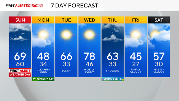
If you have fallen in love with our recent warm temperatures, you will get an encore mid-week. Highs on Tuesday and Wednesday will return to the 60s and 70s, albeit for only those two days.
Thursday, with the arrival of Spring, we will see the return of showers and cooler temperatures.
Stay up to date with the KDKA Mobile App – which you can download here!