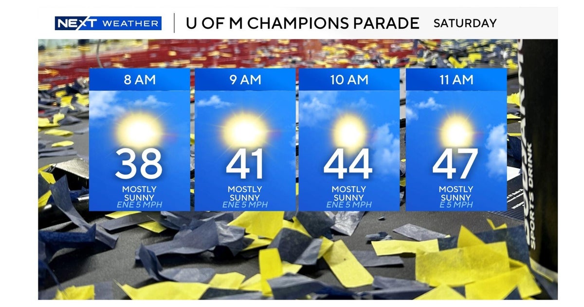
Showers in Pittsburgh linger on Sunday and Monday as temperatures cool this week
PITTSBURGH (KDKA) - Scattered showers linger tonight across the tri-state area, with a slow-moving area of low pressure to our north.
First Alert: None
Aware: Much cooler midweek!
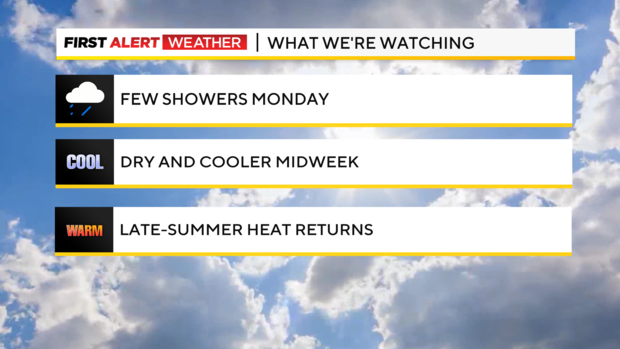
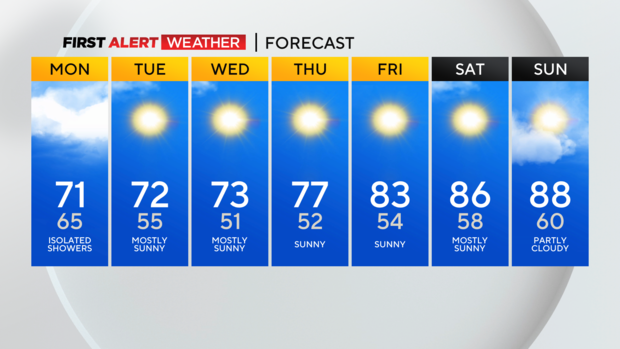
This pesky feature will finally kick out of here to the east later Monday and will take the showers with it. Until then, expect a few overnight showers and some isolated showers through late Monday afternoon with mostly cloudy conditions.
Temperatures behind a trailing cold front Monday will cool us down considerably to nearly 10 degrees cooler than today for both highs and lows tomorrow night. Lows in the lower 50s through midweek will be the most cool and comfortable we've felt since early June.
Sunshine and lower to mid-70s will make for a dry, pleasant week, with another little taste of early fall-feeling weather.
But if you're not ready to bid farewell to the summer heat, hang in there. Models are pointing to a sharp warmup toward next weekend and into the Labor Day weekend that would see temperatures well above normal and even back into the mid-to-upper 80s.
WEATHER LINKS:
Current Conditions | School Closings & Delays | Submit Your Weather Photos