Severe thunderstorm watch canceled for Pittsburgh-area's northern counties

PITTSBURGH (KDKA) -- A severe thunderstorm watch that covered several counties north of Pittsburgh has been canceled.
FIRST ALERT: On Monday, there are isolated storms north this evening. For tomorrow, there's the potential for storms and gusty winds with a marginal risk (1 out of 5).
AWARE: A few showers and storms could pop up around 6 p.m.
A severe thunderstorm watch had been issued for Armstrong, Butler, Lawrence and Mercer counties, but a little after 6:30 p.m., the National Weather Service said it was canceled.
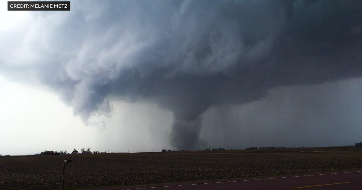
Monday is going to be mostly sunny and mainly dry with a high of potentially 90. That would make it the 18th 90-degree day of the year so far. We have isolated storms in which some could be severe with large hail north of Pittsburgh and I-80. There's a slight risk for those areas (2 out of 5). There's a small window frame for these later tonight around dinner time through possibly 10 p.m.
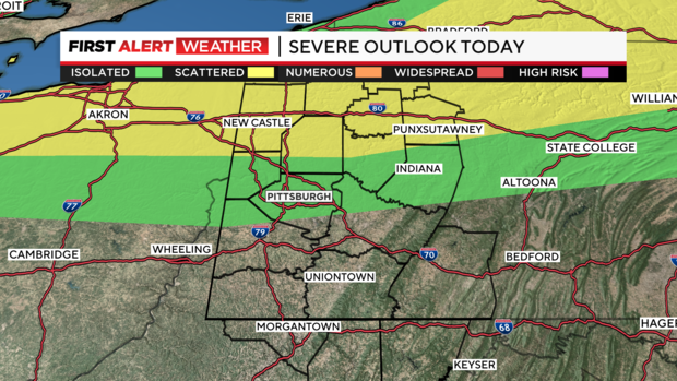
Tuesday is also a KDKA First Alert Weather Day because isolated strong to severe storms are possible. Everyone is under a marginal risk (1 out of 5) and the biggest threat is damaging winds and heavy downpours. This will be mainly after 2 p.m. tomorrow.
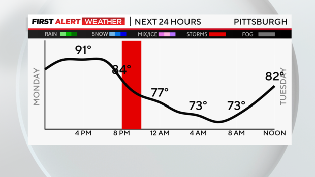
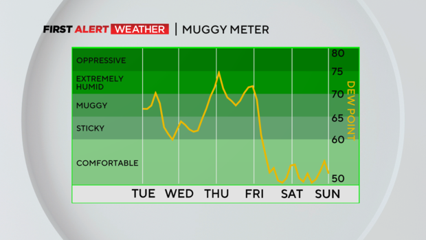
Wednesday we really cool down on the back side of that cold front, bringing highs only in the upper 70s for many areas. Thursday will also be dry and seasonable with highs in the low 80s.
Friday there's a chance for rain showers before we dry out and catch a break from the heat and humidity for the weekend.
WEATHER LINKS:
Current Conditions | School Closings & Delays | Submit Your Weather Photos