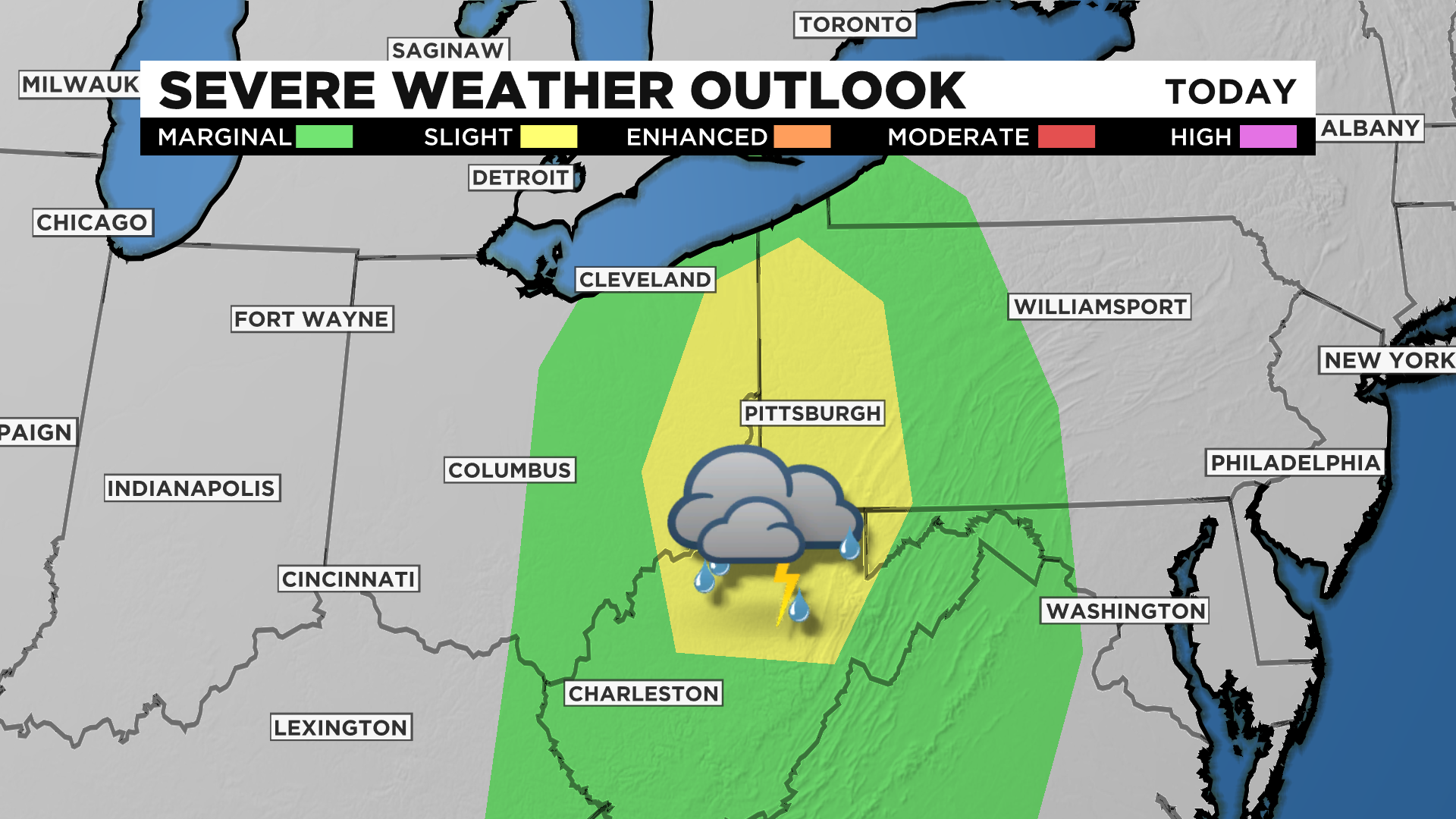
Pittsburgh Weather: Strong Storms Including Possible Tornadoes In Wednesday's Forecast
PITTSBURGH (KDKA) - Strong storms including tornadoes are possible today as an upper low rotates through our area.
The upper low's outer band will move through tonight sometime between 4:00 p.m. to 9:00 p.m., giving us our chance for severe storms.
WEATHER LINKS:
Current Conditions | School Delays & Closings | Local Radar | Weather App | Photos
While severe weather will be possible for the late afternoon and evening hours, just light passing showers should be expected this morning.
By around 10:00 a.m., a number of communities should see mostly dry conditions with some sunshine breaking through the clouds.
The dry conditions will stick around through 3:00 p.m. with storm chances returning for the late afternoon to the evening.
From 4:00 p.m. through the evening hours we will see rain chances go up as an outer band from an upper-low moves through our area.
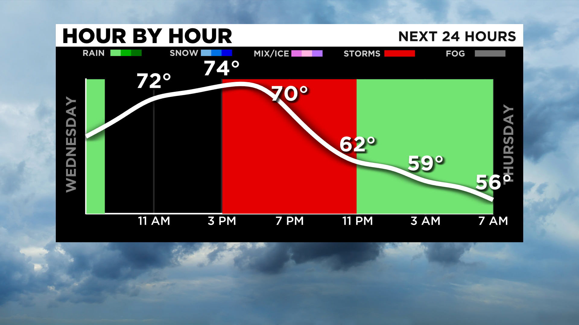
If you're caught out driving during the time that the leading edge of rain rolls through expect a downpour with low visibilities, windy and possibly dangerous conditions.
Please remain weather aware throughout the day and especially after 4:00 p.m.
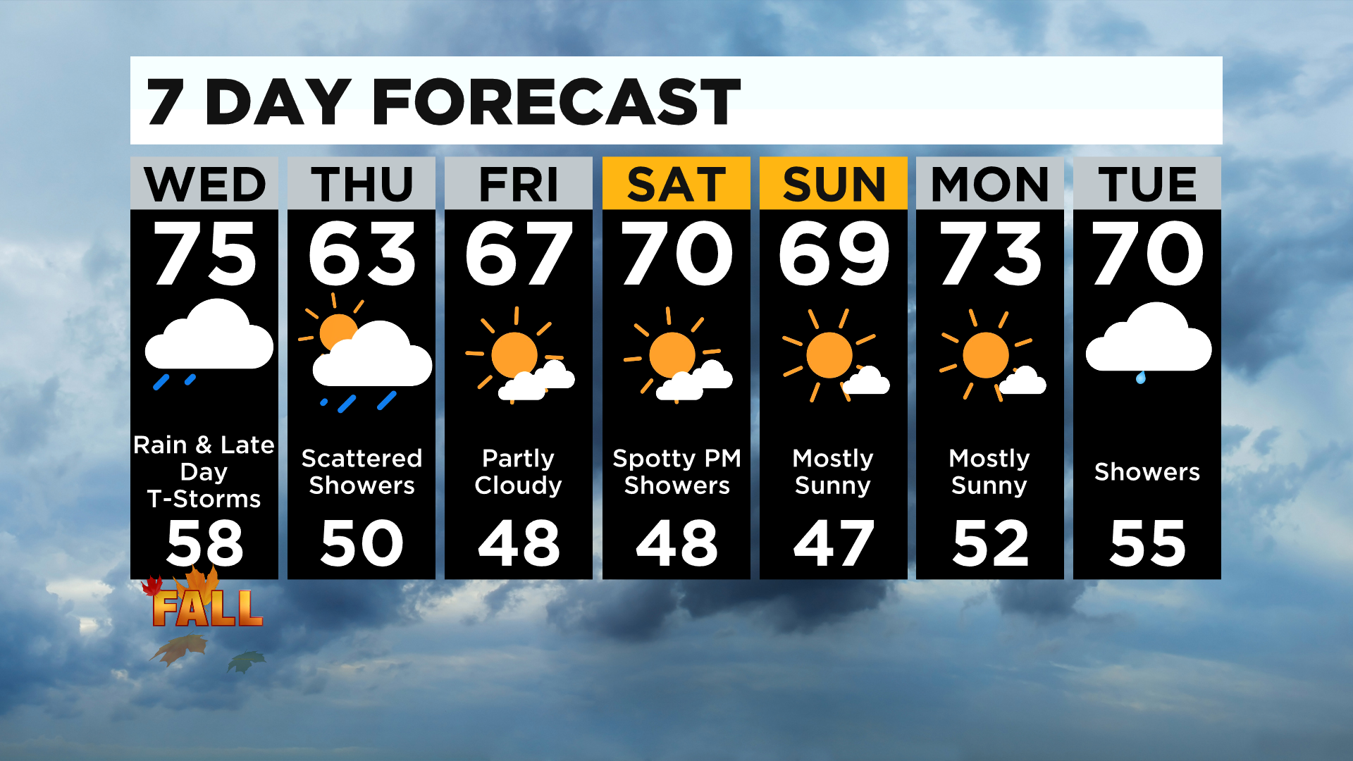
Looking ahead, fall begins this afternoon at 3:21.
Fall weather will be in place for the rest of the week with highs today in the mid-70s but highs in the 60s both on Thursday and Friday.
There is a rain chance on Saturday afternoon.
Stay up to date with the KDKA app, which you can download here.


