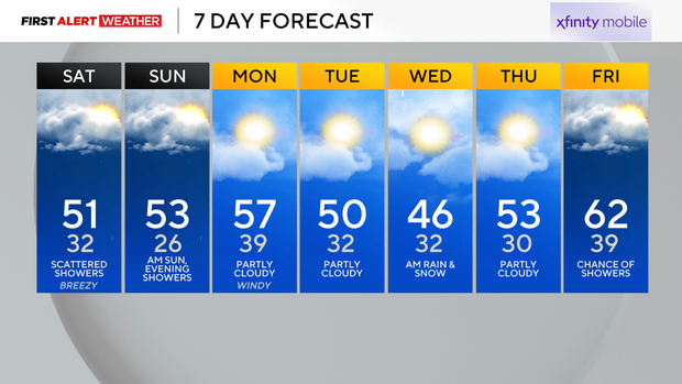
Scattered showers expected Saturday ahead of more rain Sunday evening into Monday morning

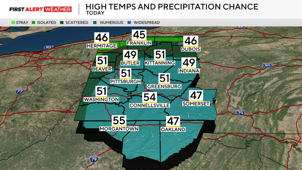
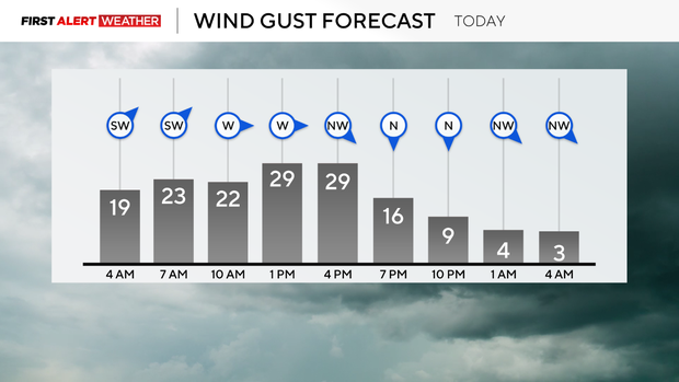
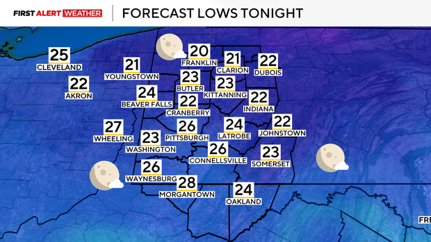
Saturday morning begins seasonably mild across our area, with temperatures hovering in the low to mid 40s thanks to a southwest breeze and cloudy skies through the overnight hours. A trough of low pressure currently moving through Indiana and Ohio will lead to rain showers mainly from just after sunrise to mid afternoon Saturday, especially across the Pittsburgh metro and points south and east. The atmosphere will be cold enough aloft to support a few snowflakes mixing in with the showers, possibly north of Route 422 toward our I-80 counties and in the highest peaks of the Laurels, but accumulation is not expected. Winds will be gusty through early afternoon with gusts up to 30mph possible. Highs will occur around mid-morning with temperatures hovering in the low-mid 40s through the afternoon before ultimately dropping into the low-mid 20s on Sunday morning.
WEATHER LINKS:
Current Conditions | School Closings & Delays | Submit Your Weather Photos
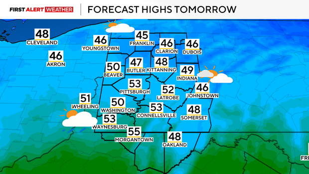
After Sunday morning's hard freeze, temperatures will recover by afternoon with highs in the low 50s. A brief spike into the mid 50s is likely Sunday night into Monday as southerly winds advect warmer air and moisture ahead of an approaching trough and low pressure. The time of arrival of this system will bring scattered to numerous rain showers mainly during the evening Sunday into Monday morning. An isolated thunderstorm cannot be ruled out. By the time the weekend ends, most spots across Western PA will have received around 0.5 inches - 0.75 inches of rain. This will be beneficial as we have started to slip into a slight rainfall deficit in recent weeks. Skies will gradually clear on Monday, although an isolated shower cannot be ruled out as a front passes through during the afternoon and evening.
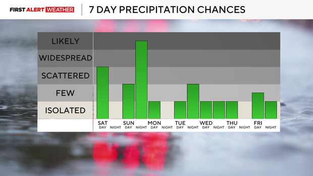
The trough that brings this round of rain will be followed by several days of slightly below normal temperatures toward the final full week of March, although based on the latest models, things do not look as cool as originally expected. A second disturbance swinging in from the west late Tuesday night into Wednesday will produce scattered to numerous showers. Temperatures during this time look to support a mix of rain and snow that will quickly exit through the morning hours of Wednesday. A warming trend back to above normal temperatures is expected by the end of next week.
Stay up to date with the KDKA Mobile App – which you can download here!