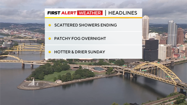
Scattered showers come to an end; Sunday to be sunny, hot across Pittsburgh area
PITTSBURGH (KDKA) -- The pesky low-pressure center that has given us a showery Saturday has helped us in the rain department but now heads off to the east tonight, leaving us with patchy fog overnight and a sunny, hotter Sunday.
Alert: None
Aware: Hotter Sunday
Normals: Average High: 83 | Average Low: 63
Southwest breezes Sunday and Monday will push temperatures back into the upper 80s and close to 90 in some spots Sunday and Monday. We could see a stray shower pop Monday afternoon with the best chances east into the Laurel Highlands, but otherwise, the day should be mainly dry.
A series of weak weather systems will move in from the northwest late Monday through early Wednesday, and force a cold front to slowly move south into the hot and humid air mass ahead of it. This will likely lead to additional spotty storm chances followed by some cooler and drier air by mid to late next week.
Tropical Storm Debby is now moving into the Gulf of Mexico with 40-mph winds and will travel north just off the western Florida coast. Landfall is now estimated as a weak hurricane Monday in the northwestern section of Florida.
From there, Debby's moisture moves into Georgia and Carolinas early next week and will likely end up in the Mid-Atlantic by late next week. As of now, it is unlikely to give us any rain, but we will keep watching!
Overall, temperatures cool down to normal lower 80s by late week and next weekend.

WEATHER LINKS:
Current Conditions | School Closings & Delays | Submit Your Weather Photos