River flooding risk low as rain moves in through Friday
PITTSBURGH (KDKA) - Any Alert Days Ahead? Nope.
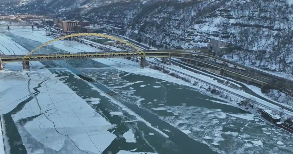
Aware: Yesterday was the 29th day in a row with Pittsburgh recording at least an inch of snow on the ground at 8 a.m. We had 6 inches of snow on the ground on the 17th.
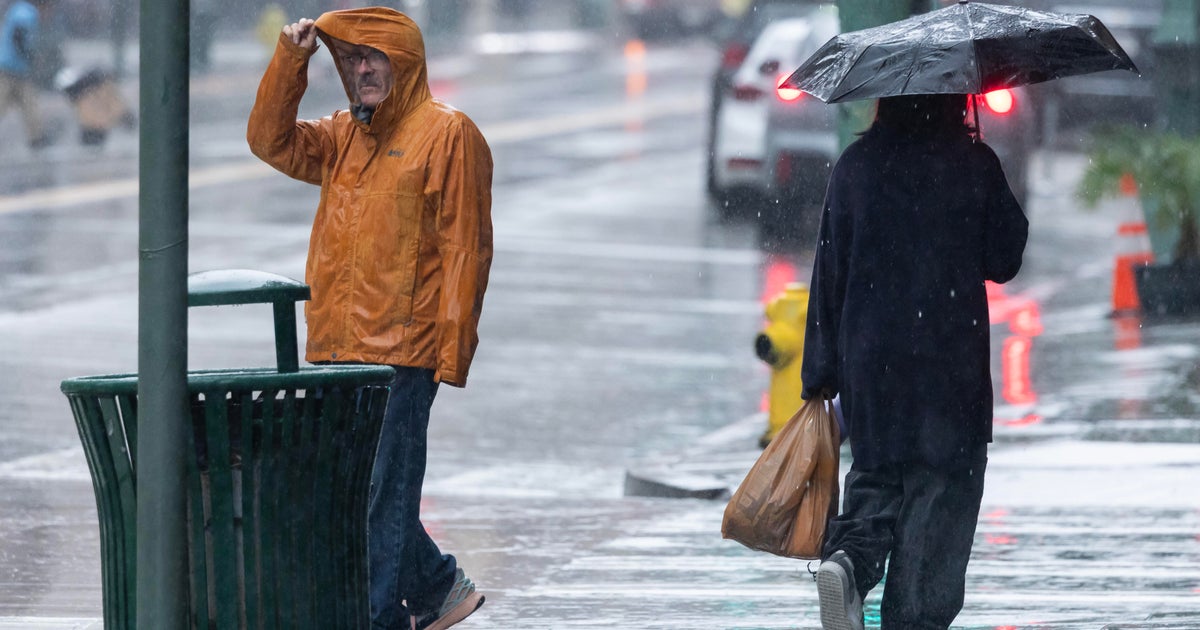
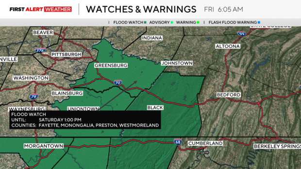
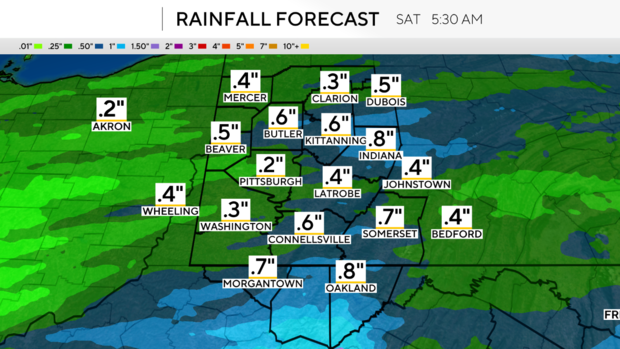
The best chance to see rain today comes late this afternoon into the evening hours. I have fairly widespread rain showers coming through between 4 p.m. - 7 p.m. with only scattered showers expected outside of that window. Rain totals for today will only be around a half inch in Pittsburgh. Totals will be closer to an inch for places south of I-70. This is also where flood watches have been issued due to concerns of river and creek flooding. Flooding is forecast to occur on the Tygart Valley River in the center of West Virginia. The Monongahela River is also seeing a forecast in the action stage for a couple of spots to occur overnight tonight. If you live along the Mon you should be aware that river levels will be in the action stage and in a couple of spots near minor flood stages over the next 48 hours.
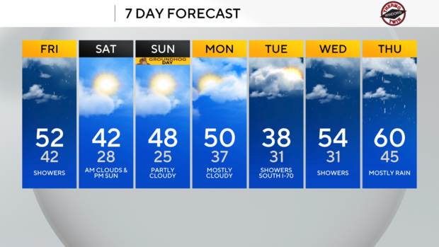
Looking ahead, temperatures will technically remain mild over the weekend, but that's just on the first look. Saturday is a little misleading with the daily high being hit at midnight. Temperatures the rest of the day will hover near the seasonal average. We should get back to mild and pleasant afternoon weather on Sunday and Monday, and things are looking dry on both days as well. Rain chances will be back for the middle of next week, with the best rain chance happening next Thursday. Thursday will also have a chance for us to see highs near 60 degrees.
WEATHER LINKS:
Current Conditions | School Closings & Delays | Submit Your Weather Photos