Rain lingers in Pittsburgh on Sunday morning before a cloudy, milder week
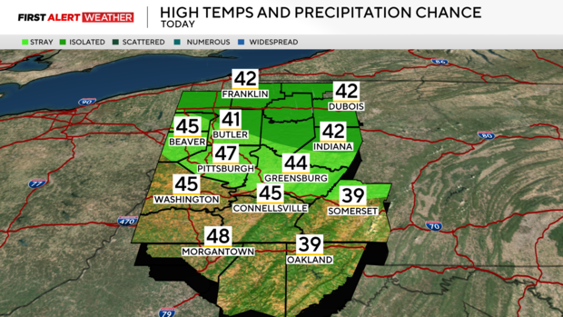
PITTSBURGH (KDKA) - Cloudy skies are still present across most of Western PA and Northern WV early Sunday morning. High pressure is expected to move east through the day, but there will still be a lot of low-level moisture trapped beneath the high, so expect mostly cloudy skies to persist most of the day.
Some of our southernmost counties may see some clearing by late afternoon.
WEATHER LINKS:
Current Conditions | School Closings & Delays | Submit Your Weather Photos
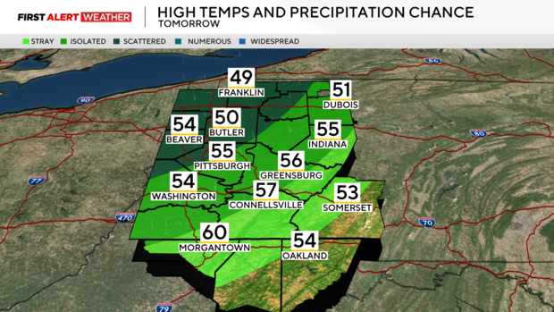
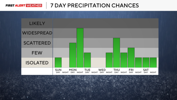
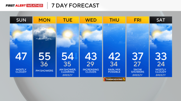
Skies will partially clear Monday morning leading to a cool start, but a warm front will move in from the west allowing for an increase in moisture and clouds through the day. Expect mild temperatures as well with highs peaking in the low to middle 50s by late in the evening hours, but this mild air will be accompanied by rain as a cold front approaches from the west.
Rainfall amounts will be between 0.1" to 0.5". Lingering showers are expected for early Tuesday morning with partly cloudy skies and steady to falling temperatures through the day.
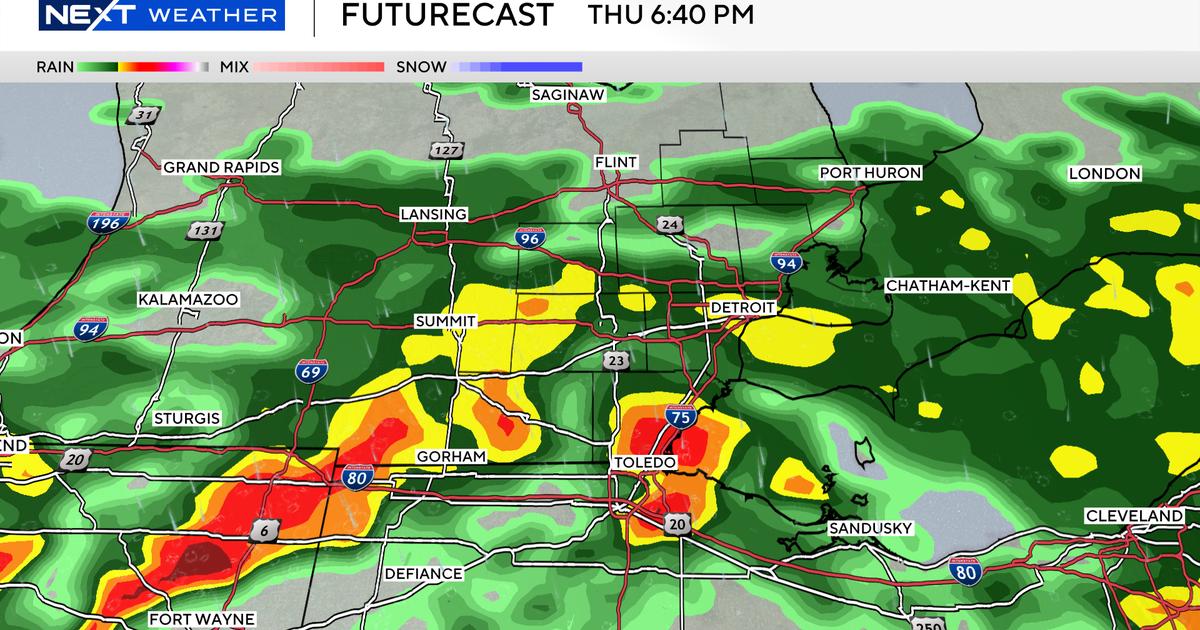
Tuesday's system will set us up for what we see late in the week around Thanksgiving. A large temperature gradient will exist from north to south across the Ohio River Valley with colder air to the north and warmer air to the south. Models are in fairly decent agreement that there will be a wave of low pressure aloft to track east from the Plains toward the region. This wave will likely be accompanied by a swath of precipitation. As of Sunday morning, models and model ensemble members (which are used in forecasting to account for uncertainty in large-scale weather patterns) are clustered into two general scenarios.
The first scenario involves the upper-level system being more amplified with a low-pressure tracking farther north across the Ohio Valley into Western PA. This would result in more rain, and "warmer" air, and leave any mixed wintry precipitation issues primarily for northwest PA.
The second scenario involved the upper-level system being less amplified with a wave of low pressure tracking farther south leaving most of Western PA and Northern WV with less precipitation and cooler temperatures. Currently, I am leaning more towards the first scenario being a more probable case. I expect models to continue to be in disagreement through at least Tuesday morning and then we should have much higher forecast confidence by then.
As colder air moves in by Friday, some lake-effect snow showers are possible. The long-range outlook continues to show a very decent probability for a period of colder-than-normal temperatures into the first week of November.
Stay up to date with the KDKA Mobile App – which you can download here!
