Pittsburgh's seasonable weather continues, more warm temperatures ahead this week
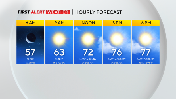
PITTSBURGH (KDKA) - Sunday morning begins with mostly clear skies and seasonably cool temperatures across most of Western Pennsylvania, with the exception of some passing clouds in northern West Virginia.
WEATHER LINKS:
Current Conditions | School Closings & Delays | Submit Your Weather Photos
Temperatures have largely dropped into the 50s for most locations.
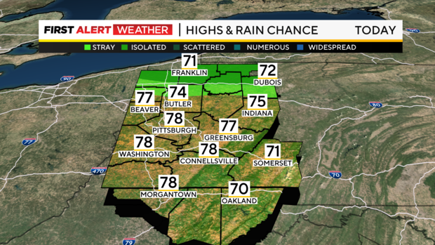
This afternoon, seasonable to even slightly below-average temperatures will once again be great in most of our area with highs in the mid to upper 70s, and a few low 80s farther south and west. Some lake-effect showers may occur midday through mid to late afternoon north of I-80, but dry air will be in place across the rest of our area with intervals of clouds mixed with sun.
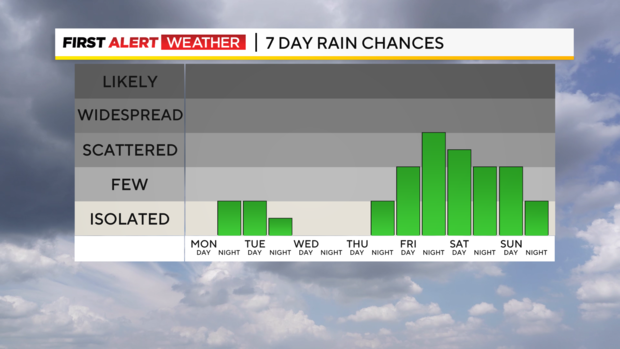
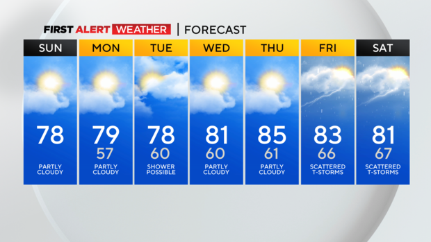
Most of this week will be dry outside of a weak weather system passing overhead Monday night into Tuesday which will result in increasing clouds along with a few showers.
This will be a fairly weak system with limited moisture, so widespread or heavy rain is not expected. The best chance of rain is farther south into Southwest Pennsylvania, Northern West Virginia, and Northwest Maryland.
Following this passage of this system, a Canadian high pressure cell will pass from west to east to our north around the Wednesday-Thursday timeframe resulting in winds shifting to the east and southeast across Western Pennsylvania.
This will lead to a warming and dry wind coming off the higher terrain to our east which will push daytime highs back toward the low-mid 80s.
The dry and warmer stretch may end toward the end of next week as a slow-moving system approaches from the west bringing increased opportunities for showers and thunderstorms by next Friday and Saturday.
Stay up to date with the KDKA Mobile App – which you can download here!
