Pittsburgh's warm and dry streak continues through the weekend before mid-week showers
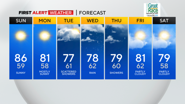
PITTSBURGH (KDKA) - Today is well above normal by 10 degrees, making it to the mid to upper 80s.
FIRST ALERT: None
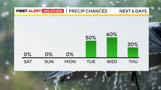
AWARE: Rain showers return on Tuesday!
Average High: 76 Low: 56
We have had a streak of sunshine, and it doesn't end here. Tomorrow, the mostly sunny skies and mid-80s continue so keep all of your plans in place! Monday will be the last day with mostly sunny skies and highs around 80. It was a little breezy today, with low humidity, and we will see the same trend tomorrow. If you're noticing your allergies are acting up, ragweed and grass pollen are moderate in the Pittsburgh area today.
We are in desperate need of rain around the region, and we finally have a good chance from Tuesday through Thursday as tropical moisture moves north from the southeast. Right now, it looks like most areas will see scattered showers starting as early as Tuesday morning south and then on and off through Wednesday and Thursday.
After that, it looks like we will have mostly sunny weather returning, with highs in the upper 70s and low 80s for the weekend!
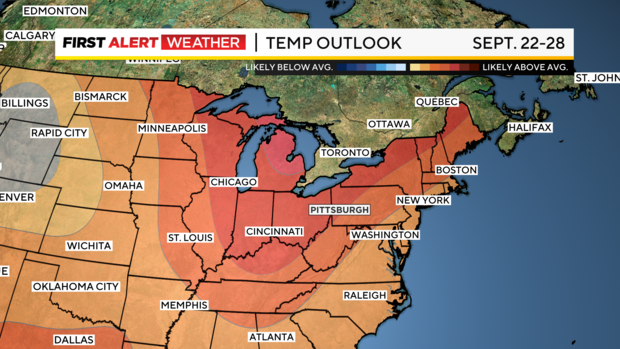
The warming trend looks to stick around through the end of the month!
WEATHER LINKS:
Current Conditions | School Closings & Delays | Submit Your Weather Photos