Pittsburgh Weather: Workweek cooldown on the way
PITTSBURGH (KDKA) - Hope you enjoyed the nicer weather we had this past weekend!
ALERT: None.
AWARE: Scattered showers Monday evening.
WEATHER LINKS:
Current Conditions | School Closings & Delays | Submit Your Weather Photos
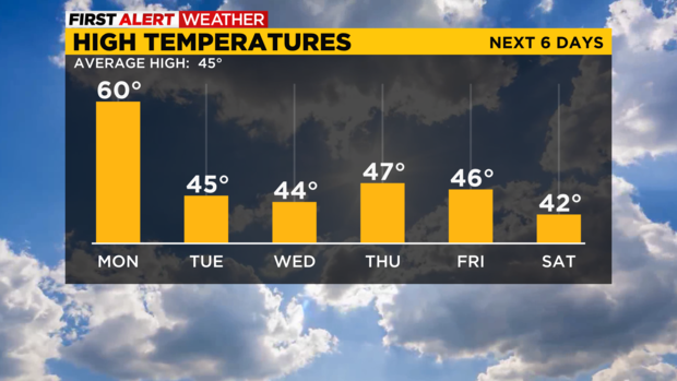
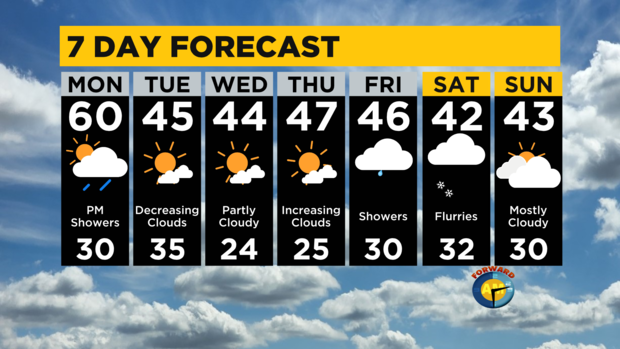
Low 60s for highs come back tomorrow afternoon with clouds increasing. Showers will be arriving by the evening, but nothing heavy should form. Just some passing showers that will wet the surfaces up through midnight.
This will be a cold front moving through, and colder air will follow behind. The rest of the week will have highs in the low to mid-40s which is pretty average for early March. Dry skies take over Tuesday through Thursday, with morning lows even dipping down into the 20s.
Our next system arrives Friday, with most of the area expected to see rain because highs will be in the 40s, but the I-80 corridor and mountains could see a mix during the day.
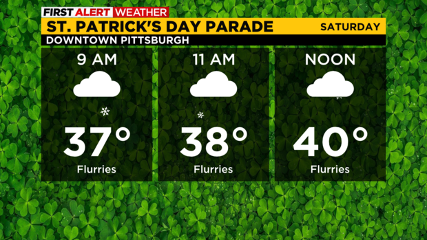
Eventually, everything will switch over into all snow by Saturday afternoon, and flurries will linger during the first half of the weekend. The Pittsburgh St. Patrick's Day parade is this Saturday, and it is looking chilly, with temperatures in the afternoon in the upper-30s to lower-40s with breezy conditions. So dress warmly if you're headed downtown!
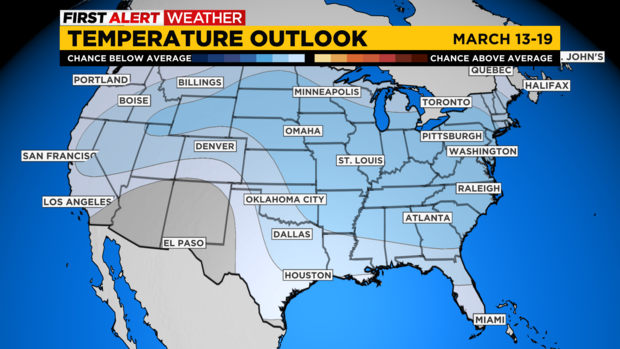
The latest 8-to-14-day outlook (which would be March 13-19) shows that our temperatures will likely be below average leading up to St. Patrick's Day.
This could mean highs in the upper 30s & 40s for some of those days. So don't think winter is done just yet!
Stay up to date with the KDKA Mobile App – which you can download here!