Today will be the warmest day of the week in Pittsburgh with storms rumbling through tonight
PITTSBURGH (KDKA) - By now you know the drill: We warm up. We near record highs. Storms arrive and rumble through. We then cool down with maybe even a couple of hours of snow. We then repeat the pattern over and over again.
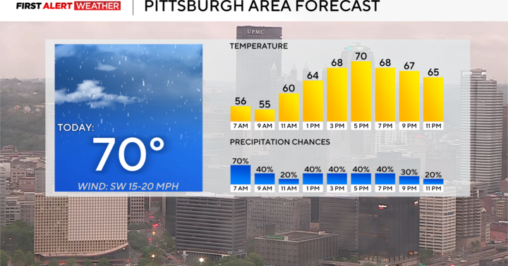
Today we are in the "near record temperature" part with highs soaring to the mid-70s.
WEATHER LINKS:
Current Conditions | School Closings & Delays | Submit Your Weather Photos
The normal high for today is just 48 degrees so we will be nearly 30 degrees warmer than that. The morning will start mild with temperatures in the mid to upper 40s. Noon temperatures should be in the mid-60s.
The record high for today is 79 degrees.
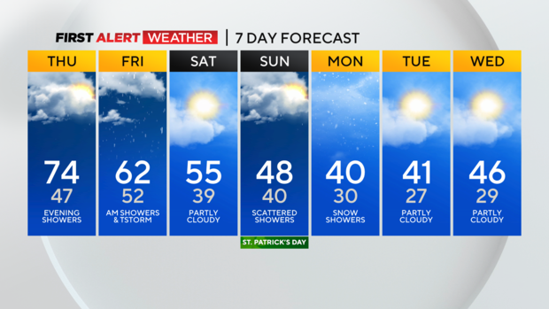
We won't get that warm but I do have us hitting 74°. The further into the day you go the thicker the cloud cover will be.
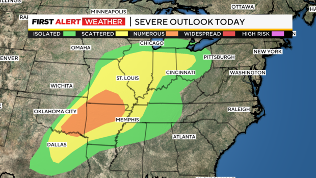
I believe scattered to widespread rain chances will hold off until the evening and overnight hours. There will also be a storm chance. Downpours, frequent lightning, gusty winds, and even small hail will all be possible as the line of storms rolls through.
While the best chance for storms occurs south of I-70, I don't think you can rule out some storms rumbling through Pittsburgh as well.
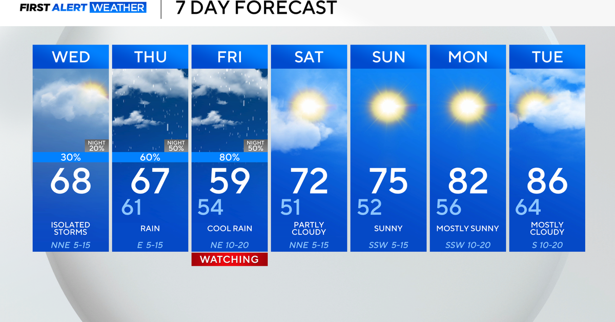
Storm chances should peak around 2 p.m. with mostly rain around for Friday morning. Rain chances will continue through Friday but will only be in the 40 percent coverage range from sunrise through the rest of the day.
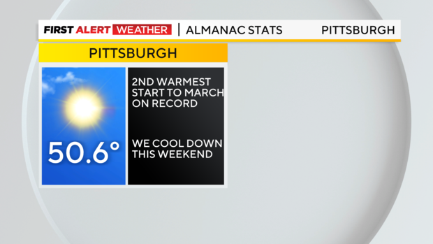
When it comes to temperatures, this month so far has been the second warmest start to March on record.
We will begin to cool down starting on Friday. Friday highs will hit the low 60s.
We should see highs in the mid-50s on Saturday.
Highs will hit the upper 40s on Sunday with a brief round of rain and potential storms as a cold front drops in.
Finally, we will see a snow chance with windy conditions on Monday as cold air rolls in.
Stay up to date with the KDKA Mobile App – which you can download here!
