Pittsburgh Weather: Thursday looks dry as Ian's impact looms
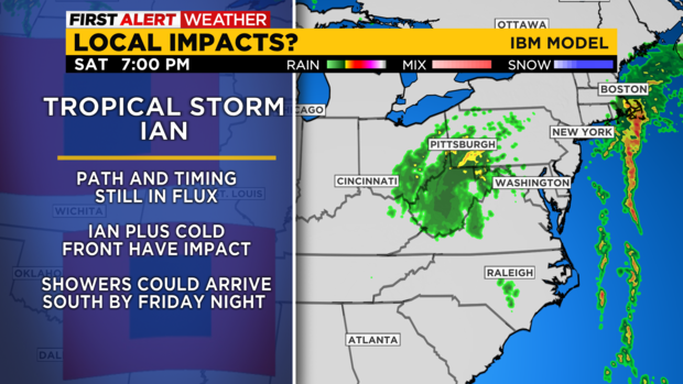
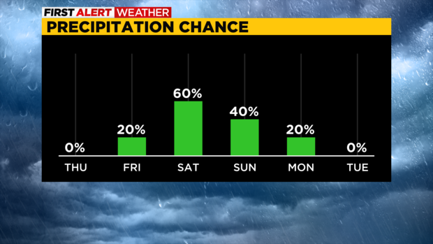
PITTSBURGH (KDKA) - The first rain from Ian is now expected to arrive here locally just after midnight on Saturday morning.
For us, Ian will bring off and on showers to the area as we remain in the outer rain band area. Rain totals at this point aren't looking too high for us.
WEATHER LINKS:
Current Conditions | School Closings & Delays | Submit Your Weather Photos
The same can't be said for parts of West Virginia and Maryland - they could each be looking at several inches of rain falling in some spots.
As of 4 a.m. on Thursday morning, Ian was a category 1 hurricane with sustained wind speeds of 80 mph around the eye of the storm.
While the eye of the storm is no longer evident on radar or satellite imagery, Ian is centered over central Florida (think: Disney World) and is continuing to slowly move to the north northeast. Ian could still technically be a hurricane when it moves back offshore later today.
Ian is expected to make a second landfall somewhere along the Georgia-South Carolina coast. Hurricane warnings may have to be issued for those areas. Once making this second US landfall, Ian will turn into a rainmaker bringing flash flooding to areas along the east coast.
Ian is expected to continue north until interacting with a cold front sometime on Saturday or Sunday. The front will likely keep most of Ian's rain just to our south. Parts of West Virginia though could get slammed though. The cold front will play a key part in who gets big rain totals from the remnants of Ian.
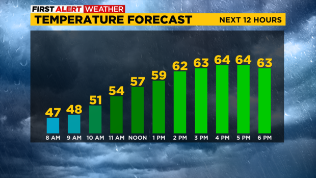
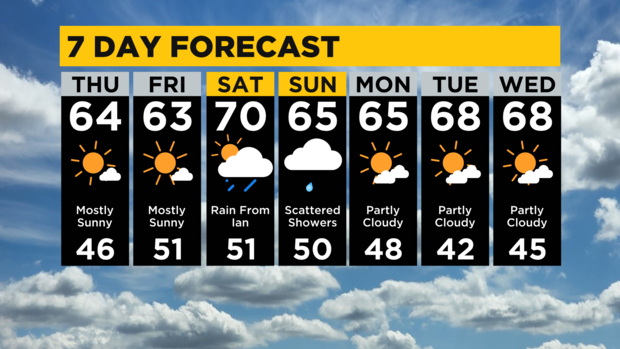
Turning to our local weather, today is looking dry and seasonal with highs in the low 60s. We did hit 60 degrees yesterday in Pittsburgh. There may be a little fog in spots this morning.
Thicker fog should be expected on Friday morning with the thickest fog occurring up along I-80.
Friday highs will be near 70. Morning lows today and on Friday will be in the mid to low 40s.
Stay up to date with the KDKA Mobile App – which you can download here!
