Pittsburgh Weather: Severe Storm Chances
PITTSBURGH (KDKA) -- There's another chance for severe weather on Monday with the area placed under a marginal risk.
At this point, strong straight-line winds along with frequent lightning and downpours are the main concerns.
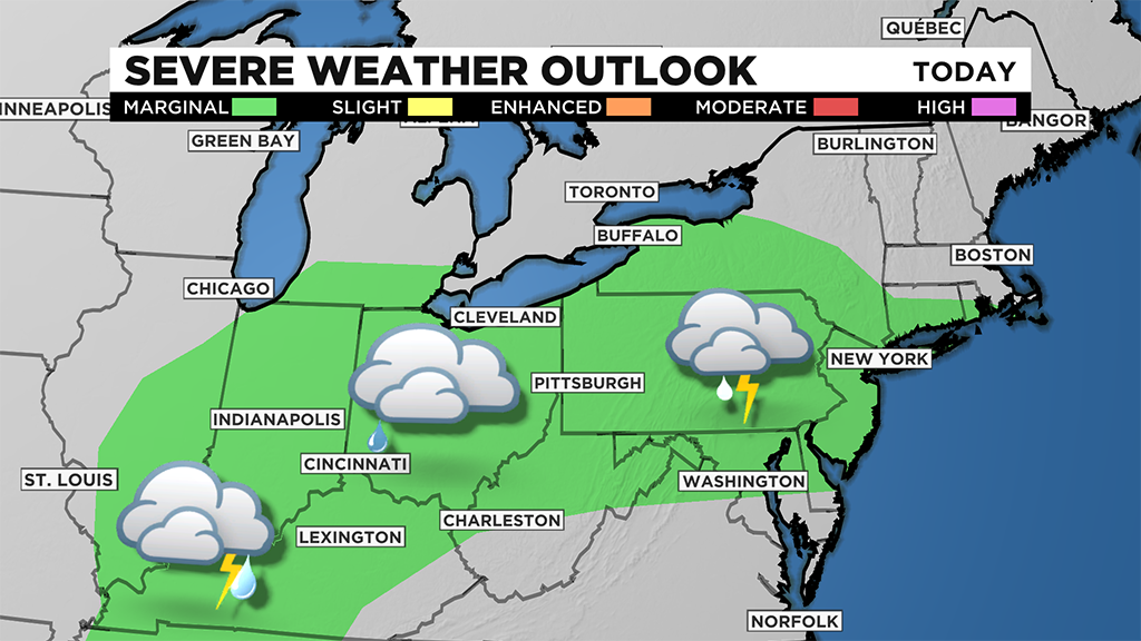
I think there is a very real possibility for us to see our daily risk bumped from the marginal to a slight risk of severe weather this afternoon depending on what radar and satellite imagery is showing.
The set-up is a classic one for severe wind speeds with us east and just south of an upper low that is churning along the Illinois-Missouri state lines near St. Louis.
There is a moisture tongue that extends through Tennessee and Kentucky with a warm front slowly moving north through northern New York.
This puts our area in the 'warm sector' with plenty of moisture to work with.
Model data doesn't show much in the way of storm development this afternoon due to a strong cap, or layer of stable air sitting over the surface.
If the cap is breached though, there is nothing stopping the formation of strong storms.
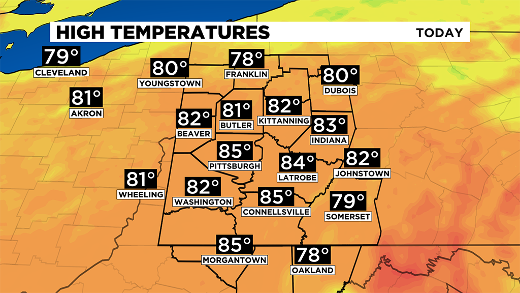
Highs today will likely be a little warmer than yesterday's highs.
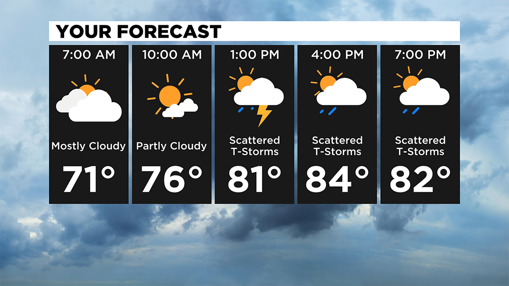
I have Pittsburgh hitting 85 degrees for the daily high.
This will be a warm week overall with highs remaining in the mid to low 80s through Wednesday, and then highs bumping up to near 90 degrees on Thursday and Friday.
Storm chances will stick around on Tuesday with our area already under a marginal severe risk.
At this point it looks like it's just going to be rain on Wednesday with it completely dry and pleasant (although hot) on Thursday.
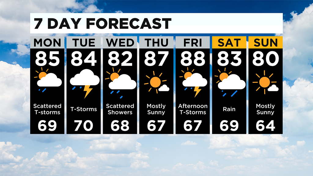
I have just a rain chance late Friday evening at this point with pretty much the entire 'day' dry.
WEATHER LINKS:
Current Conditions | School Delays & Closings | Local Radar | Weather App | Photos
Stay up to date with the KDKA app, which you can download here.