Pittsburgh Weather: All Eyes On Mon, Ohio And Yough As River Flooding Concerns Rise Due To Ida's Remnants
PITTSBURGH (KDKA) -- The remnants of Hurricane Ida have thrown a very wet blanket across Southwestern Pennsylvania.
The torrential rains caused widespread flash flooding, but now the concern is shifting to river flooding. All eyes are along the Monongahela and the Youghiogheny rivers for the next 24 to 36 hours.
The highest rainfall amount is for 3.71" in Avella. Generally speaking, most areas picked up about 1-3" of rainfall. Pittsburgh picked up 3.11".
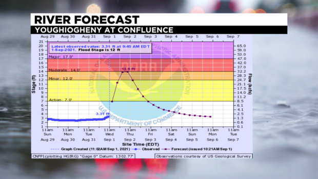
The Youghiogheny River at Confluence is still under a Flood River Warning until Friday morning where Minor Flooding is expected to to occur at 13.9 feet, which is just under Moderate Flood State. Flood Stage is 12 feet.
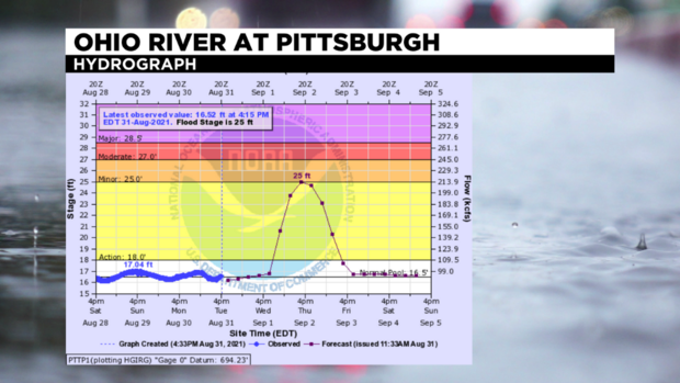
The latest update has the Ohio River at Pittsburgh expected to crest at 21.8 feet at The Point, which is still at the top of Action Stage (18 feet).
Right now, both Rivers are under a Flood Watch until Thursday night or Friday morning, and this afternoon are still below action stage.
WEATHER LINKS:
Current Conditions | School Delays & Closings | Local Radar | Weather App | Photos
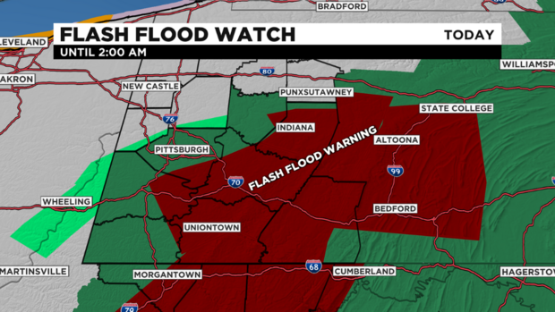
The Flood Watch has expired for Beaver and Butler counties, but others south and east are still in effect until 2 a.m.
The Flash Flood Warning for for parts of Allegheny, Fayette, Washington and Westmoreland counties go through 3:30 p.m. This means flooding is happening in those areas, so turn around and don't drive through high rushing waters.
Rain has tapered off for areas north and west, but areas east along the ridges and areas near I-70 have a few more hours left of heavy to moderate rain.
By later this evening, we will dry out the all eyes will be on the rivers.
Stay up to date with the KDKA app, which you can download here.
