Strong storms bring tornado risk to Pittsburgh area on Saturday
PITTSBURGH (KDKA) -- Friday's weather conditions in the Pittsburgh area will be comfortable, but more storms are coming.
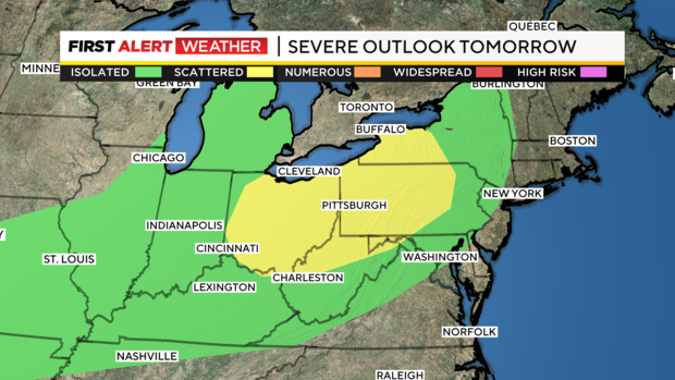
FIRST ALERT: Saturday is a First Alert Weather Day due to strong storms. Wind and tornadoes are the main threat. The Pittsburgh area, excluding Greene and Fayette counties, is under a flood watch from Saturday morning through late Sunday night.
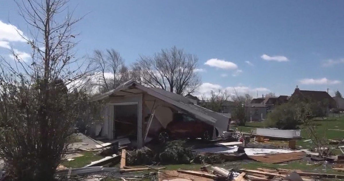
AWARE: The National Weather Service confirmed five tornadoes from Wednesday night.
Another stormy day is coming on Saturday with strong gusty wind and tornadoes the biggest concern for the day. As of Friday morning, we are under a slight (level 2 out of 5 with 5 being the highest) risk of severe weather.
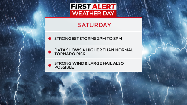
Severe weather chances will peak in the afternoon hours as a line of strong storms sweeps through. Ahead of the line we may see individual cells spinning in from the southwest. Any storms ahead of the line will bring a chance for large hail and potentially even a tornado. The biggest issue as the line of storms sweeps through will be strong straight-line winds along with quick tornadic spin-ups.
Tornadoes are also hard to forecast. It's not like rain where you know where its going to be and how much you can expect to see. With tornadoes, the data points at the risk for tornadoes developing. That "risk" is higher than normal for our area on Saturday.
When it comes to the data, everything is screaming that we will see an environment primed for tornado development. The significant tornado parameter number from the NAM 3k peaks above 6 just north of Pittsburgh. STP starts at 0 and any values less than 1 means there is little chance for tornado development. 3-5 is looked at as high. At the peak time tomorrow, numbers of above 5 are concerning. We are asking everyone to please be weather-aware. There's no way of knowing if anyone at all will be impacted by a tornado tomorrow, but the data is pointing to there at least being a moderately high risk.
Today is looking fantastic. Highs should be in the mid-80s. I have noon temperatures around 80 degrees. Skies should be mostly sunny this afternoon with winds out of the southwest at 5-10 mph.
Saturday's high should hit the mid 80s. There will be some rain around before the main line arrives after 2 p.m. Rain will be the heaviest up along I-80. Line of storms should move through Pittsburgh around 5 p.m., but could be as late as 8 p.m.
Temperatures cool down a little heading into next week with highs near 80 degrees on Sunday and Monday.
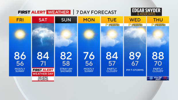
I have July 4 seeing a high of 88 degrees.
WEATHER LINKS:
Current Conditions | School Closings & Delays | Submit Your Weather Photos