Pittsburgh Weather: First Alert Weather Days issued for Friday, Saturday ahead of snow and single-digit temps
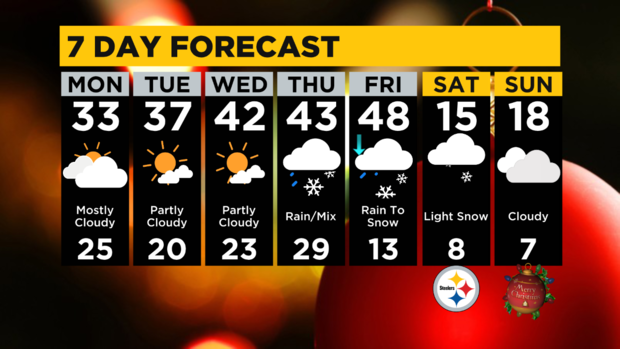
PITTSBURGH (KDKA) -- While it's expected to be a cloudy Monday, a winter storm system and bitter cold temperatures could soon be on the way.
Friday and Saturday will be First Alert Weather Days. The system will bring rain Thursday changing to snow Friday followed by plummeting temps in the single digits by Christmas Eve.
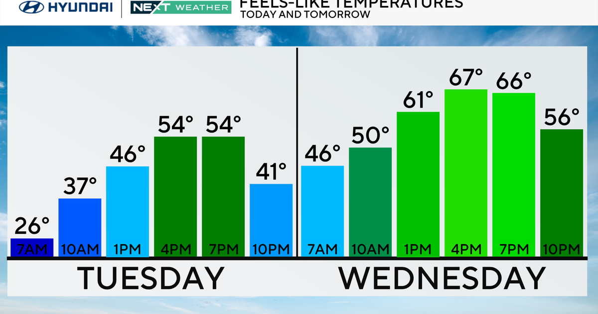
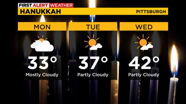
Today, a few flurries are hanging on in some spots here and there and clouds will slowly decrease through the afternoon with highs only reaching the lower to mid-30s, which is cooler than normal.
A few peeks of sun will alternate with clouds Tuesday and Wednesday with temps slowly warming to the upper 30s Tuesday and near 40 Wednesday, which is near normal for the official arrival of winter.
All eyes then turn to a late week storm system that will likely bring rain starting Thursday morning (a wintry mix in the Laurels to start) and then eventually turning to snow Friday afternoon/evening as sharply colder air invades.
Holiday travel will be wet Thursday and slick later Friday, so make plans accordingly and be especially cautious on the turnpike and I-68 through the higher elevations where roads could be slick and snow-covered during most of the holiday period.
Snow accumulation is likely for everyone Friday night into early Saturday and temperatures will be plummeting into the single digits for Christmas Eve. Winds will also be gusting up to 40-50 mph, so that Saturday night Steelers game will be bitterly cold with likely wind chills below zero.
WEATHER LINKS:
Current Conditions | School Closings & Delays | Submit Your Weather Photos