Pittsburgh Weather: Cloudy Conditions Ahead Of Overnight Storm Chances
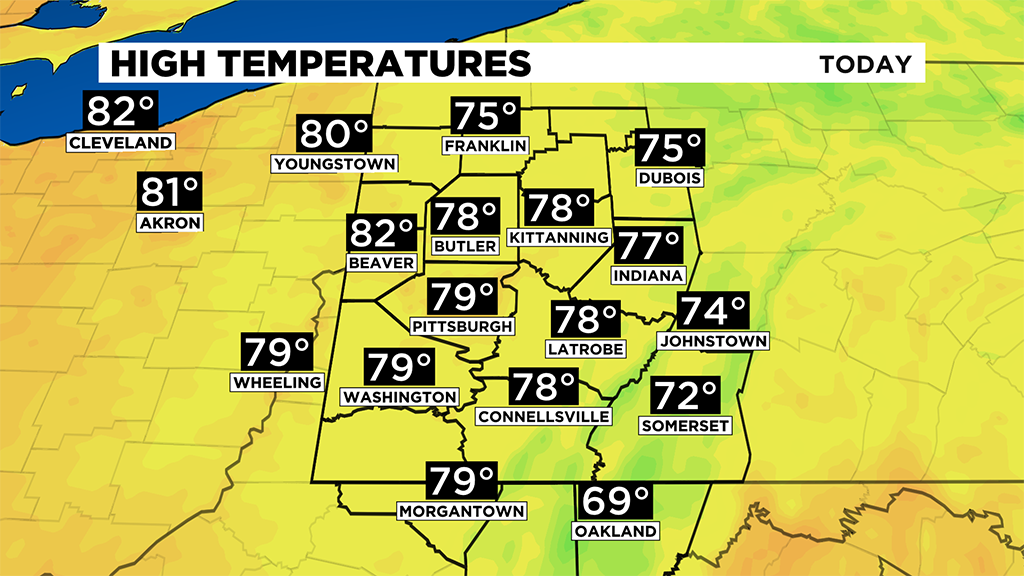
PITTSBURGH (KDKA) -- High temperatures today should be a good five to ten degrees warmer than yesterday with highs near 80 degrees.
I have Pittsburgh hitting 79° for a high.
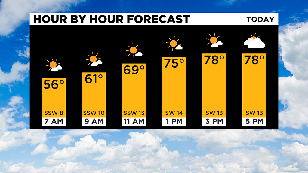
For the day, I will call our skies partly cloudy but most of our clouds will be in place before 8:00 a.m. and then after 4:00 p.m.
The middle of the day should be mostly sunny. Wind speeds will be fairly strong this afternoon with winds hitting 15 to 20 mph.
With today being so nice, it allows us to take a look ahead at what to expect overnight tonight with the chance for severe weather.
At this point, I think we will be completely dry through midnight.
There will be a storm chance from what looks to be 1:00 a.m. through 5:00 a.m. on Tuesday morning.
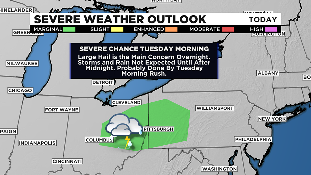
Due to this threat, the storm prediction center has us under a marginal severe weather threat.
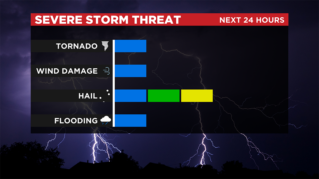
The storm chance comes just ahead of a cold front that will move through later on on Tuesday morning. The jet stream ahead will be in a location that will allow strong divergence aloft and convergence ahead of the system. Dew points won't be extreme so potential energy will be on the low side. These conditions are exactly what you'd expect when it comes to a large hail forecast.
The rest of the work week is looking dry, even with another cool blast of air arriving late on Wednesday.
This should temporarily bring high temperatures down to the 60's on Thursday before we warm back up.
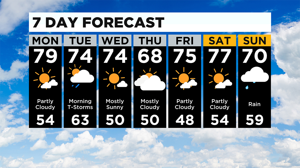
I have a feeling I will be putting in at least a small rain chance for Thursday and possibly Wednesday with the arrival of the cooler air.
WEATHER LINKS:
Current Conditions | School Delays & Closings | Local Radar | Weather App | Photos
Stay up to date with the KDKA app, which you can download here.