Pittsburgh Weather: Afternoon and evening winter weather on the way
PITTSBURGH (KDKA) - Get ready for some more winter weather to arrive this afternoon.
Both rain and snow will move into Western Pennsylvania around lunchtime and then last all throughout the day.
WEATHER LINKS:
Current Conditions | School Closings & Delays | Submit Your Weather Photos
Depending on where the freezing line sets up, that can greatly affect the snow totals. Areas further north have a better chance to see snow while areas further south will see rain switching to snow.
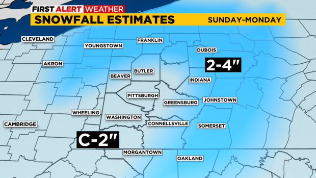
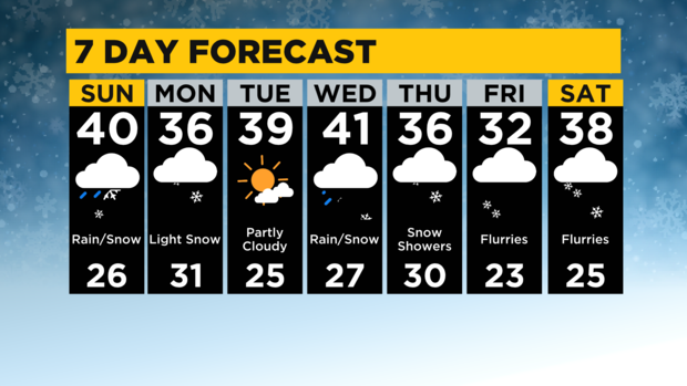
The Pittsburgh area could see both with all of it switching to snow by Sunday night. Light snow will linger into Monday, but most areas will see between a coating to 2" of snow by Monday, the higher elevations could see between 2-4".
Most of the snow accumulations will be happening Sunday night into Monday morning. Travel can become slick and slushy over the next 24 hours, so use caution and give yourself extra time.
Tuesday will be partly cloudy with highs back into the low 40s. But then another system arrives Wednesday bringing us both rain and snow, so a very similar setup to today's system.
Depending on powerful the warm air is with this system, that can greatly hinder our snow totals. But given this forecast, it can get messy for any commuters.
It then switches back to all snow showers for Thursday and Friday.
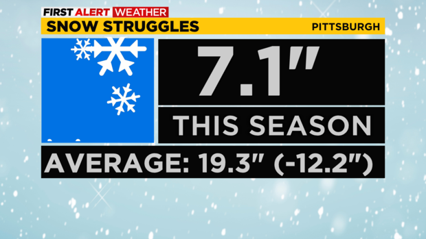
Keep in mind, we are way behind on snow totals so far for the winter season. We usually see nearly 20" of snow by mid-January for the season, but we've only seen about 7".
So we need over a foot of snow to even catch up to our average snowfall amounts.
Stay up to date with the KDKA Mobile App – which you can download here!
