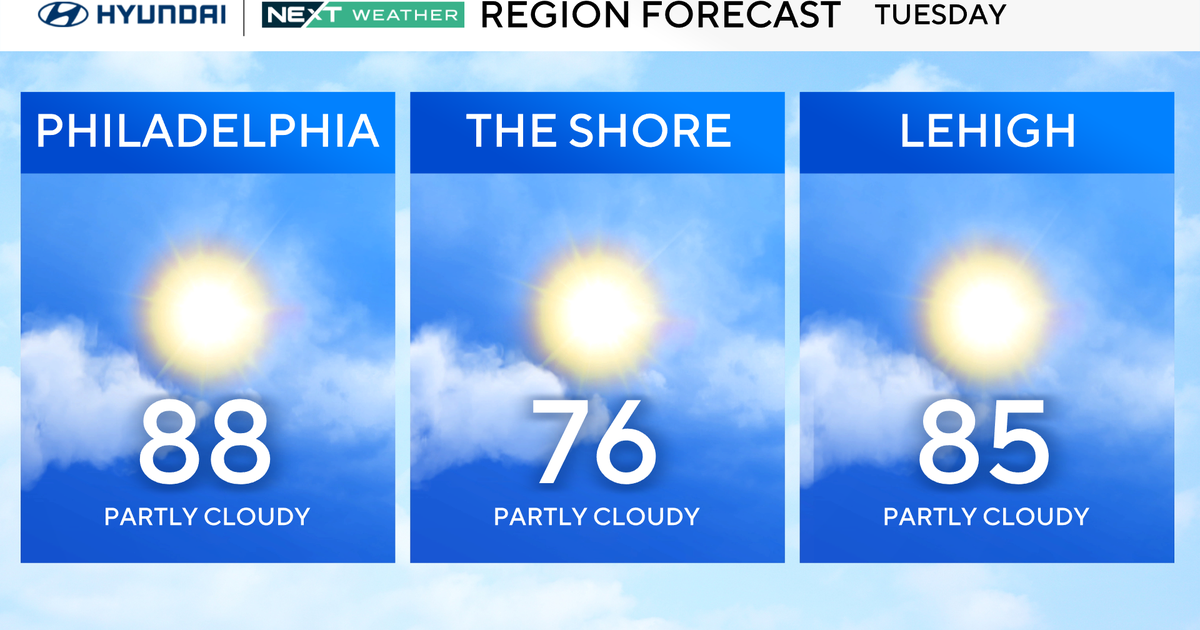
Pittsburgh Weather: A quiet Sunday, but snow arriving soon
PITTSBURGH (KDKA) - We're only 10 days away from the official start of the winter season, but we're already feeling like it!
ALERT: None.
AWARE: Rain/snow/winter precip possible Thursday & Friday.
WEATHER LINKS:
Current Conditions | School Closings & Delays | Submit Your Weather Photos
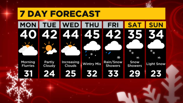
There is a chance for some flurries tonight and early tomorrow, but little to no accumulation is likely. Most of us tomorrow will be stuck in the 30s with morning lows around 30° then afternoon highs around 40°. Mostly cloudy skies will take over, but we'll see a few peeks of sunshine. Tuesday and Wednesday mornings will be very chilly in the mid-20s, but keep in mind this type of weather is very typical this time of year.
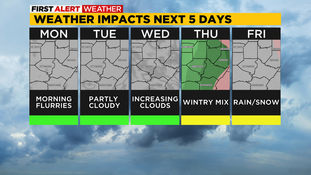
The sun finally sticks around Tuesday afternoon with highs in the low 40s, but then clouds return Wednesday. Highs remain in the mid-40s through Thursday, but then much colder weather comes next weekend thanks to our next weather-maker arriving Thursday. Rain showers take over Thursday and then combine with much colder air, so the chance for winter precipitation like sleet or freezing rain is possible. As we get closer, we'll have a better idea of the likely scenario.
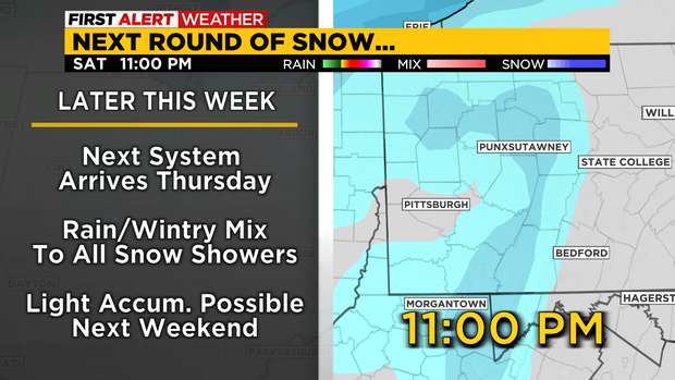
Eventually, all that rain or mixing will switch over to all snow by Friday night, then snow showers linger all throughout next weekend. Light accumulations are looking possible for now, but we know for sure that it'll be cold with highs only in the 30s.
Stay up to date with the KDKA Mobile App – which you can download here!