Pittsburgh will see rain remnants of Hurricane Helene early next week
PITTSBURGH (KDKA) - Good evening. The remnants of major Hurricane Helene, which brought devastating flooding to portions of the Carolinas and Tennessee, have merged with an upper-level low over the lower Ohio River Valley, and are finally moving into our region.
First Alert: None
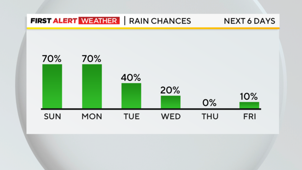
Aware: Shower chances now through Tuesday then cooler
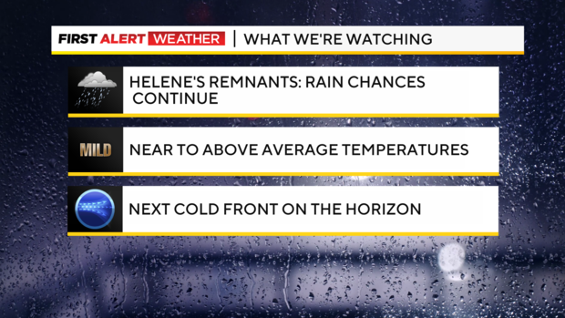
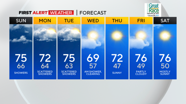
Scattered showers will alternate with light rain overnight and into Sunday. Not a washout by any means tomorrow or Monday, but know that you could be caught in a shower or light rain at any point during the day or evening. Widespread showers/light rain are likely to bring us around a half-inch to an inch of rain by late Tuesday night across the area, which will be welcome due to our ongoing drought conditions.
Temperatures will remain slightly above average over the next several days, with highs in the mid-70s and lows only in the lower to mid-60s (the normal high is 72). A pretty potent cold front swings through here Tuesday night into Wednesday morning, cooling us off to highs barely reaching 70 by Wednesday and helping us feel a bit more like fall.
Sunshine and dry weather will finish out at the end of next week!
WEATHER LINKS:
Current Conditions | School Closings & Delays | Submit Your Weather Photos