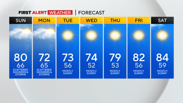
Pittsburgh looking at periodic rain and storms chances this weekend before cooler weather moves in
PITTSBURGH (KDKA) - A pesky, slow-moving low-pressure center keeps scattered storms and showers in our forecast off and on through Monday.
Alert: None
Aware: Scattered storms continue tonight and Sunday
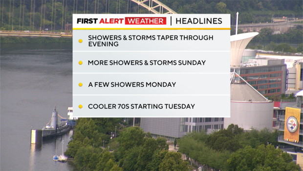
Storm chances will wane after sunset tonight, but storms popping up until then have the potential for gusty winds and hail with heavy downpours.
We've already seen a few severe thunderstorm warnings, and these will continue to pop up through around 9 p.m. Sunday will feature more scattered convection, with showers more prevalent along with a few rumbles of thunder (but low severe storm chances).
Monday brings lingering showers until later in the afternoon, when the cold front passes and pushes all of this to the east. Behind that, get ready for more fall-feeling weather in the 70s the rest of the week with plenty of sunshine and dry time!
WEATHER LINKS:
Current Conditions | School Closings & Delays | Submit Your Weather Photos