Lingering rain on Saturday morning followed by cloudy skies and mild start to next week
PITTSBURGH (KDKA) - Heavy snow fell across the Laurel Highlands on Friday leading to accumulations in the double digits for parts of our area. The highest total, 14" fell in Grantsville, MD in Garrett County. Amounts ranged from 3-6" across portions of Indiana, Westmoreland, Fayette, Somerset, and Preston Counties. The event total for Pittsburgh was 0.5" between Thursday and Friday.
All Winter Storm Warnings for our area will have expired by 7 a.m. Saturday as temperatures have warmed above freezing across all of our coverage area this morning.
WEATHER LINKS:
Current Conditions | School Closings & Delays | Submit Your Weather Photos
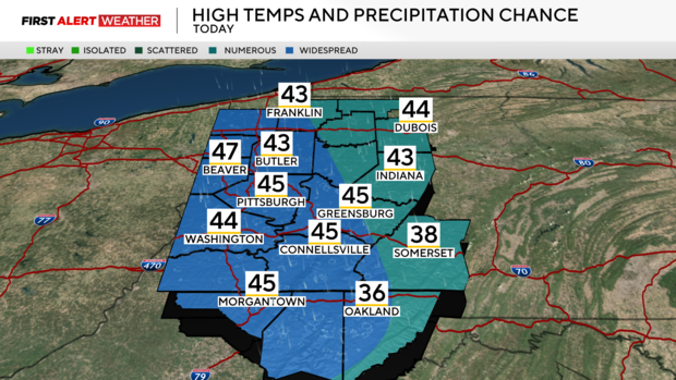
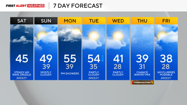
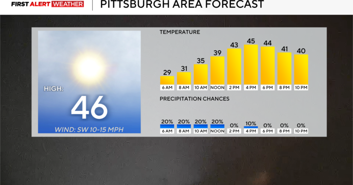
This morning, a steady band of lake-effect rain continues to train from northwest to southeast across our area. High-res modeling shows this band gradually diminishing between 10am-noon with a few lingering showers or areas of drizzle persisting accompanied by low clouds through the evening. Temperatures will remain steady in the low to mid-40s.
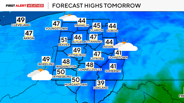
Under mostly cloudy skies tonight, the range in temperatures won't be too large with lows Sunday morning in the upper 30s to near 40. High pressure is expected to move east tomorrow, but there will still be a lot of low-level moisture trapped beneath the high, so expect mostly cloudy skies to persist most of the day due to the lack of low-level wind helping to mix that trapped moisture.
Some of our southernmost counties may seem to be clearing by late afternoon.
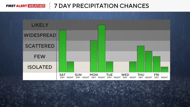
Skies will partially clear Monday morning leading to a cool start, but a warm front will move in from the west allowing for an increase in moisture and clouds through the day. Expect mild temperatures as well with highs peaking in the middle 50s by late in the evening hours, but this mild air will be accompanied by rain as a cold front encroaches from the west.
Lingering showers are expected for early Tuesday morning with partly cloudy skies and falling temperatures through the day.
Tuesday's system will set us up for what we see late in the week around Thanksgiving. A large temperature gradient will exist from north to south across the Ohio River Valley with colder air to the north and warmer air to the south. Models are in fairly decent agreement that there will be a wave of low pressure aloft to track east from the Plains toward the region.
This wave will likely be accompanied by a swath of precipitation. I say precipitation because depending on the track of the system and how much cold air is in place, portions of western PA could see some wintry mix. If the system is weaker and the track trends farther south, Thursday-Friday will just be cloudy and cold.
If we see a more central track, then mixed precipitation would occur. If the track is farther north, that would bring in warmer air from the south and result in just rain. Stay up to date as we iron out details over the coming days and uncertainty becomes less.
Stay up to date with the KDKA Mobile App – which you can download here!
